Welcome to SP!  -   
 
 New features are here! - Read More... 
Areas & Ranges·Mountains & Rocks·Routes·Images·Articles·Trip Reports·Gear·Other·People·Plans & Partners·What's New·Forum

Topo map of the somewhat...

 
[ Sizes: Orig | Med | Small | Thumb ]
Topo map of the somewhat...
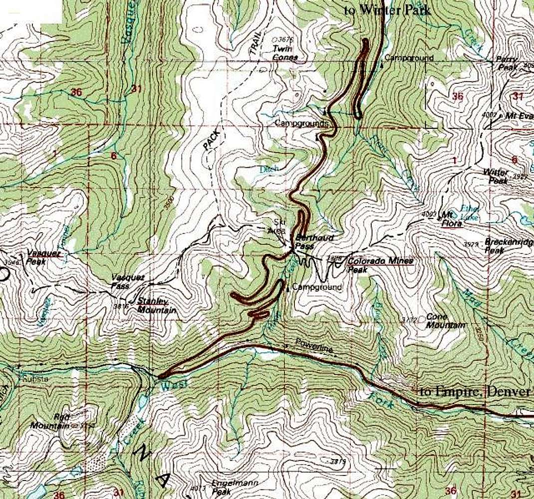
Topo map of the somewhat confusing area around Berthoud Pass, Colorado. Peaks underlined in red on the Continental Divide are covered in Summitpost.com. These include Colorado Mines, Flora, Stanley, and Vasquez.
US40 runs across Berthoud Pass from I70 on the south-eastern side to Winter Park and Lake Granby to the north.


Comments

No comments posted yet.


Sign in to post!

Don't have an account? Register now.


Rate This Image
Current Score: 87.13

Log In To Vote
 Mount Flora (Mountain/Rock)

Mount Eva in context. View to...
« PREV

Viewing
#2 of 19
GALLERY
The North Slopes of Mount...
NEXT »

 CharlesD's Image Gallery

Fern Canyon Flatirons
« PREV

Viewing
#56 of 325
GALLERY
Pawnee Pass route topo
NEXT »


 Stanley Mountain (Mountain/Rock)


 Colorado Mines Peak (Mountain/Rock)


Image Data

CharlesDSubmitted by CharlesD
on Mar 31, 2004 7:05 pm

Image ID: 47999
Hits: 5130 

Lat/Lon: 39.80500°N / 105.736°W


"Never say "N factorial", simply scream "N" at the top of your lungs."

© 2006-2012 SummitPost.org. All Rights Reserved.