
|
|
Mountain/Rock |
|---|---|
|
|
39.79614°N / 105.76229°W |
|
|
Hiking |
|
|
Spring, Summer, Fall, Winter |
|
|
12497 ft / 3809 m |
|
|
Overview
Since this mountain is fairly an easy and short climb, it is ideal for beginners, families, or just anyone who has little time on their hands and wants to climb some alpine peaks. Even though the hikes to the peak are short, the views are spectacular, and the peaks rise well above the timberline. The easy nature of the peaks also belies their danger as severe thunderstorms and lightning strikes are prevalent throughout the summer months.
This and the surrounding peaks are great for winter climbs as well as the trailhead at Berthoud Pass is open year round. With easy access and a high elevation trailhead, this is one of the easiest to climb of the 12 thousand foot peaks in the Rockies.
Unfortunately, there are radio towers on top of the peak and a track closed to vehicles, but this is still a nice hike.
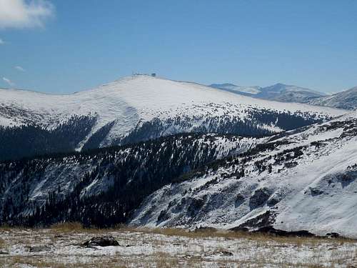 Colorado Mines Peak as seen from the slopes of Twin Cones. October 12 2013.
Getting There
The trailhead is at Berthoud Pass, which is on mile marker 243 on Highway 40. Berthoud Pass can be reached from the north and Fraser and Winter Park or from the south and Empire. The Empire exit off I-70 is exit 233 for those driving from the south. Park at the now closed Berthoud Pass Ski Resort parking lot. The trailhead is across the highway. Highway 40 is open and plowed year round allowing easy year-round access to the trailhead.
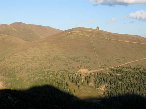 Colorado Mines Peak (the peak with the towers on it) itself is a pretty uninspiring peak, but the peak offers fine views and is very easy to climb. August 19 2009 as viewed from the slopes of Stanley Mountain.
Routes Overview
These are overviews only, so click on the route page links for more details.
By far the easiest route to the peak and the route that will be descibed here is the Colorado Mines Peak from Berthoud Pass route. See the route page for much more detail. The total distance is 1.7 miles with 1185 feet elevation gain.
It is also to possible to continue over the ridge north from the summit passing over Mount Flora, Mount Eva, Perry Peak, and James Peak. This is a long all day hike for an experienced hiker. Don't attempt it in bad weather.
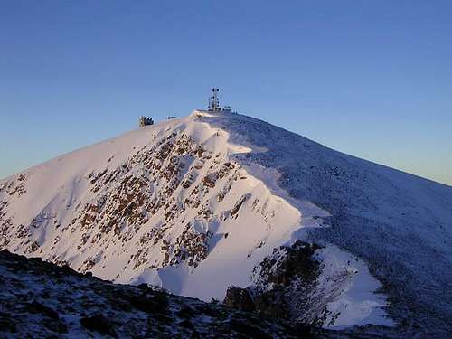 Colorado Mines Peak from the saddle with Mount Flora.
Red Tape
No permits are required.
When To Climb
These are usually easy peaks all year round, and are good practice peaks for winter. The snow free season is late June through early October. Since the routes follow ridge-tops, avalanche danger is usually fairly low as long as you don't stray from the ridge. Highway 40 is plowed in winter allowing for quick and easy access year round.
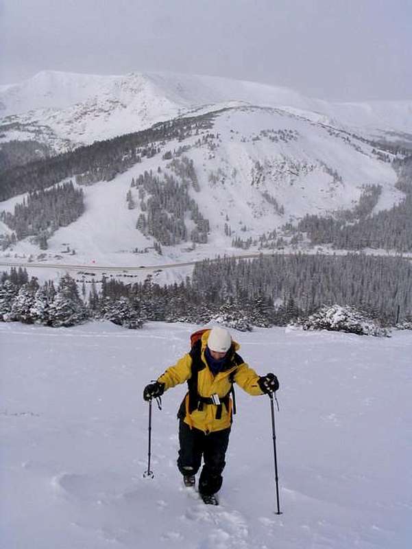 Climbing Colorado Mines Peak in late November.
Camping
These peaks are mostly day climbs only, but there are campgrounds along Highway 40 in the Fraser Valley, and one just south of Berthoud Pass.
There are five campgrounds between Berthoud Pass and Winter Park. These are the campgrounds in order from Berthoud Pass north to Winter Park:
Second Creek Campground
DAR Campground
Spruce Lodge Campground
Midland Campground
Idlewild Campground
For info on these campgrounds listed above, call the ranger station in Granby at 970-887-4100.
There is one campground along Highway 40 just south of Berthoud Pass:
Floral Park Campground
For information on this campground, call the ranger station in Idaho Springs at 303-567-2901.
Mountain Conditions
For current trail and snow conditions, more information, and access issues contact:
Sulphur Ranger District
9 Ten Mile Drive
Granby, CO 80446
970-887-4100
BERTHOUD PASS AREA MOUNTAIN WEATHER FORECAST
Below is the climate summary for nearby Berthoud Pass at 11,315 feet elevation, and at the trailhead. These are all averages, so expect more variation, but this will give you a good idea about the climate at higher elevations in the area. *National Weather Service Data 1950-1985.
| MONTH | HIGH | LOW | SNOW DEPTH | DAYS W/PRECIP |
| JAN | 21 | 1 | 42" | 19 |
| FEB | 24 | 2 | 52" | 16 |
| MAR | 29 | 6 | 63" | 20 |
| APR | 36 | 14 | 67" | 17 |
| MAY | 45 | 23 | 53" | 16 |
| JUN | 54 | 32 | 17" | 11 |
| JUL | 62 | 39 | 0 | 14 |
| AUG | 60 | 38 | 0 | 14 |
| SEP | 53 | 31 | 0 | 11 |
| OCT | 42 | 21 | 3" | 10 |
| NOV | 30 | 10 | 14" | 15 |
| DEC | 23 | 3 | 29" | 18 |