Toggle navigation
Mountains
Routes
Images
Trip Reports
Forum
What's New
People
Areas & Ranges
Articles
Trailheads
Canyons
Huts & Campgrounds
Albums
Logistical Centers
Fact Sheets
Lists
Custom Objects
Gear
Plans & Partners
WELCOME TO SUMMITPOST
SIGN IN
REGISTER
Silver Couloir
Additional Parents
Image
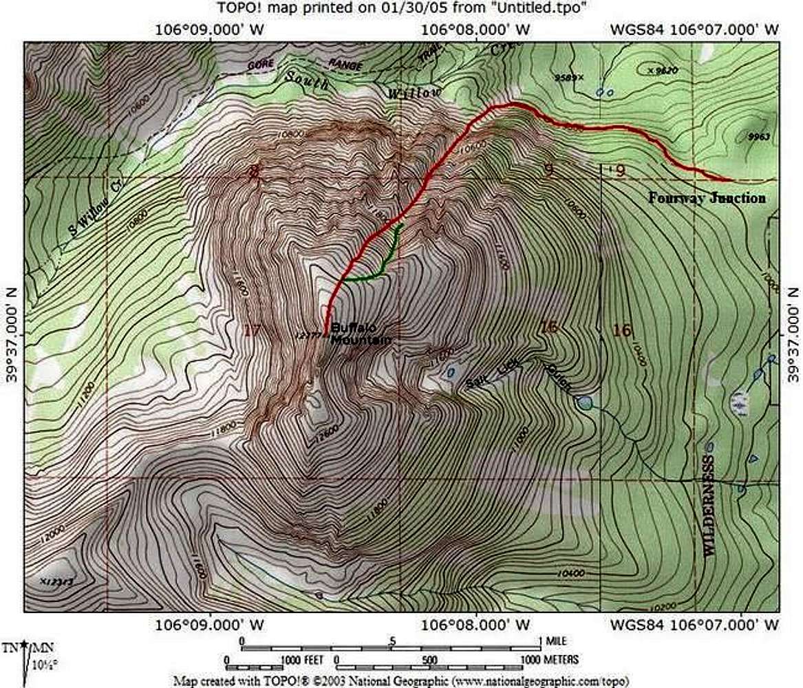
Topo showing the route and...
View High-Resolution Image
Topo showing the route and...
Topo showing the route and approach for the
North Chute
from the fourway junction on the trail. Main route is in red while an alternate finish is shown in green. Created with National Geographic Software
« PREV
NEXT »
miztflip
on
Jan 30, 2005 7:32 pm
Comments & voting
Other parents
Lat/Lon:
39.61700°N / 106.142°W
Image ID:
87528
7803 Hits
73.06
% Score
3
Votes
Log in to vote
Comments
No comments posted yet.
to post!
Don't have an account?
Silver Couloir
(Route)
You are at
the First
Image
Viewing
#1 of 6
GALLERY
NEXT »
miztflip's Image Gallery
« PREV
Viewing
#208 of 268
GALLERY
NEXT »
Buffalo Mountain
(Mountain/Rock)
Loading....
×
You need to login in order to vote!
User Name
Password
Remember me
Forgot your password?
Log me out when I close my browser.
Keep me logged in all the time.
sign in as a user
Don't have an account?
Register now for FREE
Rating available
Suggested routes for you
People who climb the same things as you
Comments Available
Create Albums
Register Here


