Prologue
I'd been on vacation (read: climbing) quite a lot already this year, so my girlfriend decided it was time to spent some vacation-time together. She wanted to go and see Marrakech. I reluctantly agreed upon going when we could do Toubkal as a side trip. In the end we agreed on two days in the mountains and five days of doing whatever she likes (Marrakech and the desert). Although I now know that two days is possible, I would advise on doing it in a three day trip.
Getting there
Initially I wanted to go by bus as it's cheap. Unfortunately there are two problems with that. The bus goes once every day, at 10.00 - not an option for us as we'd get there too late to start the ascent (but still lose a day). Second problems was that they only take you as far as Asni, which means you'd have to take a taxi to do the remaining 17km.
In the end we decided to take a taxi. I agreed on the (high) price of 400 dirhams (paid half that coming back). You can probably get it cheaper, but we left Marrakech at 18H00 and it was already getting dark. This meant the driver could probably not pick up any people on the way back. The road isn't that good either, so the way back in the dark wouldn't be nice for our driver either.
I also told him that I would only pay 400 dirhams if he would drive slowly. I'm not a big fan of taxi-drivers in these kinds of countries, especially not in the dark on narrow mountain roads.
Imlil
Imlil is a pretty nice mountain village. When we were there it was quite calm and relaxed, but I suspect that in the summer months it won't be as serene. You'll pretty much find everything you need there. We bought all our food there and the mountain equipment shops are well equipped and will be able to provide you with all material you'll possibly need. The rental equipment is a bit older but still in good working order.
We arrived in Imlil after dark. The taxi driver dropped us off at the Hôtel Soleil and actually, we couldn't have asked for a better place. Nice views (in the morning), good food, friendly people and not too expensive (€ 15 a night with breakfast). The guy at the reception was very knowledgeable about Toubkal and I'm sure he'll be able to help you out with most things you need.
If you need more information or a guide, right across the parking from hôtel Soleil is the Tourist Info & Mountain Association & Guides bureau.
![Mountain equipment shop in Imlil]() The biggest mountain equipment shop in Imlil. The biggest mountain equipment shop in Imlil. |
![Girlfriend having breakfast in front of the hôtel Soleil]() Girlfriend having breakfast at hôtel Soleil. Girlfriend having breakfast at hôtel Soleil. |
Quick reference map for Imlil
![Map of Imlil]() Map I made from the city of Imlil.
Map I made from the city of Imlil.Imlil to Toubkal Refuge
Just walk up the main street in Imlil and take the first right (if you see the bridge on your left, you've gone too far). At the end of this street, take a left (near the end of this street, on your left hand side, is the mountain equipment shop). You'll now see a building with an arrow => Toubkal. You're on the right track. Follow some steps up and you're on the trail.
![Last corner to the trail in Imlil]() Imlil, last corner to trail. Imlil, last corner to trail. |
![Start of trail in Imlil]() Start of the trail in Imlil. Start of the trail in Imlil. |
![Donkey]() You can rent a mule at the start of the trail. You can rent a mule at the start of the trail. |
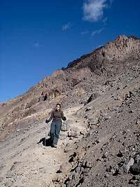
You'll pass a smaller village and a school, after which you cross a river. When we were there, there was hardly any water in the river so crossing it was easy. I suspect that it might be a lot harder if there's been a lot of rain.
![Village after Imlil]() Village after Imlil. Village after Imlil. |
![Armed school_wide]() School building. School building. |
![Armed school]() Armed school, close-up. Armed school, close-up. |
The trail is always very good and clearly visible. When you cross another bridge a lot higher on the mountain, you're almost in Sidi Chamarouch. This is about halfway and the last place to buy some food or drinks before the refuges. After Sidi Chamarouch the trail gets a bit steeper, but only slightly.
![Bridge over river just before Sidi Chamarouch]() Bridge just before Sidi Chamarouch. Bridge just before Sidi Chamarouch. |
![Trail just after Sidi Chamarouch]() Trail after Sidi Chamarouch. Trail after Sidi Chamarouch. |
The refuges
You'll have two choices: the Refuge Neltner or the Refuge du Toubkal. We didn't compare beforehand and just took the one that was closest (the bottom one). We didn't book ahead and there were plenty of free rooms available. This might not be the case in summer!
The Refuge du Toubkal appeared to be the best choice as we had heating (a fireplace we hurdled around with 25 people ), the other one didn't have any heating according to the people who stayed there. The rooms were nice and clean, but weren't heated. There were free blankets available if you wanted one.
When we were there the toilets were clean and the showers too. I took a shower, but there was no warm water (not sure if there ever is).
The food in the Refuge du Toubkal was plain bad. I wouldn't eat there again. Seriously, if you can: bring your own food and cook it yourself - it was that bad. If you do end up eating there, don't hesitate to ask for salt and hot sauce to give/mask taste.
![Refuge]() Late evening picture of the Refuge du Toubkal
Late evening picture of the Refuge du ToubkalRefuge du Toubkal to Toubkal summit
When we started it was still dark. So when we went the wrong way, I blamed the darkness. Actually I just hadn't bothered to look up the route and followed the trail. Don't do this! The trail leads you further into the valley from the refuge and although that feels right, it isn't. In fact you have to go left just after passing the refuge.
We started the actual ascent about two hours behind everyone. My girlfriend was already tired from the previous day when we started, so needless to say we weren't going very fast. To make it even worse, I had acclimatisation issues (again).
It took us about four and a half hours to finally reach the summit. When we got there I was pleased because we were practically alone up there. Most people were probably already back in the refuge, Imlil or even Marrakech. Furthermore, the sun was shining, the view was great and it wasn't even that cold. Oh and I was there with my girlfriend who made her first summit.
![My girlfriend and me on the summit]() On the summit together with my girlfriend. On the summit together with my girlfriend. |
![Me on the summit]() Me on the summit. Me on the summit. |
![The steep side of Toubkal.]() The steeper side of Toubkal. The steeper side of Toubkal. |
The walk back to the refuge isn't that hard or far. It should take you about an hour -unless you have bad knees, like me. We had surprisingly little snow for November and I actually would've preferred snow to the scree slopes.
![My girlfriend descending the last part to the refuge]() Girlfriend descending last scree slope back to the refuge.
Girlfriend descending last scree slope back to the refuge.360° summit view
More images
More images can be found in my
album.
All pictures including some of Marrakech can be found in
my picasa webalbum.
Comments
No comments posted yet.


 The biggest mountain equipment shop in Imlil.
 Girlfriend having breakfast at hôtel Soleil.
 Imlil, last corner to trail.
 Start of the trail in Imlil.
 You can rent a mule at the start of the trail.
 Village after Imlil.
 School building.
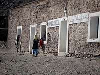 Armed school, close-up.
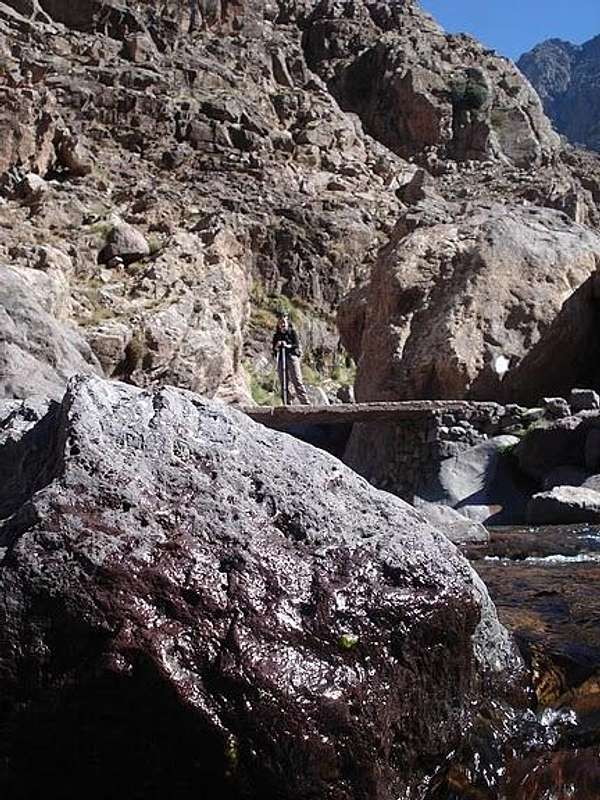 Bridge just before Sidi Chamarouch.
 Trail after Sidi Chamarouch.
 On the summit together with my girlfriend.
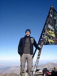 Me on the summit.
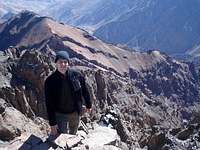 The steeper side of Toubkal.