
|
|
Route |
|---|---|
|
|
45.85960°N / 7.67690°E |
|
|
Footpath |
|
|
Most of a day |
|
|
EE |
|
|
Approach
Follow instruction to get Cheneil in Main Page section.
Route Description
Path begins at 2023 mt. (Alpe Barmaz), car parking free to get to Cheneil basin.
Follow "Alta Via 1" direction. Cross tiny Cheneil village and walk toward Colle di Croux (2697 mt. - 1h45min.). Passed col di Croux, get into Chamois valley. With a little descending traverse and crossing a desolate stone land, in about 30 min., Col di Nana (2775) is reached.
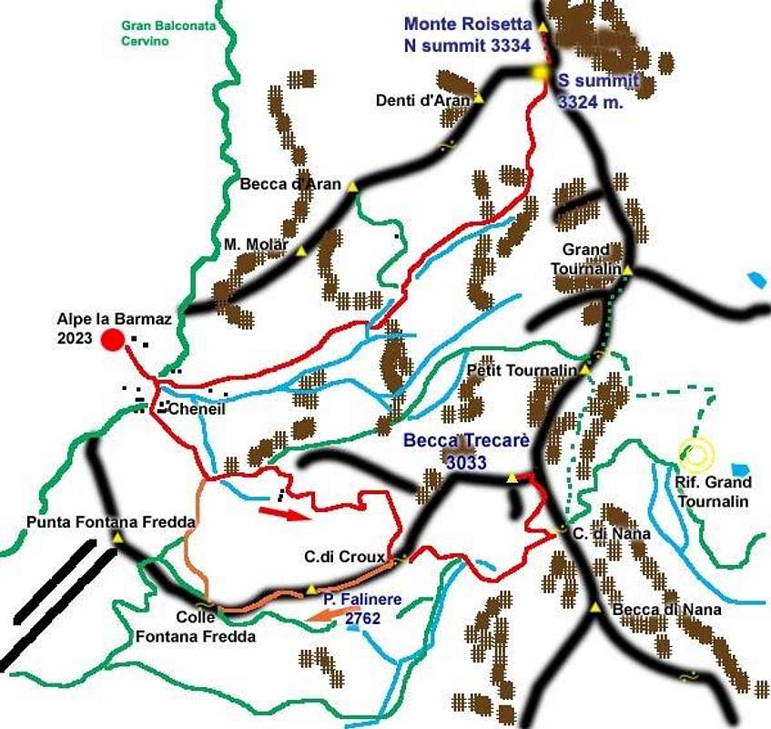
Homemade map for Trecarè/Roisetta area.
Red line: footpath for both destinations. Orange line: interesting traverse to Falinere, coming back from Trecarè.
Green line: other important trails
Remember: from Cheneil to Col di Nana, always follow AltaVia1 signs.
From Col di Nana, forward N direction to reach NE Trecarè shoulder. Last 15 minutes are very steep, but never dangerous.
Best period: from June to October, according to first snowfall.
Essential Gear
Classic alpin gear required. Trek poles may help you in ascent from Col di Nana to Trecarè summit.
Miscellaneous Info
If you have information about this route that doesn't pertain to any of the other sections, please add it here.