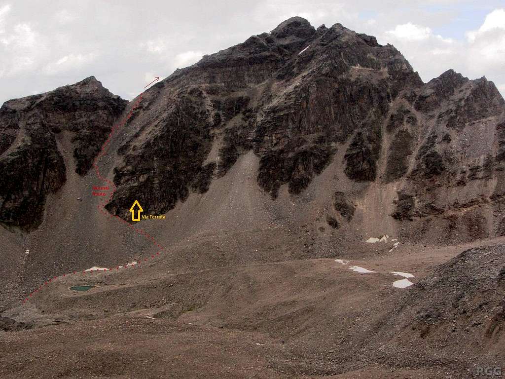
Tschenglser Hochwand normal route (lower half)
For more details, click on the image for a bigger version.
From the end of the Zaytal valley, the normal route to the Tschenglser Hochwand ascends a steep scree gully. Fortunately there is a trail, otherwise it would be hard work (and unpleasant) to get up there. The gully is steepest at the top. On the descent, from about half way down it's possible (and much faster) to go straight down the scree instead of following the trail.
Seen from the southeast, from low on the Großer Angelus northwest ridge.
29 Aug 2014.


