
|
|
Route |
|---|---|
|
|
38.69805°N / 106.4516°W |
|
|
Mountaineering |
|
|
Summer |
|
|
Most of a day |
|
|
Hike |
|
|
Getting There
Directions to the beginning of Tincup Pass Rd in St. Elmo:From the town of Buena Vista drive 8 miles south on Route 285 to a place known as Nathrop and then turn west onto Route 162. Drive this road 16 miles to the ghost town of St. Elmo (the first 10 miles are paved and the rest is a well graded dirt road). In St. Elmo, go thru “Main Street”, turn right and cross the bridge to the north side of Chalk Creek. Then make an immediate left and continue to the west end of town.
Route Description
In St. Elmo, head west and hike or drive (4WD) Tincup Pass Road. The lower parts of the road go through an aspen forest. As you reach the western end of the valley, the road starts to go up steeply.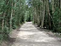 Tincup Pass Rd | 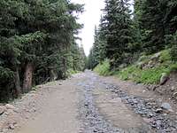 Tincup Pass Rd |
Option one, via the eastern slopes of Fitzpatrick Peak:
All distances are per my GPS.
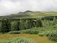
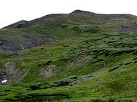
After 4.85 miles on Tincup Pass Rd, you will reach tree-line (11750 ft) at a place identified on USGS Map as Sawmill Hill. A beautiful grassy basin can be seen to the west with Fitzpatrick Peak rising above it.
Fitzpatrick
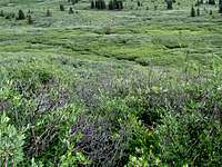
You can follow any path to reach Fitzpatrick. The dense growth of bushes in the basin, however, make it difficult to hike through the basin. If you chose to do this route (in summer), you should be ready to do much bushwhacking.
Bushwhacking
Once you reach 12000-12200 ft, the bushes go away gradually. You can then hike to the summit of Fitzpatrick.
Option two, via Tincup Pass:
All distances are per my GPS.
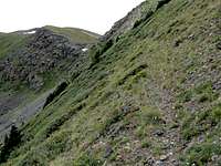
Hike or drive to/near Tincup Pass. Point 12780 ft sits between Tincup Pass and a 12412 ft saddle at the base of Fitzpatrick’s northern ridgeline. I went to the area at the border of the scree slopes of Point 12780 ft and the bushes that grow below it.

Bushes & scree
I was able to find a beaten path that allowed me to traverse the slopes of Point 12780 ft.
Traverse
Once at the 12412 ft saddle, the easy northern ridge-top of Fitzpatrick can be followed to reach the summit.

Northern Ridgeline