13577
I was supposed to climb Ellingwood Point and Blanca Peak via Ellingwood Point's
north ridge (5.3), but my "partner" decided to start without me. I climbed to the base of Ellingwood's north ridge route and gave a few yells for my "partner". He was no where to be found. I later learned that he climbed Blanca Peak via a fourth class variation of Gash Ridge. So, I decided to climb California Peak. I had no map of this area on me, only an annotated topo of Ellingwood Point and Blanca Peak, but I had a faint memory that I had to climb north from Lily Lake. So, I crossed some steep, loose scree to Lily Lake and climbed the peak north of Lily Lake. There was a summit register on it indicating that it was UN 13577.
California Peak
I could now see California Peak and decided to climb north towards it. This was an enjoyable, simple ridge run and much more enjoyable than the climb up to UN 13577.
13476
I continued north on the ridge to UN 13476 and took a photo of the Southern Sangres.
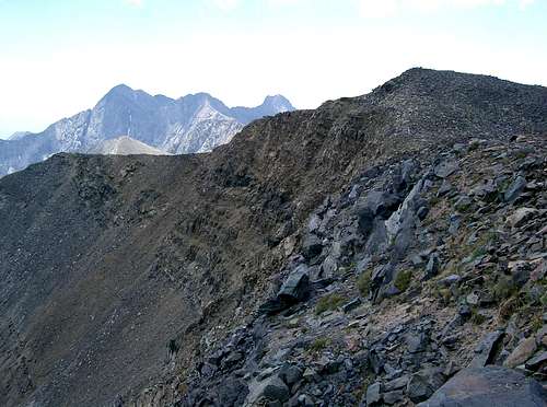
![Sangre de Cristo Range]() Southern Sangres.
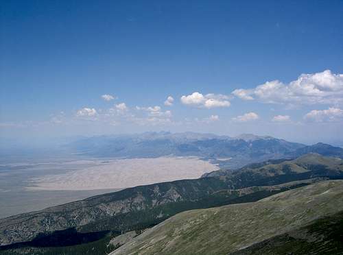
Southern Sangres. Then, I turned around and took a photo of the Northern Sangres and the Sand Dunes.
![Northern Sangre de Cristo Range]() Northern Sangres and Sand Dunes.
Northern Sangres and Sand Dunes. I continued up to the summit of UN 13476. This unranked thirteener was uneventful compared to the last two peaks. I knew the Zapata Trail lead off of ones of the peaks on the west side of the Huerfano Valley, but wasn't sure which one since I didn't have the appropriate map with me. I decided to descend to the Huerfano Valley here since the idea of walking back up the road to my car didn't appeal to me. The descent was initially steep scree mixed with grass. At treeline, the terrain got steeper and sandier. Eventually, I bushwhacked to the meadow just above the trailhead.

Comments
No comments posted yet.