
|
|
Route |
|---|---|
|
|
38.90700°N / 105.1243°W |
|
|
Hike |
|
|
Half a day |
|
|
Walk Up / Easy Scramble |
|
|
Approach
See the "Getting There" Section on the Main Page. Use the Upper Fourmile Road Trailhead:
Travel US 24 to the town of Divide, and turn south on CO 67 South (not to be confused with CO 67 North, which goes from Woodland Park, 8 miles away).
Go 4.25 miles from this turn to a poorly signed left turn onto the Upper Fourmile Road. On the way, you will pass a turn for Mueller State Park. Once you pass the park, look sharp for a sign that says, "Rocky Mountain Camp," and then another sign 100 meters from there for, "Crags Campground." Turn left here. There is a ranch here with horses. Cross a small bridge, and begin to travel uphill on the dirt road. The road is rough, but passable for passenger cars. If you travel here in winter, expect the road to be plowed, but don't count on it. This road gets icy. This road also goes to the popular Crags Campground and the trailhead for the alternate trail to Pikes Peak.
Travel 1.1 miles up this road until you reach a sharp switchback. You will see a gate straight ahead with a small pulloff. Park here. This is the trail head. The road beyond the gate is prohibited to motor vehicles.
Route Description
Begin past the Trailhead and walk up the old road. Follow this road to the top of a ridge, where you will intersect another old road. Take a right (east) onto this more heavily traveled old road / trail. This trail is easy to follow.
Follow this trail for about two miles to where it ends near Raspberry Mountain. At this point, a single track trail continues to the summit. Follow this small trail until you see the boulder-covered summit of Raspberry Mountain. At this point, work to the left (west) side of the summit, and look sharp for the easiest way to the top. The easiest way to the top will involve a move or two of easy scrambling. Take your time and find the easiest way up. If you feel like you are moving into the realm of technical climbing, retreat and find another way.
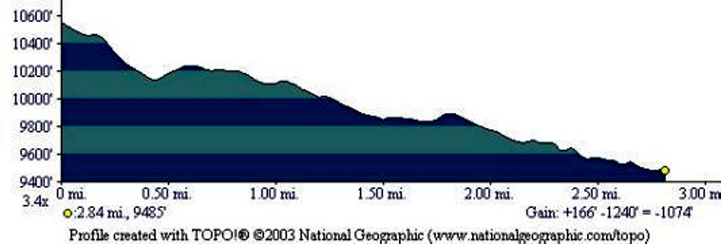
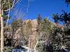
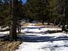
(Refer to accompanying photos, map, and elevation profile.)
Enjoy the expansive views in all directions, and especially, the view of Pikes Peak. If you live in Teller County, try to find your house!
Round Trip Mileage: 5.6 miles
Elevation Gain: 1,200 feet
Time: Fit Hikers can make it in about 2 1/2 or 3 hours. Add about an hour in winter (or more, depending on conditions).

 |  |
Essential Gear
Standard hiking gear in the summer.
Winter climbers will appreciate snowshoes, and standard winter gear.
Miscellaneous Info
If you have information about this route that doesn't pertain to any of the other sections, please add it here.
ghoepfner - Sep 24, 2021 3:56 pm - Hasn't voted
Raspberry Mountain - Divide, ColoradoThe route described is no longer available due to private property issues. From the bridge at the Crags Campground site, you now drive 2.5 miles to the trailhead. There is a well-marked trail that is part of the Ring the Peak trail system and signs directing you to the summit of Raspberry.