Introduction
Topping the list for our group’s August 2015 eastern Sierra hikes was Cloudripper. Three of the four of us had tried Cloudripper via Vagabond Peak (aka Thunder and Lightning Peak) as a day hike in 2014. Two of us made it to Vagabond, but we lacked the energy to cross the saddle to get to Cloudripper. This time, we planned to hike to Green Lake and camp there, before attempting the two summits.
The Hike to Green Lake
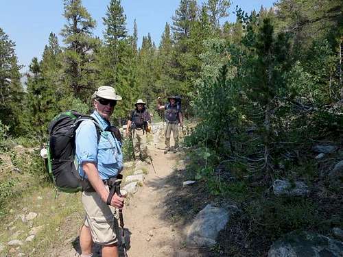
A minor comedy of errors delayed our departure from the trailhead at South Lake. After fixing and then having to refix a backpack, we did a quick food check – “I thought YOU had packed tomorrow night’s dinner – which necessitated a quick return to Four Jeffrey Campground. Ruvicha, Steve2, Jim* and I departed the South Lake trailhead at about 1:30 pm. The trail heads roughly northeast from the north side of the upper parking lot at South Lake. It’s a good, very visible sand and rock trail but, over the first mile, it has more downs than ups. We met two college students who intended to hike up an old water pipe that goes steadily up and later intersects the trail to Green Lake, saving some distance over following the trail. But they advised that the pipeline might prove a bit sketchy with backpacks. (On the return trip, it appeared that the sketchier parts of the pipe lie beyond where it intersects the Green Lake trail.)
![Heading to Green Lake]() Ruvicha, Jim* and Steve@ on trail from South Lake
Ruvicha, Jim* and Steve@ on trail from South Lake![Heading to Green Lake]() Jim* on trail from South Lake
Jim* on trail from South Lake
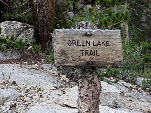
After a mile on the trail and a loss of 500-600 feet of elevation, we found the sign marking the trail to Green Lake. (Had we continued on the first trail, we would have hiked down for about three-quarters of a mile to Parchers Resort, something that we remembered for the return.) Once on the sandy, well-established trail to Green Lake, we immediately began a series of switchbacks that carried us up the southeast side of the canyon looming over Bishop Creek and the road to South Lake. Occasional breaks in the trees afforded great views of the mountains to the west and south, though smoke coming over Bishop Pass from fires on the western side of the Sierra made the viewing less than ideal.
![Green Lake Trail]() Sign marking Green Lake trail
Sign marking Green Lake trail![Parchers Resort]() Parchers Resort from trail to Green Lake
Parchers Resort from trail to Green Lake
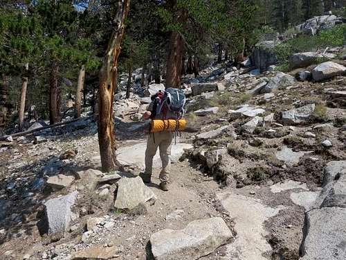
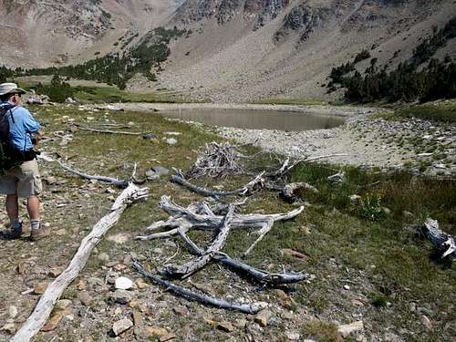
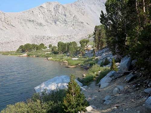
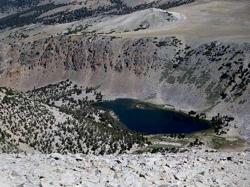
After passing Bluff Lake (very low water level), the trail climbed less steeply as we headed southeast for Brown Lake (also low). From Brown Lake, we climbed a short ridge to the east and then descended to Green Lake, following the trail to the southeast side of the lake, where we made camp. It took us a leisurely two and a half hours to cover the nearly four miles from the South Lake trailhead. We pitched our tents at 11,140 feet, about 1300 net feet higher than the trailhead.
![Brown Lake]() Brown Lake
Brown Lake![Ridge to Green Lake]() Trail from Brown Lake crosses this ridge to Green Lake
Trail from Brown Lake crosses this ridge to Green Lake![Green Lake Trail]() Descending to Green Lake
Descending to Green Lake
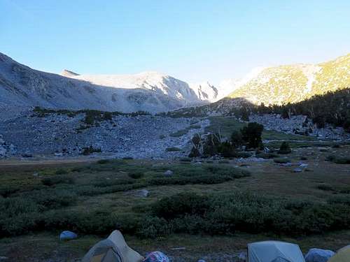
Fortunately, the wind shifted in the early evening and began blowing from east to west. That cleared out all of the smoke from the westside fires. All four of us got up at 2:00 am for a spectacular view of the Perseid meteor shower against a stunningly brilliant Milky Way.
Hiking to and Summitting Vagabond
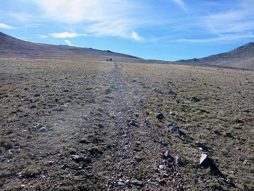
The next morning, we had our daypacks loaded by 8:15 am and were on the trail, which loops around the south end of Green Lake and climbs on a long switch to the north, steadily gaining altitude. After the first switch, the well-used trail turned back toward the southeast, shortly cresting a ridge to enter a barren plateau.
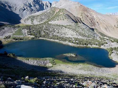
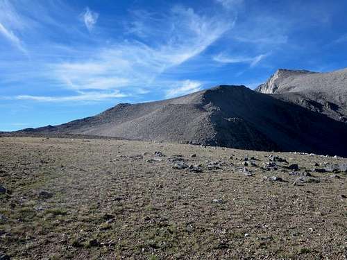
![Vagabond Peak]() Vagabond Peak (at left) in early morning from Green Lake
Vagabond Peak (at left) in early morning from Green Lake![Green Lake]() Green Lake from trail to Vagabond Peak
Green Lake from trail to Vagabond Peak![Northwest of Green Lake]() View to northwest from above Green Lake
View to northwest from above Green Lake![Vagabond Peak]() Vagabond Peak at left, Green Lake at lower right
Vagabond Peak at left, Green Lake at lower right
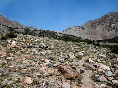
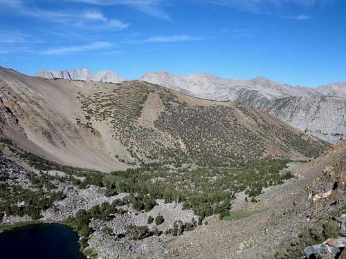
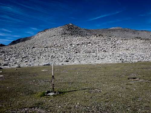
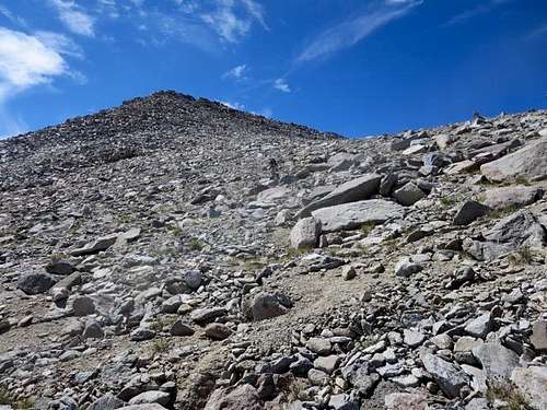
At about a mile from Green Lake, we passed a post alongside the trail. At 9:15 am, after 1.4 miles on the trail from Green Lake, we hit a second post. That is where we left the trail. While it would have been possible to ascend toward Vagabond earlier, we had heard that this slope to the south of the trail was the easiest path up, and we had encountered no problems on it the year before. Once one leaves the trail, one just hikes south up the sand and rock (there are some use trails, but they fade in and out).
![Trail to Vagabond Peak]() On plateau heading to cut-off to Vagabond Peak
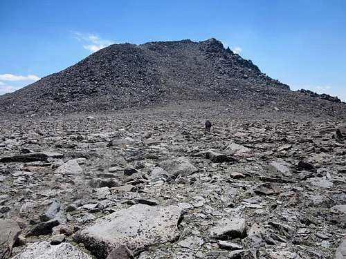
On plateau heading to cut-off to Vagabond Peak![Vagabond Peak]() Vagabond Peak
Vagabond Peak![Turn-off for Vagabond Peak]() Second post, turn-off to ascend to Vagabond Peak
Second post, turn-off to ascend to Vagabond Peak![Slope to Vagabond]() On first slope to Vagabond Peak
On first slope to Vagabond Peak
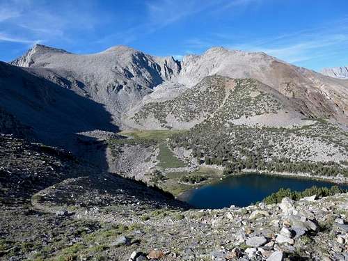
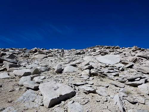
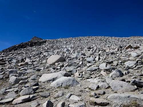
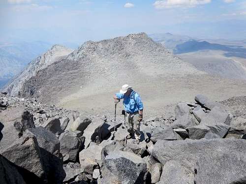
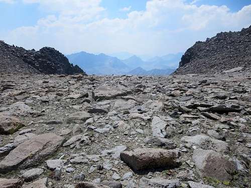
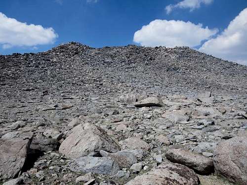
Forty minutes and six-tenths of a mile later, we stood atop the first ridge and crossed a sandy plateau before ascending the second slope directly to Vagabond’s summit. The higher up, the more rock to scramble over and around. We reached the summit by noon, 3.4 miles from our campsite and now at an elevation of 13,374 feet.
![Vagabond Peak]() Vagabond Peak with Cloudripper on left
Vagabond Peak with Cloudripper on left![Vagabond Peak]() Second slope to Vagabond Peak
Second slope to Vagabond Peak ![Green Lake]() Green Lake from final approach to top of Vagabond Peak
Green Lake from final approach to top of Vagabond Peak![Vagabond Peak]() Final steps to top of Vagabond Peak
Final steps to top of Vagabond PeakTopping Cloudripper
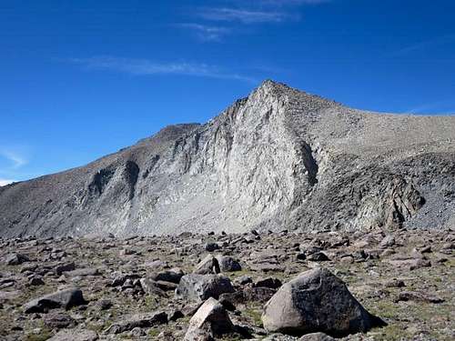
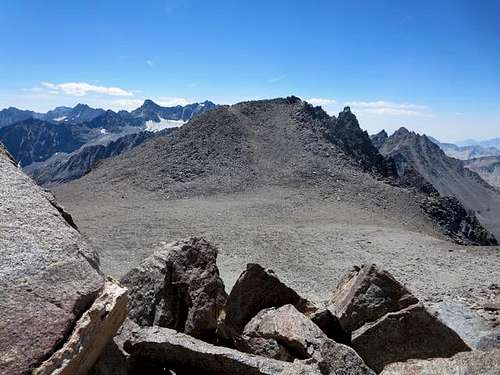
After twenty minutes on Vagabond, we down-climbed the rocky southeastern face to the saddle linking Vagabond to Cloudripper. In doing so, we shed about 300 feet, which meant regaining 450 or so feet to get to the top of Cloudripper.
![Cloudripper]() Cloudripper from Vagabond Peak
Cloudripper from Vagabond Peak![Cloudripper]() Cloudripper from saddle from Vagabond Peak
Cloudripper from saddle from Vagabond Peak
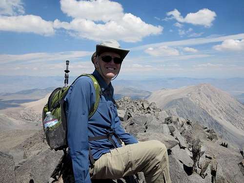
We reached Cloudripper’s rocky northern peak at 1:40 pm, about four miles from and 2300 net feet above our Green Lake campsite. That was enough for us; we decided not to go all the way to the higher center peak. The north peak afforded good views in all directions, marred only by smoke that was now again blowing in from the west.
![Nearing Top of Cloudripper]() Ruvicha nears top of Cloudripper
Ruvicha nears top of Cloudripper![Atop Cloudripper]() Atop Cloudripper
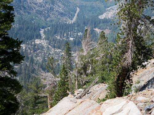
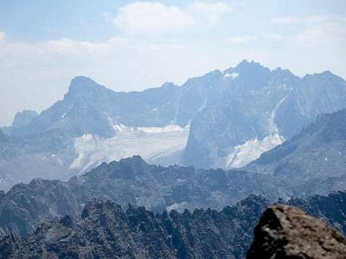
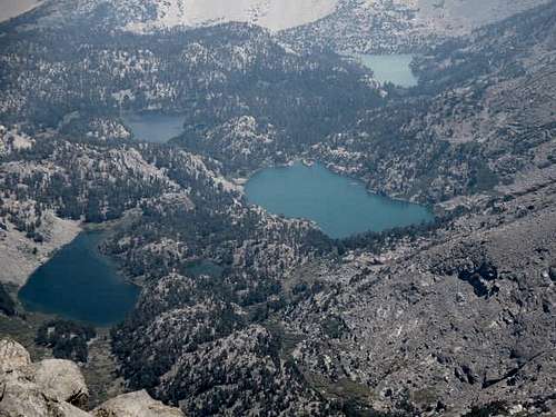
Atop Cloudripper![Palisades]() Palisades through smoke from western Sierra fires
Palisades through smoke from western Sierra fires![Number Lakes]() Number lakes through smoke from western Sierra fires
Number lakes through smoke from western Sierra firesHeading Back
After 20 minutes, snacks and congratulatory photos, we descended Cloudripper’s north slope and headed back across the saddle to Vagabond. We saved some elevation gain by not returning to Vagabond’s summit but instead crossed the midpoint of the ridge that runs southwest of the summit before heading back down the way we had come.
![Cloudripper]() Looking west from saddle between Cloudripper and Vagabond Peak
Looking west from saddle between Cloudripper and Vagabond Peak![Vagabond Peak]() Heading up Vagabond Peak ridge from saddle from Cloudripper
Heading up Vagabond Peak ridge from saddle from Cloudripper
We were back on the trail before 5:00 pm and back at Green Lake at 5:40 pm, completing an eight-plus mile hike for the day. The smoke continued to flow in, offering little decent stargazing that night. The wind kicked up considerably, with gusts of up to 50 MPH, making for a noisy time in the battered tents.
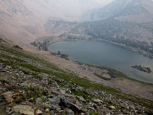
![Green Lake]() Green Lake through late afternoon smoke from western Sierra fires
Green Lake through late afternoon smoke from western Sierra fires
The next morning, we broke camp, and hiked back out. Where the Green Lake trail intersected the South Lake-Parchers Resort trail, we decided to head north (and down) to Parchers. There we dropped our packs and had something cold to drink while Jim* kindly walked up to the South Lake parking lot to fetch the car.
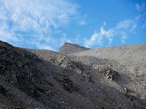
![Vagabond Peak]() Vagabond Peak, day after summitting from Green Lake
Vagabond Peak, day after summitting from Green Lake
All in all, a good backcountry hike. We enjoyed Green Lake and the views from Vagabond and Cloudripper. It’s nice to have Cloudripper done – it will be great to report climbing that in this year’s Christmas letter.
(The hike was mostly Class 1/2, with a bit of easy and fun Class 3 scrambling over rock near the two summits. A note about times. Our group is old and slow, and the hiking times reflect that. Most hikers in decent shape should be able to cut significant time off of the times noted above and could even do Vagabond and Cloudripper via Green Lake as a day hike, though it would make for a longish day.)
Comments
No comments posted yet.