
|
|
Area/Range |
|---|---|
|
|
46.15338°N / 11.45926°E |
|
|
overview
Val Calamento is situated in the central part of the long chain of the Lagorai (Eastern part of Trentino Alto Adige:ALPS-EASTERN PART), along the road that go from Telve (Village Valsugana) to the Manghen Pass.
This is a splendid Alpine valley rich in fields, woods and pastures.
From here one can make excursions into the Lagorai mountain chain.
The road leads to Manghen Pass (km.35) at altitude m.2047. At the pass, which connects Valsugana with the Fiemme Valley, one has a splendid vista of the Cadino Valley and the surrounding mountains.
From Val Calamento, ascending on the left, opens the Musiera Valley, characterized by a green plateau with magnificent views of the Valsugana.
Val Calamento
Getting There
BY CAR:Telve can be reached along the Brennero A 22 motorway (exit at Trento Centro, 38 km) and continuing along SS 47 della Valsugana (exit Borgo Valsugana); afterwards the along the SP 110 di Telve.
BY TRAIN:
Public transport:
FS station Trento (Munich-Rome line)
FS station Borgo Valsugana (Valsugana line, Trento-Venice)
Società Atesina bus connection: from Trento and Borgo Valsugana.
AIRPLANE
The nearest airports:
Verona - Valerio Catullo
Venice - Marco Polo
Milan - Linate
Bolzano - Bolzano Sud
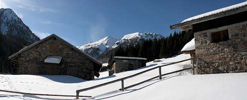
 Val Calamento | 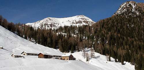 val calamento | 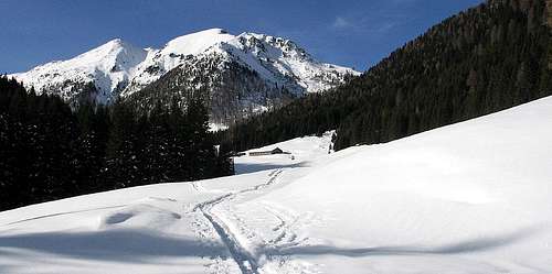 val calamento |
From Trento: go along the SS47 of Valsugana till Telve village, hence go along the road that leads to the Manghen Pass.
You travel for 20 minutes until the beginning of the Valley where it is the Bridge of the Salton main entrance for the valley.
The Val Calamento is an alpine valley lateral to Valsugana and is run, all along, by the Maso stream.
This valley goes toward NW between slopes covered by thick woods of broad-leaved and conifers; in the higher part the vegetation becomes less thin hosting some larches, mugho pines and some pinus cembra.
Ponte del Salton (Salton bridge) 1067m :
starting from here one can arrive to the Musiera highland (1400m) following for a while the sentiero della Pace (Peace path) or ascend the Val di Fregio along the path SAT 315 that leads to Malga d’Ezze showing the fine views on Cima Sette Selle, Sasso Rotto and the homonymous Cima d’Ezze.
From Malga D’Ezze, along the path SAT 374 you can arrive also to the Oasi of Valtrigona.
From Salton bridge, driving for 4 km you get a fork:
the left branch leads to the starting point of the path SAT 374 for the Oasi di Valtrigona "unique in the whole Alps" (following for some 100 metres you arrive to a big car parking).
the right branch can be driven up (10 hairpin bends) to the Passo Manghen 2047 m., the only pass crossing the Lagorai group.
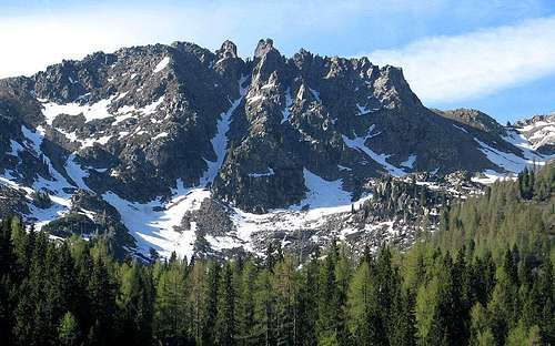
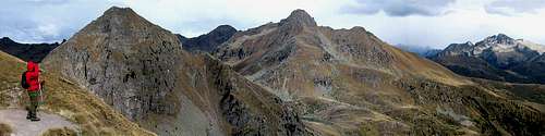
The easily accessible summits from Val Calamento are: Monte Pastronezze, Cima Cagnon, Cima Sette Selle, Monte Slimber, Monte Cadino, Monte Ziolera, Monte Valpiana, Pala del Becco, Monte Croce.
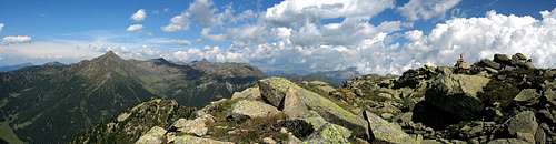
Monte Pastronezze summit
Hiking route
 Monte Croce 2490m. | Val Calamento - Malga Valtrighetta - path 370 - Malga Cagnon di Sopra - path 407 - Passo Scalet - path 460 | |
 Monte Ziolera 2478m. | ||
 Pala del Becco 2422m. | Pala del becco | Val Calamento -Passo Manghen - path 322 - path 322A - Forcella pala del Becco |
refuges
Rifugio Passo Manghen 2020m. -Passo ManghenBivacco ANA Mangheneti 2100m. - Passo Cadino
Rifugio Malga Valtrighetta 1440m. - Val Calamento
Malga Valtrigona 1632m. WWF - Val Calamento
Malga Agnelezza 1632m. WWF - Valtrigona
Pala del Becco 2422m.
Map and Books
val calamento
external links
OASI DELLA VALTRIGONA in Trentino Alto Adige ( Val Calamento) Oasi WWF" The nature sanctuaries managed by WWF Italia are nowadays 117, and cover about 30,000 hectares of territory - 6,500 hectares of which belong to WWF -, scattered everywhere: a complex and articulated protected areas system, the largest one managed by a private Association in Italy and among the main ones in Europe.
In the WWF Nature Sanctuaries almost all the natural environments of our Country are represented, to the extent that they form a homogeneous and representative system of the Italian natural ecosystems: from the alpine grasslands to the gypsum coasts, from the largest wetland system in Italy to wild canyons, from waterfalls to caves, from plain woods to the Mediterranean forests, from the peaks covered with snow to the steppe, from the beech tree woods to the wild hedges. There are areas which without WWF would have been disappeared, and thanks to its help abandoned, degraded, and over-exploited areas have been brought back to life. Animals and plants diminishing everywhere have found in the Nature Sanctuaries a safe shelter, others have been recovered: like the Sardinian deer, now safe from extinction, or the wolf, in constant growth, or the otter, which still has some possibilities to be saved; the same can be said for the several plants, often endemic species, or for those less and less widespread vegetal complexes like the fir woods along the Apennines, the hygrophilous woods, the evergreen forests. Several environments which are protected in the nature sanctuaries are part of endangered ecosystems at a European level, or they house transcontinental migratory species."Parks.it
 Val Calamento | 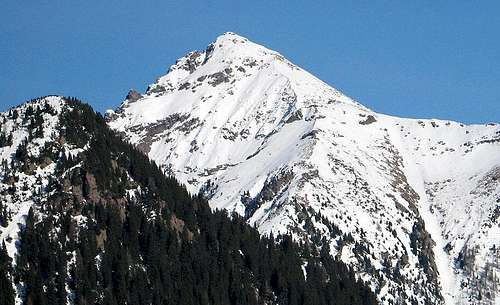 Val Calamento | 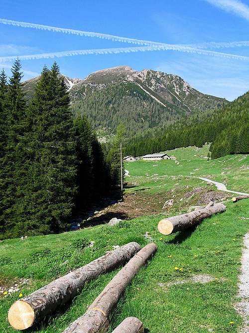 Val Calamento |
weather forecast
For weather and avalanche conditions in Trentino look at this pages:wetterzentrale
Meteotrentino
Meteo Alpin
Società Meteorologica Italiana
Il meteo .it
eurometeo
Provincia di Bolzano