
-
 5198 Hits
-
 74.01% Score
-
 4 Votes
|
|
Route |
|---|---|
|
|
46.28539°N / 13.66631°E |
|
|
Hiking, Scrambling |
|
|
Summer, Fall |
|
|
Half a day |
|
|
Rating The Tour By Hiking Standards
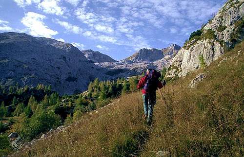

0. General: 700 m to 2041 m, exposition S and SW, marked path till the W shore of Krn Lake, then abandoned military path from the World War I, on top easy scramble. Some care is needed on steep grassy slopes. Gear: Good shoes and poles.
1. Effort: 1350 m, 5 h.
2. Power: 1 - no difficulties, only walk-up.
3. Psyche: 3 - medium (steep grassy and rocky slopes).
4. Orientation: 3 - medium (below the summit ridge no path).
Getting There
You start the tour at the end of Lepena valley. See the parent page how to get there.
Route Description
Via Cez Potoce pass.
If we don't feel keen exploring WWI remains and searching passages, we can go by a more comfortable variant around. From the Western shore of Krn Lake we continue towards the SW to Planina na Polju (alpine meadow), 1530 m, there turn right and start ascending by a shallow grassy ravine towards the NW. Also there we can find old paths and the terrain is not steep. The route is not marked, but we should have no problems reaching Čez Potoče pass, where we turn right and start ascending the summit ridge.
Descent.
Of course we can descend by the route of ascent, but here I shall describe the route from Čez Potoče pass towards the north. When/if somebody will put this as an ascent route, I shall delete this part. The reason is, that I don't remember all details any more.
From the summit we descend by the main ridge to Čez Potoče pass. There we turn right, northwards, and descend first by the ravine (screes), then we keep left, crossing the slopes of Skutnik and Lopatnik. The direction is NW and we can still follow a tiny (probably hunters) path. After some 30 min of descent from Čez Potoče, we stop crossing the slopes and go more directly downwards. If visibility is good, we shall probably succeed to find Planina Zagreben (ex alpine meadow, today there's a good hunters hut). In fog we shouldn't go by this descent route! If having orientation problems, we should just keep westwards, avoiding thus to get too much down into Šumik gorges. From the hunters hut the descent gows down into Lepena valley by a very good hunters path, which we can't miss any more. If we have enough time we can also try to enter Šumik gorge and see some of its waterfalls. For the whole descent takes some 4 hours!