-
 1179 Hits
-
 81.18% Score
-
 13 Votes
|
|
Route |
|---|---|
|
|
45.62096°N / 7.57367°E |
|
|
Trad Climbing |
|
|
Spring, Summer, Fall |
|
|
Most of a day |
|
|
VI- max, UIAA |
|
|
8 |
|
|
Overview
Verde Smeraldo
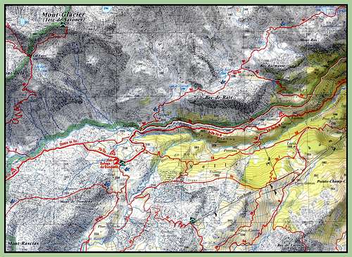
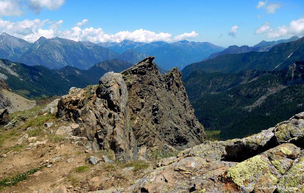
The Becs Raty are a complex of peaks located at the head of the Champorcher Valley with steep rocky walls facing to the South and more gentle slopes on the opposite side. As the plural name says they are not a single peak but a series of summits arranged on the same watershed ridge. The most interesting side to climb is certainly the South, dropping down to the gravel road heading towards Dondena with 200 to 300 meters high walls, on which are traced some fine climbing routes with various difficulty and commitments. One of these latters is the fine "Verde Smeraldo" (Emerald green), a relatively recent itinerary (2009) running on the interesting SE Wall of the Punta Placche della Scuola, located on the ridge starting westward from Becs Raty main summit.
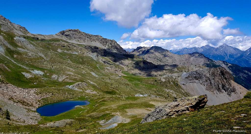
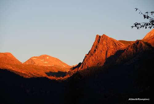
Moreover the surroundings of Becs Raty and the views are magnificent, being situated inside the Parco Naturale del Monte Avic. During the descent, developing on the opposite side of the climb, you can enjoy superb views over the Lac Giasset and Lac Raty and over some beautiful summits, as Mont Glacier and Mont Delà.
Getting There
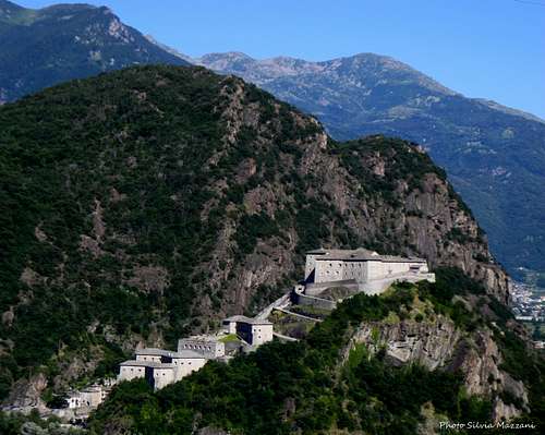
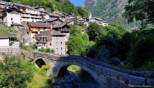
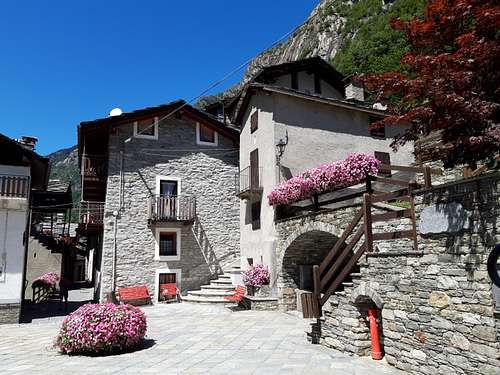
The nearest village is the beautiful Champorcher 1427 m, situated in Valle d'Aosta county in the namesake valley, the first one on the left entering Valle d'Aosta. This valley starts in Hone, a town located near the well know majestic fortress of Bard.
Road access
From Italy - Take the A5 Motorway and exit Pont Saint Martin, then continue on the road SS26 toward Hone-Bard. Here leave the main road and turn to left on the road SR2 entering the Valle di Champocher, and follow the signposts to Champorcher. The road steeply rises with some hairpins, pass Pontboset then stretches in the valley towards Champorcher. Once you reach Champorcher take the road to the right to Dondena, climbing the mountain up to La Cort (signpost), where it becomes unpaved. The dirt road - from where the stunning wall of the main Raty peak begins to be visible - proceeds to half-sail for a good stretch, then it starts cutting the slope S of Bec Raty. Pass over the black rocks at the base of Bec Raty Ridge, pass over to the aqueduct's hut where it starts the approach path to the route Poiane (signposts) and leave your car after about 500 meters in the locality Alpe Champlong, on a parking lot to the right of the road, just below the vertical of Punta Placche della Scuola and near a house with a bridge.
From France - Reach Aosta through Mont Blanc Tunnel or Petit S. Bernard Pass. From Aosta drive to Hone Bard. From here continue as in the previous point.
From Switzerland - Reach Aosta through the Grand S.Bernard Tunnel or the namesake col. From Aosta drive to Hone Bard. From here continue as in the previous point.
Route Description
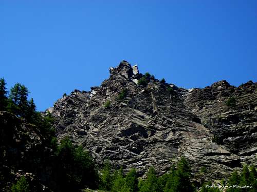
Punta Placche della Scuola
Verde Smeraldo report - UIAA scale
Summit altitude: 2417 m
Difficulty: VI - max (UIAA scale)
Climbing length: 320 m
Equipment: some fix along the pitches, equipped belays
Exposure: SE
First ascent: R. Sgubin, B. Fontanelli, M. Rivetti, M. Rivetti 2009
Starting point: Alpe Champlong
Fine route on good rock, pleasant and fun, in a setting of great beauty.
Approach - From the parking lot it is clearly visible the slab of Punta Placche della Scuola, where the route runs. A cairn indicates the beginning of an old royal grassy road, follow it briefly until two bends, after which a cairns marks the beginning of a trace. Leave the road and follow the trace marked with other cairns, climbing the steep slopes of grass and stones. On the left of a slab area it's situated a big cairn just below the start of the route (name "Verde Smeraldo" partially cleared on the wall). 30 min. from the road.
Route report
L1 - Overcome the steep litte wall above the cairn, then on easier rock and grass to the base of the obvious slab, IV+, then III, 45 m
L2 - Climb the fine slab, then a little dihedral and a second slab located to the left. A slight traverse leads to a wall that exits to a ledge. Traverse the ledge leftwards to the base of another slab, V, 45 m
L3 - The beautiful slab rises up to a belay below a wall cut by a crack, IV, 40 m
L4 - Up some large boulders heading to the obvious crack and climb it. Move to the right and on easier rock reach the summit of the first rocky pillar, IV+, 45 m


It follows a transfer of about 60 meters on a trace, then on a grassy ledge towards a big larch. Pass over to the base of the second rocky pillar.
L5 - Climb a small wall and head towards a second one, slightly overhanging. Overcome it by moving slightly to the left and then returning right. Up a series of walls and a shallow corner to a ledge, then a last short wall leads to a second grassy ledge, V, 50 m
L6 - The crux pitch. Reach the base of a beautiful red and white slab, climb it slanting left, to an obvious roof, traverse left then directly on the beautiful ridge to a large terrace, VI- (a move), 40 m


L7 Don't head to a well visible sling to the right, but stay left and climb up a short wall to an obvious overhang, overcome it to the right, then climb a reddish slab and a ridge with a small overhang. A last slab exits to a large terrace, V+, 40 m
From the belay move to the left on easy rocks to get the summit.

Descent - From the summit descend slightly in direction W and then go up to a huge cairn on a col, from which a yellow marked trail leads down the slope to W passing to the left of the characteristic Lago Giasset 2308 m. Once on the shore of the lake continue across meadows to an unpaved road leading to the main road to Dondena refuge (signposts). At the signposts turn to left and follow the road. In about 10 minutes you will return to the parking lot.


Essential Gear
Normal climbing gear: ropes 2x60, helmet, 10 quickdraws and a set of cams to integrate the protection along the pitches
Red Tape


There are not particulary restrictions in hiking and climbing. Becs Raty are situated inside Parco Naturale del Monte Avic.
Where to stay

Different possibilities in Val Champorcher
When to climb
Favorable exposure makes it possible to climb from late Spring to late October
Guidebooks and maps