
-
 15615 Hits
-
 74.12% Score
-
 5 Votes
|
|
Route |
|---|---|
|
|
34.20164°N / 118.27249°W |
|
|
Hiking |
|
|
Half a day |
|
|
I |
|
|
Overview
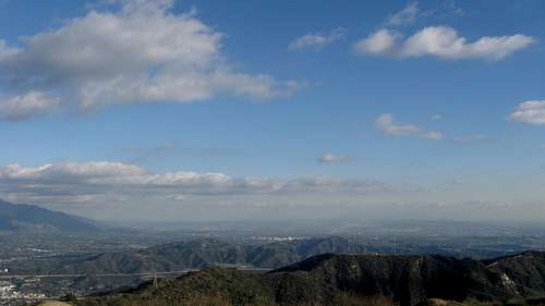
This is a very nice, off-trail, urban hike easily accessible from a freeway with a 2100 ft. gain in roughly 2.5 miles for a fantastic view. By no means a typical hike. It is special. The following marked-up topo shows the general parameters of the hike after it leaves a regular trail and becomes an off-trail adventure on a ridge line: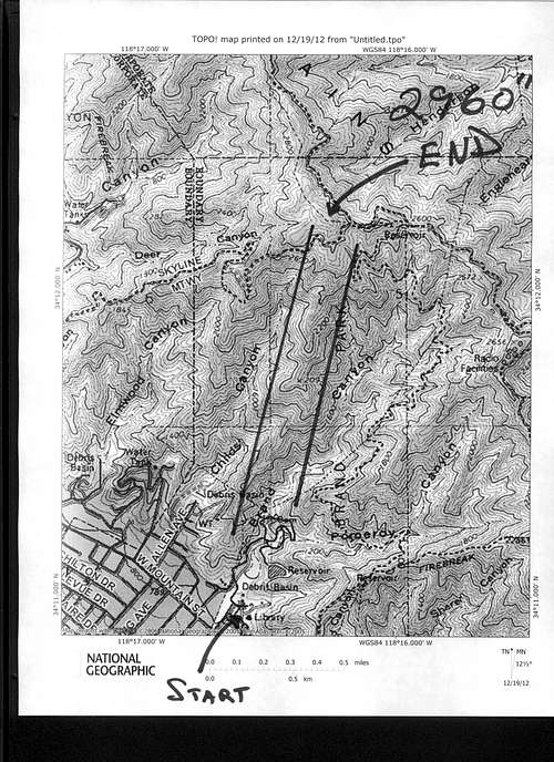
Topo showing range of ridge line and end of Verdugo Mountain Brand Park Canyon Hike
Getting There
Take the San Fernando Exit where I-5 and the 134 freeways intersect. Take San Fernando Road toward Burbank. Quickly turn right after about 3 lights on Grandview Blvd. Take it all the way straight up to Brand Park and park in the upper parking lot near Brand Library. The hike begins from the parking lot.Route Description
This hike is approximately 5 miles long, up and back, with a gain of a little over 2,000 feet, 2,060 by my altimeter watch. It is not on trail. It is extremely advisable to have long sleeves and pants, poles and water (it is hot, as it is south facing). I have done it in 2.5 hours. Figure 60% of your time going up and 40% to return. One doing this hike should be comfortable with a small amount of bushwhacking and have the confidence to proceed by following geography up and down a ridge. No permit is required.
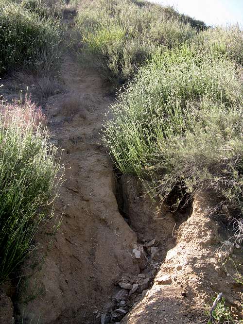
The hike begins in the parking lot at Brand Park to the left of the library, starting at a short maintained trail marked with a cross right next to the road. Follow it a minute or so to the water tower where there is a three way split. Take the middle, paved trail (the left trail goes down into the wash, the right goes up a different, popular trail). In a very short distance, maybe a minute, you will pass a reservoir, and then wind down a road left. You will come to an offshoot gravel road which you will take toward Brand Cemetery (there is a sign at the offshoot). Take this offshoot which becomes a trail and passes Brand Cemetery (there is a visible obelisk inside the fenced cemetery). Go up this trail a little bit and you will see a ruined building on the left made of cinder blocks. Keep going past this structure and follow the creek up at a right turn (the creek has been to the right since coming up from Brand Cemetery). You will now start encountering some fallen trees and the like, but it is not too hard to navigate. Just keep going up the canyon and soon you will see some very old stone stairs with severely overgrown brush. You are to be moving up the canyon on the left. The turn off point to what I consider the start of the real hike will be just shy of the first damn, up over a stone wall on the left with some old decayed stone stairs, and over a fallen tree. Here is a picture leading up to the starting point:
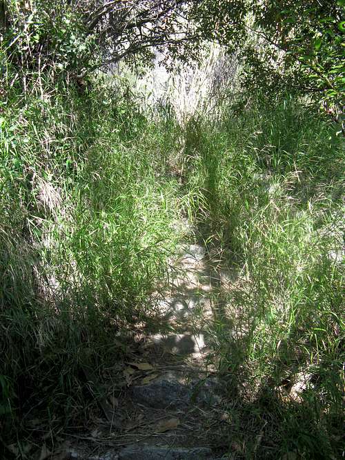
Old stone stairs before damn and turning point
Remember, the starting point is just below the first damn, and very close to 3 tall palm trees that presently are highly visible. You can see the palm trees in the following picture (in the bottom left hand quarter of the picture) which was taken from a vantage point on up the hill, where you can also see the obelisk at Brand Cemetery with magnification (look at about the middle of the following picture, about 20% from the right border).
Bottom third looking down at 3 palms and also showing obelisk at Brand Cemetery
If you are on pace to do this hike in 2.5 hours, the turn off point beginning what I have called the real hike will be anywhere from 7-13 minutes from your car, depending upon how fast you start out.
Once you make this turn off, the rest of the hike will not follow any trail, unless you consider an overgrown use trail from the 2005 Harvard fire or a drainage wash a trail. I have personally noticed that this trail has become much more overgrown as time goes by. Hopefully more people will start doing this hike to help keep some of the growth in check. The basic strategy of the hike, in a nutshell, is to follow ridgelines up to the old Brand Road, a 2000 ft. elevation gain from the parking lot, then cross over that overgrown road and proceed up a hill, to its top, then to the left, until an obvious and small plateau is gained where one has an approximate 360° view. So, at any time, one just has to keep this perspective and, even if no use trail is visible (which happens now and again), keep proceeding up. It will pay off nicely in the end.
Getting back to the trip route, once you make the turn off, there is a small use trail that proceeds somewhat up through some small tree like bushes and to the right, until a small hill is gained. Here is an early picture on this route:
Just starting bottom one third of hike
Once this is done, a drainage wash trail up a ridgeline to the left is obvious. Here is a picture looking up this “path”:
Bottom third going up hill
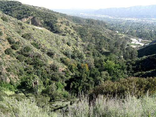
This hill is probably the toughest portion of this hike. It is not fast. It is steep in places, and crumbly, requiring planned foot placement. I always use poles. (Once a friend of mine did this hike without poles and with poor shoes, meaning shoes that did not grip loose crumbly dirt well, and I had to push him portions of this hill.) It reminds me of traveling up the first bump on the south ridge heading up to Iron Mountain after Allison Saddle, and this really is like a small section of that hike. That is what you will be dealing with. Also, this too is a South ridge, which means sun exposure. Luckily this is a much smaller gain until you reach the top. Here is a picture looking at this hill from across the canyon (not a part of this trail)(note also the three palm trees, again, at the bottom lower left part of the picture):
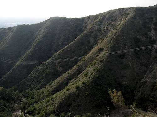
View of bottom third hill, including starting point of 3 palms, from across canyon
Top of bottom third looking across canyon for visual placement marker
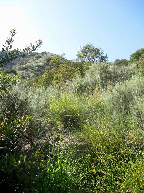
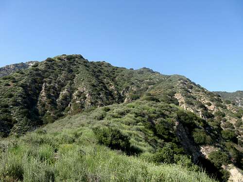
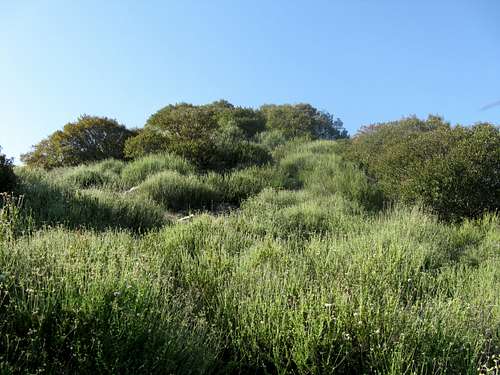
The next third of the hike going uphill will eventually bring you atop a hill, from which you can start to see the real summit to which you are heading. Before you reach this point, there will be several small hills. Some portions of this section will again involve steep, crumbly up-hill slopes. Just keep your eye on the ridge and proceed up. Also, don’t worry if you lose the use trail; just keep going and eventually you will regain it, although some small bushwhacking may be required. I have posted a picture to give some idea of how this section looks. This section of the hike proceeds along the ridge line between Brand and Childs Canyons. Here are some pictures along this segment:
Beginning of middle third
Heading up middle third toward tree bushes to go through
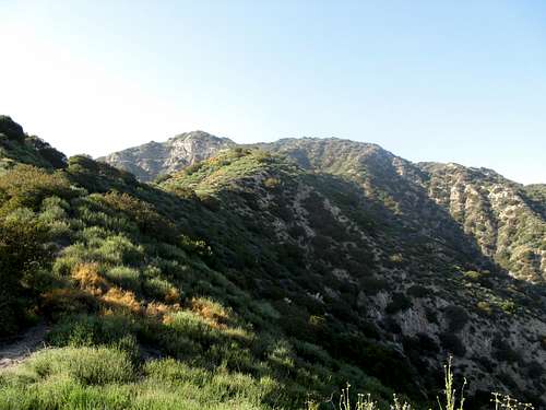
Top third looking up
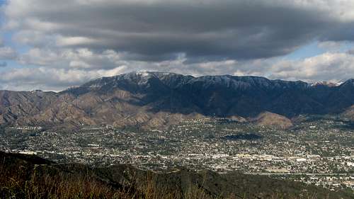
Top view looking north with snow dusting
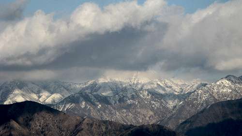
Top view looking north, close-up, of snow on San Gabriel Mountains
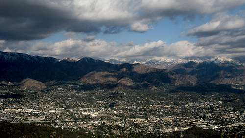
Top view looking toward Pasadena
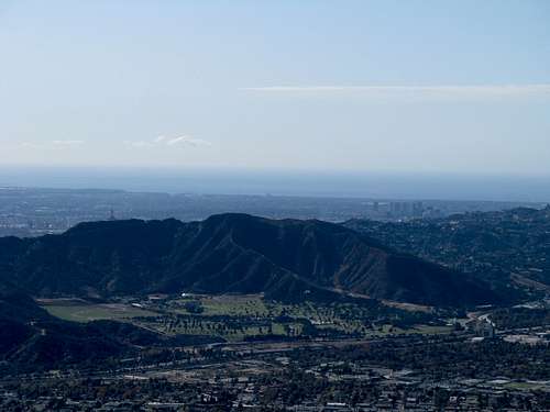
Top view close-up of Forest Lawn, Century City & Santa Monica Bay

Top view looking at Los Angeles, Palos Verdes & Catalina Island with hail on ground
Top view looking toward Mt. Lukens with snow dusting
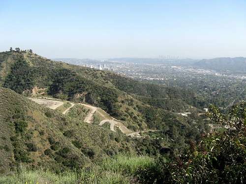
The return trip down goes much faster than the up-hill trip. If you do not want to go back down the same way, there are longer and more time-consuming options, some of which are described in various hiking books. Once you leave this wonderful vista and go back down to the road, you can follow the road to a bench with a great view; alternatively, you can take a boring road over to Verdugo Summit (but why bother?). I will not detail any such side trips or descents because they bore me, they are described elsewhere, they are slower and they are far less fun than going back down the same way. Also, going back down the same way gives one the opportunity to develop down-hill speed and strengthen muscles that often are not used on trails. And, if you are lucky enough to do the descent during a rain, you are in for a lot of fun, as long as you have some down-hill skills.
Upon doing the descent back to the turn off point just below the damn, retrace your path back to the road that had the turn off to Brand Cemetery, and then turn right. This is a paved road, which is less fun than the way described for coming up from the parking lot, but it adds some variety. Also, it ends up passing by the Doctor’s House where there are drinking fountains that make a fine finish to the hike right before the parking lot.
Now for some hazard disclaimers. Ticks are possible. Hence long sleeves & pants & vigilance. I know at least one person who got a tick on this route. Rattle snakes are possible. A buddy of mine’s dog was bit and killed by a rattlesnake on the trail portion of this hike between Brand Cemetery and the right turn across the creek. This happened in the spring of 2012; the City has since cleared this area of much brush, so this is probably less of a concern now. Finally, a mountain lion has been sighted in this park. I hiked this trail on the same day the mountain lion was seen over near Oakmont Country Club. I have seen tracks of large animals on the trail. Although the chances of an encounter seem slim, standard advice is not to hike alone (which I often do anyway) and be vigilant. My personal conclusion is that such risks are part of the reason this is such a special hike given its easy access and proximity to civilization.
I like to call this hike a non-trivial hike. I use it as a workout and to gain hiking strength, doing it regularly and often, and also to build mental toughness. You feel good once you have completed the hike. I met one older gentleman on this trail once that said he had done it over 150 times. Once you make the turn to start the ridge gaining portion of this hike, it is rare to see anybody else on the trail (I estimate that I see somebody else on this hike less than 20% of the time I hike it), which is something uncommon for most urban hikes. It also means that you can assume no help whatsoever if something goes wrong, so you better do this with others or have confidence in your ability to do a hike like this alone.
I absolutely love this hike.
Something Cool with Google Maps
Because this hike is in a small range of mountains surrounded by urban areas, you can get detailed images of most all of this hike, up to "lunch rock," at fairly high resolution on Google Maps with the satellite view. It took me awhile to undertand what I was looking at, but because I have done this hike so many times, I was able to trace my route up the mountain by reference to a faint use trail. You get a clear view of the early portion of the hike from the parking lot, the Brand Cemetary and that whole area. You can also see the three palms where the off-trail begins. From there, you can trace on up until the resolution changes just before you cross the road. So this is something you would not normally have on most hikes. It is fun to play with.
Essential Gear
Long pants and sleeves; water; poles.
Seasons
This trail can be hiked all year, although it gets very hot in the summer, which suggests an early or late start.
yatsek - Mar 3, 2013 3:29 pm - Voted 9/10
Dams?Damn the dam :)