

Viewing: 1-6 of 6

reinhard2 - Feb 13, 2008 12:59 pm - Hasn't voted
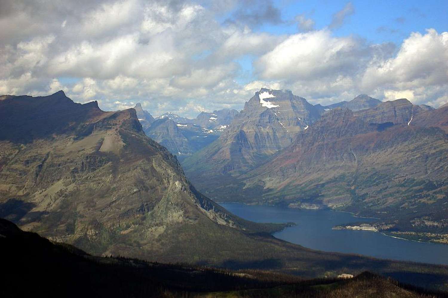
A stunning viewWhat is the altitude difference between the lake and the summits?

Moni - Feb 13, 2008 8:03 pm - Hasn't voted
Re: A stunning viewThanks! The Lake is at 4484 and Going to the Sun is at 9642 - so not quite 5200 feet.
reinhard2 - Feb 14, 2008 7:53 am - Hasn't voted
Re: A stunning viewThank you, Moni - ouph, I have to calculate, 5200 feet (your?, my?) that makes about 1730 m, right? ;-)
Moni - Feb 14, 2008 9:10 am - Hasn't voted
Re: A stunning viewVerzeihung! I should have looked at your profile page to see you would prefer meters. Saint Mary's Lake is at 1367 meters and Going to the Sun is at 2939 meters, a difference of 1572 meters. Glacier National Park has very few 3000 meters peaks, but it is very rugged terrain.

The Levitator - Mar 24, 2009 7:54 pm - Voted 10/10
CoolWhat a spectacular view of some of the other mountains in GNP.
Awesome photo!
Moni - Mar 24, 2009 9:11 pm - Hasn't voted
Re: CoolThanks - it's our computer desktop picture and I love it. Some days you get lucky!
Viewing: 1-6 of 6


Comments
Post a Comment