
Viewing: 1-3 of 3

brenta - May 1, 2005 10:46 am - Voted 10/10
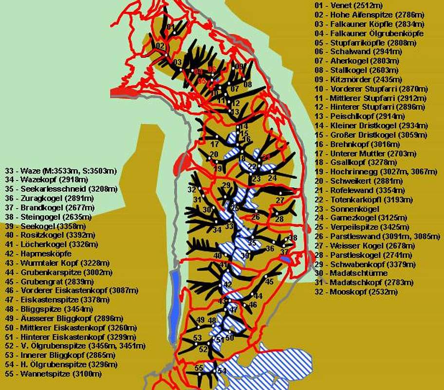
LegendThis is an impressive piece of work. Should the caption say what red and gray lines denote? Red should be trails and gray should be roads, but what about the large red expanses?

Gangolf Haub - May 1, 2005 11:35 am - Hasn't voted
Re: LegendThe large red expanses are the villages - but putting up their names would have made the map even more clustered. Therefore the huts are also missing :-(

livioz - May 1, 2005 4:09 pm - Hasn't voted
How much time...did you spend to do it? A quarter of an hour, I suppose ;-))
Perhaps you could contour with a black line the large red expanses indicating the villages. If it doesn't imply to do again all the work ....
Viewing: 1-3 of 3


Comments
Post a Comment