Toggle navigation
Mountains
Routes
Images
Trip Reports
Forum
What's New
People
Areas & Ranges
Articles
Trailheads
Canyons
Huts & Campgrounds
Albums
Logistical Centers
Fact Sheets
Lists
Custom Objects
Gear
Plans & Partners
WELCOME TO SUMMITPOST
SIGN IN
REGISTER
Peak 5950
Additional Parents
Image
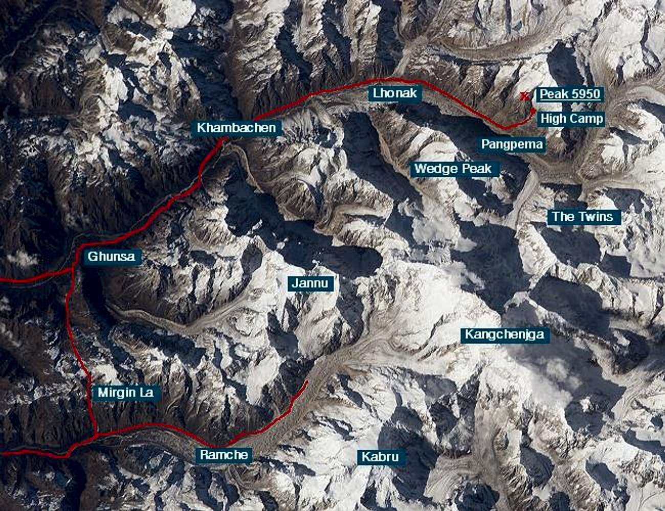
Kangchenjunga satellite photo
View High-Resolution Image
Kangchenjunga satellite photo
Nasa satellite photo of Kangchenjunga, with our trekking route indicated in red, and Peak 5950 pointed out in the upper right. Compare with
this 1899 map
drawn by Garwood during the Freshfield expedition.
« PREV
NEXT »
Nelson
on
May 12, 2005 10:11 am
Comments & voting
Other parents
Lat/Lon:
27.80280°N / 88.11330°E
Image ID:
104691
6933 Hits
85.35
% Score
20
Votes
Log in to vote
Comments
No comments posted yet.
to post!
Don't have an account?
Peak 5950
(Mountain/Rock)
« PREV
Viewing
#8 of 13
GALLERY
NEXT »
Nelson's Image Gallery
« PREV
Viewing
#120 of 402
GALLERY
NEXT »
×
You need to login in order to vote!
User Name
Password
Remember me
Forgot your password?
Log me out when I close my browser.
Keep me logged in all the time.
sign in as a user
Don't have an account?
Register now for FREE
Rating available
Suggested routes for you
People who climb the same things as you
Comments Available
Create Albums
Register Here


