Toggle navigation
Mountains
Routes
Images
Trip Reports
Forum
What's New
People
Areas & Ranges
Articles
Trailheads
Canyons
Huts & Campgrounds
Albums
Logistical Centers
Fact Sheets
Lists
Custom Objects
Gear
Plans & Partners
WELCOME TO SUMMITPOST
SIGN IN
REGISTER
Twin Sisters East
Additional Parents
Image
Twin Sisters East
View High-Resolution Image
Twin Sisters East
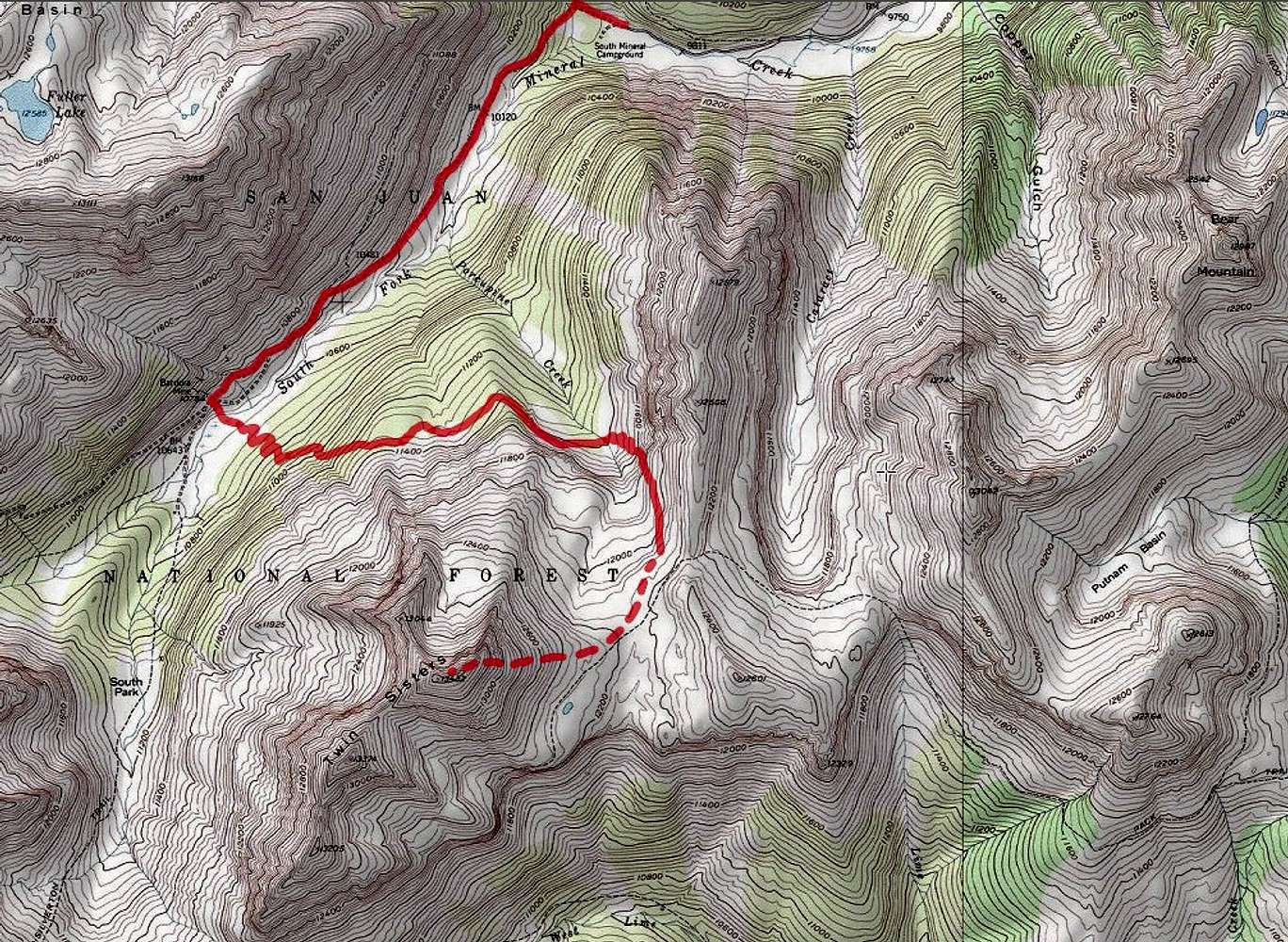
Solid line shows 4 wheel drive road to Bendora Mine and the nameless trail. Dashed line is the path that I took. The trail does not appear on the USGS map. I have drawn its approximate position by looking at satellite images.
« PREV
NEXT »
nader
on
Jun 9, 2021 4:37 pm
Comments & voting
Other parents
Lat/Lon:
37.77158°N / 107.78562°W
Image ID:
1061159
1048 Hits
71.06
% Score
1
Votes
Log in to vote
Comments
No comments posted yet.
to post!
Don't have an account?
Twin Sisters East
(Mountain/Rock)
« PREV
Viewing
#39 of 39
GALLERY
You are at
the Last
Image
nader's Image Gallery
« PREV
Viewing
#14970 of 15273
GALLERY
NEXT »
×
You need to login in order to vote!
User Name
Password
Remember me
Forgot your password?
Log me out when I close my browser.
Keep me logged in all the time.
sign in as a user
Don't have an account?
Register now for FREE
Rating available
Suggested routes for you
People who climb the same things as you
Comments Available
Create Albums
Register Here


