
Viewing: 1-9 of 9

Nyle Walton - Aug 27, 2005 10:47 am - Hasn't voted
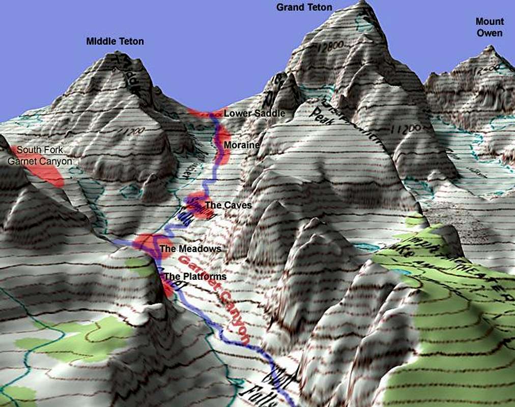
Great ArtI am amazed how you came up with this piece of cartographic art. This model displays altitude and relief that provides all the detail a prospective climber needs to understand the Grand Teton. I congratulate you on your devotion to this magnificent range of mountains.

mountaingazelle - Aug 27, 2005 1:08 pm - Voted 10/10
Very CoolThis 3-D map really shows how steep the Tetons are.
jayhup - Aug 30, 2005 3:42 pm - Hasn't voted
Excellent Graphic!Now I get a better idea of where I was last week when I was sitting at Amphitheatre Lake!

rematore - Nov 13, 2006 1:21 pm - Voted 10/10
Nice!.

MoapaPk - Mar 6, 2007 4:22 am - Voted 10/10
detailed DEMMuch sharper than the usual 3-arc-second topo software DEM.

CBakwin - Apr 7, 2008 5:01 pm - Hasn't voted
GreatBeautiful! But also it would help to know how far from the trail head to the saddle.

realdeal577 - Jun 13, 2010 10:40 am - Voted 10/10
Awesome!What a great display!
MikeLell - Nov 13, 2010 3:14 pm - Hasn't voted
NiceShame that all the contours are in feet though!

brendon - Nov 24, 2010 5:07 pm - Hasn't voted
Re: NiceWell, if it helps, the digital elevation model was metric. :/
Viewing: 1-9 of 9


Comments
Post a Comment