-
 40572 Hits
-
 82.93% Score
-
 17 Votes
|
|
Route |
|---|---|
|
|
8.9333°S / 77.7°W |
|
|
Ice Climbing |
|
|
Winter |
|
|
Most of a day |
|
|
AD +/70º |
|
|
9 |
|
|
Overview
Ferrari route on Alpamayo
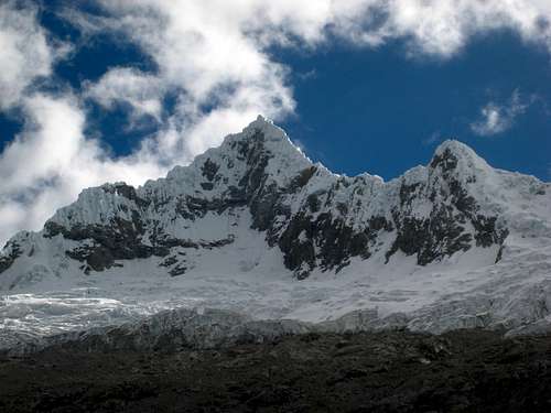
Alpamayo 5947 m. An almost perfect pyramid, so much so that it is worth the title of "the most beautiful mountain in the world". Its only drawback is not to reach 6000 meters, but perhaps also for this reason Alpamayo is a very special peak! It's a popular destination for many climbers who dream to climb its magnificent South-West wall with its famous organ pipes, nevertheless it should not be underestimated. The peak is located in the Cordillera Blanca, Ancash region, the highest tropical mountain range in the world, with its 180 km of extension in the North-South direction.
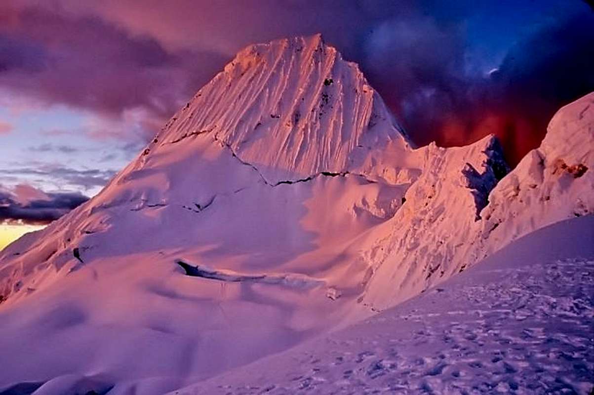
Ferrari is the easiest and therefore the most popular route to Alpamayo. It crosses the bergschrund near its uppermost part and follows the runnels to the ridge. Most times snow stakes for belaying and abseiling are in situ. When the route is prepared for commercial expeditions you may even find a fixed rope. The runnels are quite narrow, therefore it's impossible to avoid the ice-fall caused by other climbers. This can be a serious problem, when there are too many climbers in the route (except you are the first).
NB: After the July 2003 icefall the conditions in Ferrari Route seem to have changed and in recent years the Via Ferrari it is more rarely climbed in favor of the more demanding but - it would seem - safer French Direct. See the summit log.
History
The route was the first to be climbed on the SW wall of the Alpamayo and was opened in 1975 by the expedition of the Ragni di Lecco led by Casimiro Ferrari with the companions Danilo Borgonovo, Pino Negri, Sandro Liati, Angelo Zoia and Pinuccio Castelnuovo.
Getting there
There is a good choice of flights getting to Lima, both from Europe and North America, obviously many more from South America. "Lima Aeropuerto Internacional Jorge Chavez" is located in suburban Callao (about 12 km West to downtown).
Getting to Huaraz
Huaraz, the capital of the Ancash region and Cordillera Blanca, is a lively and bustling town located about 3000 meters above sea level, which offers several opportunities for accommodation and food, and also easily the possibility to arrange on-site transportation and trekking for people who haven't previously booked any service. Sometimes there are flights joining Lima and Huaraz, but they are not regular. At moment, the best way to get to Huaraz is a 6-8 hours trip by bus or private minibus (if you're travelling with an organized expedition). Currently, comfortable coaches provide a good transportation from Lima to Huaraz. There are six different bus companies, the best ones are Cruz del Sur, Movil Tours and Ancash Express.
Getting to Cashapampa
The starting point of the trail to Quebrada Santa Cruz is situated in Cashapampa 2900 m, a little "pueblo" located in the Northern Cordillera Blanca, some km N to Caraz. In Huaràz you can take a "colectivo" (public transport) to Caràz and another one from Caràz to Cashapampa. Otherwise in Huaràz you can also arrange with a small truck owner to bring you straigth to Cashapampa. This is surely the quickest way and the most convenient option if you share the transport with other passengers. The best choice is to arrange previously for "burros" (donkeys), anyhow if you haven't provide for in Huaraz, in Cashapampa you can hire arrieros (muleteers) with the traditional burros (donkeys) to help you to carry your gear along the trail. Be aware that if you didn't pre-arranged burros in Huaraz and you arrive late in Cashapampa, you may end up staying overnight there.
Approach to Alpamayo Base Camp, Moraine Camp and High Camp
From Cashapampa the path rises quite steep along the Quebrada Santa Cruz inside a narrow canyon between high rocky walls. In the first half we gain in altitude, in the second half in the distance. After the rocky gorges, the valley widens and the trail becomes less steep to get Llamacorral after about 2,30-3 hours. Here if necessary you can arrange the first camp.
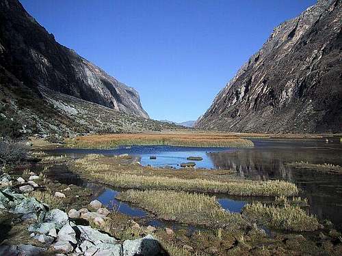
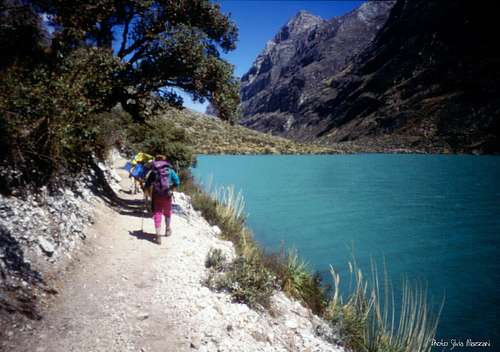
The trail continues up the valley coasting in succession two wonderful and extensive lagoons, at first the smaller Ichiccocha, then the larger one, Jatuncocha, meaning "large lagoon". During the walk we will observe the Caraz, Quitaraju, Alpamayo and Artesonraju. Successively we cross a dry floodplain with views over Artesonraju, getting to a fork marked by a signpost indicating the beginning of the Quebrada Arhuaycocha, leading to Alpamayo and Quitaraju BC. Here you leave the popular Santa Cruz trail and take the left trail: you will soon be winding up switchbacks up a steep slope. Follow this trail until you reach the obvious Alpamayo BC.Many parties will take a rest day here.
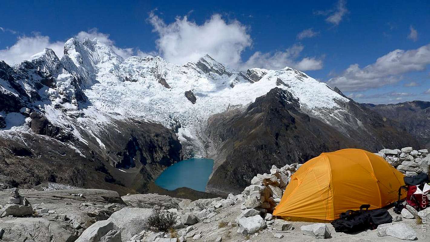
To the Moraine camp follow a path up the steep slope marked by cairns. Soon you will reach rock slabs and a number of cairns and different paths will lead you all different directions, but all lead to the Moraine camp at about 4800 m of altitude. This will take around 2 hours from the Base Camp, depending on fitness and acclimatization.
To the Col, continue to the glacier edge. Ascend the glacier avoiding crevasses towards the Quitaraju-Alpamayo Col. The final 200 m is the most difficult stretch with some short sections of 80° ice.
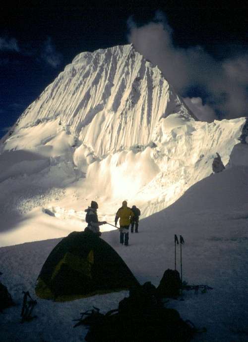
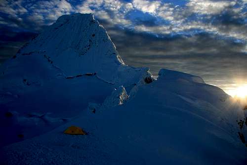
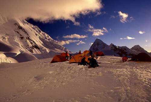
From the High camp (5300 m) you first have to descend about 50 m and then continuosly ascend the slopes under the SW-face. The climb starts right of the uppermost section of the bergschrund. 1½ - 2h from the camp.
Route Description
Route Ferrari - South West wall
Difficulty: AD +/ 70º
Length: 650 m. 8-9 pitches, 4-5 h
First ascent: Casimiro Ferrari, Danilo Borgonovo, Pino Negri, Sandro Liati, Angelo Zoia and Pinuccio Castelnuovo 1975, july 20
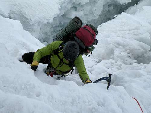
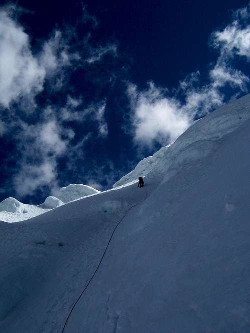
Cross the bergschrund (varying conditions, approx. 70°, 10m) and head up to a prominent rock in the middle of the SW face. Follow the runnel to the snow ridge. Except for the bergschrund, the route has a moderate inclination of 45°-50°. The slope is regular getting steeper only in the last pitch, the most challenging: 55°-60°. The ice is not very compact and partially mixed with hard snow, but the condition changes from year to year - To reach the summit, get out on the ridge, you must follow the aerial summit crest
Descent: abseiling the route
Essential Gear
Two ropes, two ice axes, crampons, helmet, 4-8 ice screws. 2-3 snow pickets. Usually you find snow stakes in the route but I would recommed to take ice screws and snow stakes (2 per climber) with you. It's possible to buy and sell them later in Huaraz. You do not have sun on the route until noon, so be prepared for a cold day!
Red Tape
The Huascaràn National Park is administered by the Instituto Nacional de Recursos Naturales (INRENA). An entrance fee is due. In 2011, the fee for the Huascaran National Park was 65 Soles for 21 days. Since 2011, officially nobody is allowed to climb without a Mountain Guide, except for the persons who are members of a Mountaineering Association. In this case, the permit can be obtained at the National Park Office in Huaraz, showing the Alpine Club card.
Always be respectful of this fragile landscape. Carry-out everything you bring in and any litter that you carry-in or that you find on the routes and help to conserve the beautiful landscape! Take care of nature as usual in the natural sites and particularly within the boundaries of all the natural parks.
When to climb
The best time to climb in Cordillera Blanca is the dry season, going from middle May to the beginning of September; it's the local winter, being Peru located on the Southern hemisphere. Anyhow, still there is usually too much snow dust in May and June for the ascents, the months of July and August are more indicated. Usually the rainy season starts in early September.
Climate, Mountain condition
The climate of the Cordillera Blanca is influenced both by the dry air coming from the Western deserts and by the wet air coming from the Eastern amazonicos forests. From May to the begining of September, the Cordillera Blanca has some periods of clear weather, expecially in June and July, generally with an alternation of few days of bad weather. During these days the mountains can get some amounts of snowfall. Sometimes August may be a month of change, expecially in the second half, with possible afternoon storms. Being the "Blanca" located in the Southern hemisphere, North and East faces get good conditions first.
The "Casa de Guias" situated near the Plaza de Armas in Huaraz is the spot where to gather information about recent snow-fall and weather conditions.
Accomodation
There are plenty of possibilities in Huaraz.
Meteo
Weather Forecasts
Meteo Huaraz - Ancash region
Guidebooks and Maps
Guidebooks
- Classic climbs of the Cordillera Blanca – Perù by Brad Johnson, 2009 revisited edition - in English
- "Escaladas en los Andes" by Juanjo Tomé Ed. Desnivel, 1999 - in Spanish
- "Climbs of the Cordillera Blanca of Perù" by David Sharman, 1995 - in English
Maps
Alpenvereinskarte 0/3a Cordillera Blanca Nord (Perú) 1:100000
External links
Parque Nacional Huascaràn
Cordillera Blanca on Wikipedia
Unesco info




kabernicola - Sep 30, 2007 9:37 am - Hasn't voted
Not the ferrariI´m afraid this route is not the ferrari, it was investigated by antonio gomez bohorquez (HE WRITES ABOUT ANDES IN THE AMERICAN ALPINE JOURNAL)and he discovered that this route was not the one ascended by ferrari (the italians climb up what is know as the french direct). Everything is in this book http://andesinfo.com/libreria/libros/libros.php . The fact is, it was a first mistake and after that everybody copied from the one before... and thats how the mistake remained as the truth!...if you want to ahave an accurate page check that info first...good job anyway