Toggle navigation
Mountains
Routes
Images
Trip Reports
Forum
What's New
People
Areas & Ranges
Articles
Trailheads
Canyons
Huts & Campgrounds
Albums
Logistical Centers
Fact Sheets
Lists
Custom Objects
Gear
Plans & Partners
WELCOME TO SUMMITPOST
SIGN IN
REGISTER
Mount Tom
Additional Parents
Elderberry Canyon
Image
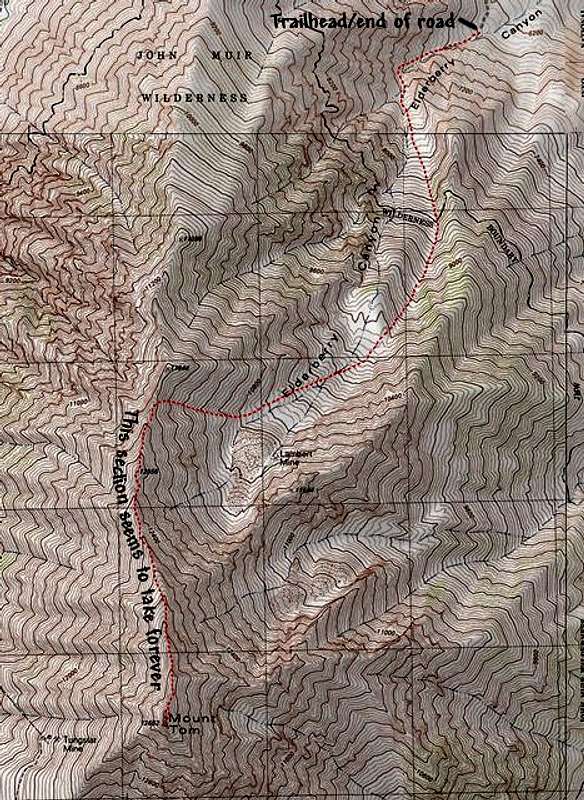
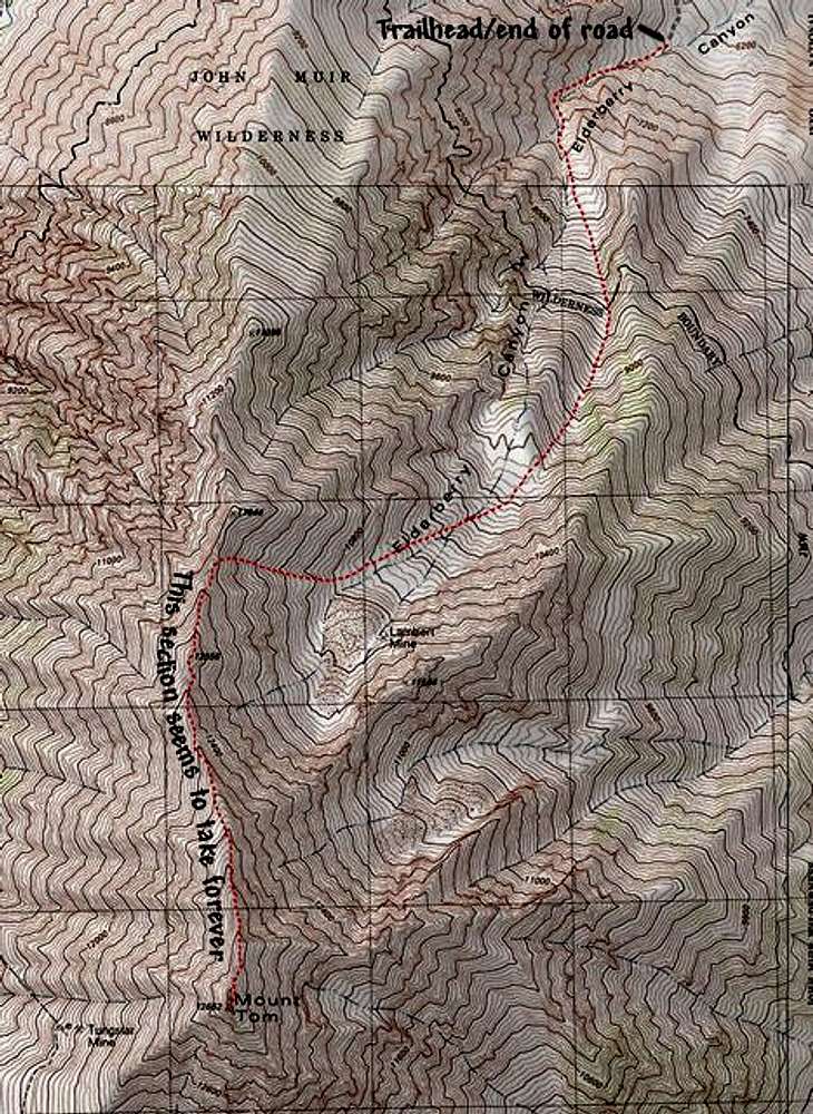
This map shows the route...
View High-Resolution Image
This map shows the route...
This map shows the route from the end of the road leading from Rovana. After the Lambert Mine, you can choose which loose, talus filled chute you wish to ascend
« PREV
NEXT »
bearbnz
on
Jan 19, 2003 10:01 am
Comments & voting
Other parents
Lat/Lon:
37.33900°N / 118.655°W
Image ID:
16065
10453 Hits
77.48
% Score
8
Votes
Log in to vote
Comments
No comments posted yet.
to post!
Don't have an account?
Mount Tom
(Mountain/Rock)
« PREV
Viewing
#45 of 199
GALLERY
NEXT »
bearbnz's Image Gallery
« PREV
Viewing
#82 of 518
GALLERY
NEXT »
Elderberry Canyon
(Route)
Loading....
×
You need to login in order to vote!
User Name
Password
Remember me
Forgot your password?
Log me out when I close my browser.
Keep me logged in all the time.
sign in as a user
Don't have an account?
Register now for FREE
Rating available
Suggested routes for you
People who climb the same things as you
Comments Available
Create Albums
Register Here


