
-
 4848 Hits
-
 71.06% Score
-
 1 Votes
|
|
Route |
|---|---|
|
|
42.80830°N / 0.2378°W |
|
|
Download GPX » View Route on Map |
|
|
Scramble+rocky ridge |
|
|
A long day |
|
|
Class 4 |
|
|
F+ (Easy sup, I+) |
|
|
II |
|
|
Approach
You must consult main page for the approach to La Sarra. |
Route Description
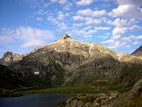 Lake Campoplano
Trailhead: dam of La Sarra (1440m)
Slope: 1600m.
Time to summit: 5h 30min or 6h. (Total 10h 30min or 11h)
It's advisable the night in the refuge of Respumoso (2140m): the time to summit from here is 3h20min, slope 900m.
For approach to refuge of Respumoso from La Sarra you must to consult the page of Picos del Infierno or Balaitous
Behind of the refuge we follow the signal, initially "Balaitous, Facha..." and after 25 meters the signal "Gran Facha" to right side. The walk is a good path with stone pavement to reach a little col. From there we descent to the left side to the dam of Campoplano. In this point after the lake we cross the little river and we follow the right border searching the cairns of stones to reach the entry of the ravine (in the ravine the snow remain generally to july).
After the ravine for a slope of stones we reach first the ibones (lakes) of la Facha and for a little path the Col of Facha (2665m).
In the col there joins the French route proceeding from the refuge Wallon.
The itinerary is a simply trek to the col but now begin the real climb. The last 400 meters across the ridge North is the most complicated part of the route. Initially we follow the little path among the rocks with orientation west (side of Respumoso) to reach some steps of I and I+ with some free stones (be carefull with the people under you!). The cairns are generally the best option but you can to climb for some different places near of the edge of the ridge. In some places you can to find some terraces to evitate the ridge. The last spun of I+ is possible to evitate in left side to reach the final ridge in the point of 2990m (called Punta Lagardere in some maps). After 100 meters and the descent and ascent of two breches we reach the virgin of the summit.
The descent is for the same route (but in winter you can to use a little coulouir from the point 2990m to reach the ibons de la Facha).
 |  |  |  |  |
Ridge North
This is the most difficult part of the route and the key of the climb. Generally is easy for the trained mountaineers but it' not advisable for other people. |  |  |
Essential Gear
Early in the season is neccesary the use and crampons and ice-axe to reach the col of Facha. In the rocky ridge with some of snow the rope is usefull.Helmet? like others peaks as Balaitous or Vignemale the fall of stones in the days with a lot of people is dangerous and the helmet is a very good idea but due to the prolonged of these climbs only a few of people take helmet to lighten the weight of the rucksack.