
-
 4160 Hits
-
 73.06% Score
-
 3 Votes
|
|
Route |
|---|---|
|
|
44.40930°N / 122.106°W |
|
|
Ridge Scramble |
|
|
Most of a day |
|
|
Walk-up |
|
|
Approach
Follow the "getting there" sections of the main page...
Route Description
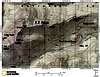
As soon as you exit your vehicle set your sites, GPS, or compass on the beginning of the ridge because the first .5 of a mile you'll be busy navigating through thick manzanita & rhododendron tangles. Once you get through the thick stuff and into the forest you'll be able to follow the ridge easily. Look for fragments of the abandon trail. The first mile is the toughest with a 1200' gain in just over a mile. Photo opps don't appear till after about 2.5 miles. The first point of interest is North Peak. A 5780' peak with a nice view south. Look for a stack of rocks at the summit with a summit register under the first rock. It dates back to 1997
After North Peak the ridge opens up to a rocky craggy ridge with great views to the east & west.
The totals for this route from the parked rig to Echo Mountain summit is about 6.5 miles round trip and a total of 2050' of elevation gain.
 |  |
Essential Gear
Water, Food, and a good knowledge of the area, especially where you parked your rig.
Miscellaneous Info
If you have information about this route that doesn't pertain to any of the other sections, please add it here.