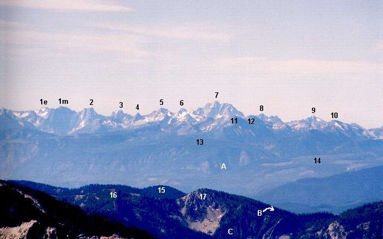
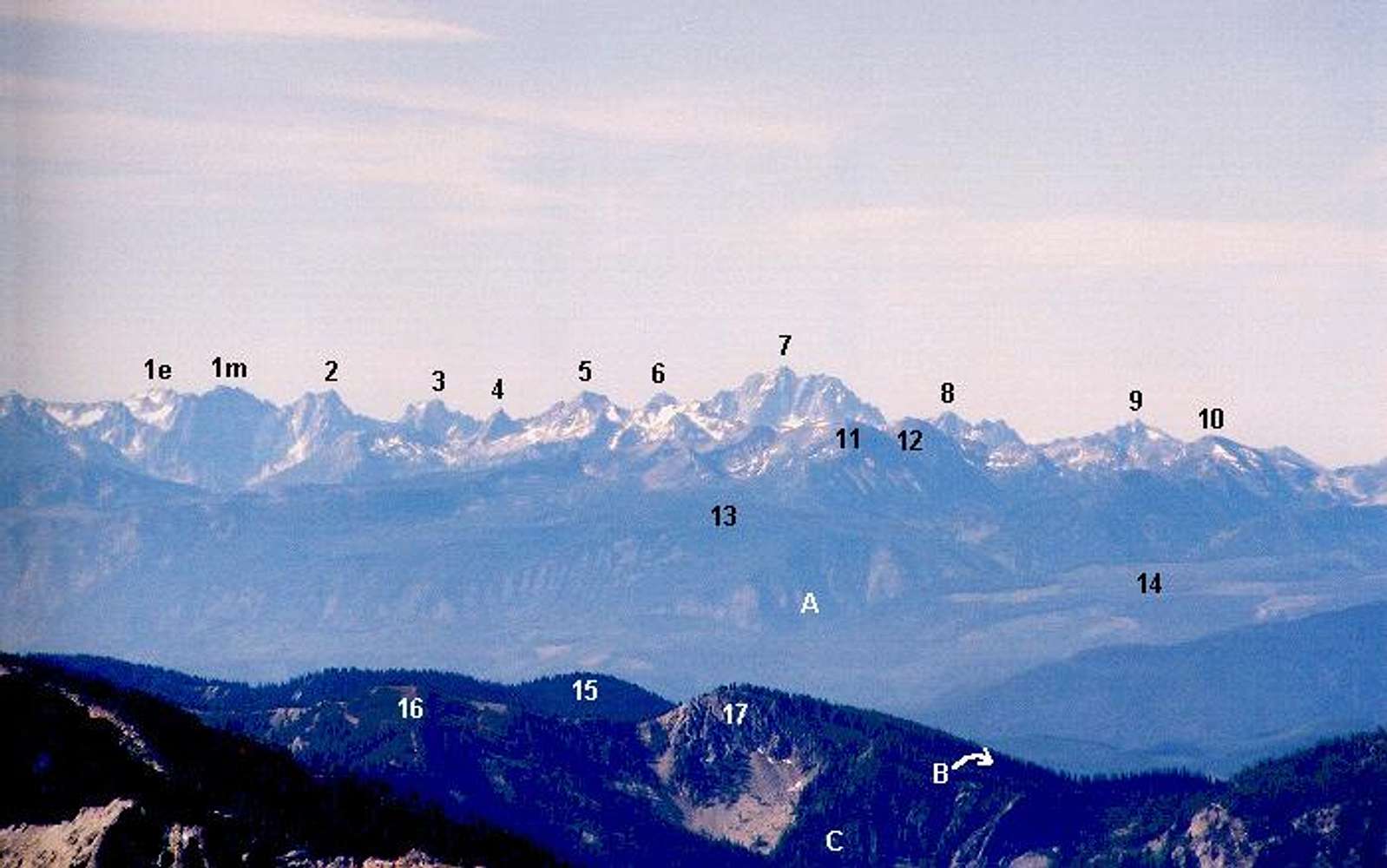
Close up looking south to the Stuart Range on July 14, 2001:
1e -- East Dragontail;
1m --
Dragontail Peak;
2 --
Colchuck Peak;
3 -- Argonaut Peak;
4 -- Pt. 8055 (East Cashmere);
5 --
Cashmere Mountain;
6 --
Sherpa Peak;
7 --
Mt. Stuart;
8 -- Eightmile Mountain;
9 -- Jack Ridge, Pk 7800+;
10 -- Pt. 7377;
11 -- Big Jim Mountain;
12 -- Pt. 7760+ on Icicle Ridge;
13 -- The Badlands;
14 -- McCue Ridge, east end flats;
15 -- Chikamin Ridge;
16 -- Pk 6716 (1.8 miles SE of Garland Peak);
17 -- Pt. 6678;
A -- Chiwaukum Creek;
B -- Chikamin Creek, which drains to the Chiwawa River;
C Head of Garland Creek.


