Toggle navigation
Mountains
Routes
Images
Trip Reports
Forum
What's New
People
Areas & Ranges
Articles
Trailheads
Canyons
Huts & Campgrounds
Albums
Logistical Centers
Fact Sheets
Lists
Custom Objects
Gear
Plans & Partners
WELCOME TO SUMMITPOST
SIGN IN
REGISTER
Mesahchie Peak
Additional Parents
Mesahchie Icefall & Couloir
Image
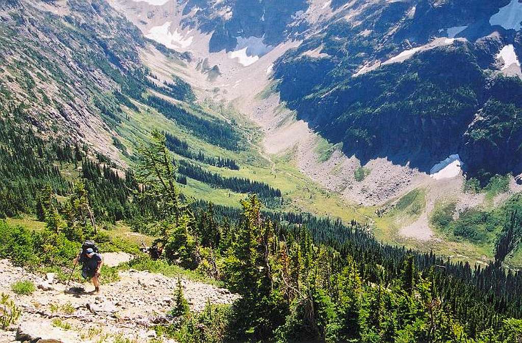
Upper Fisher Creek from about...
View High-Resolution Image
Upper Fisher Creek from about...
Upper Fisher Creek from about 1/3rd of the way across the traverse to camp from Easy Pass. Aug. 11, 2001.
« PREV
NEXT »
Klenke
on
Mar 19, 2004 12:29 am
Comments & voting
Other parents
Lat/Lon:
48.57890°N / 120.8792°W
Image ID:
46011
2889 Hits
73.06
% Score
3
Votes
Log in to vote
Comments
No comments posted yet.
to post!
Don't have an account?
Mesahchie Peak
(Mountain/Rock)
« PREV
Viewing
#46 of 80
GALLERY
NEXT »
Klenke's Image Gallery
« PREV
Viewing
#2240 of 5376
GALLERY
NEXT »
Mesahchie Icefall & Couloir
(Route)
Loading....
×
You need to login in order to vote!
User Name
Password
Remember me
Forgot your password?
Log me out when I close my browser.
Keep me logged in all the time.
sign in as a user
Don't have an account?
Register now for FREE
Rating available
Suggested routes for you
People who climb the same things as you
Comments Available
Create Albums
Register Here


