
|
|
Mountain/Rock |
|---|---|
|
|
44.10041°N / 16.32294°E |
|
|
Šibensko-kninska županija |
|
|
Hiking, Mountaineering |
|
|
4203 ft / 1281 m |
|
|
Overview
Badanj peak (1.281 mtrs) is a picturesque conical mount with layered limestone in the western part of Dinara massif, between the large field Suvo Polje and Brezovac valley. Therefore, because of its isolated position, the Badanj peak summit offers magnificent views on all sides, such as the upper ridge of Dinara, Cetina valley, Kijevski Bat, Promina and city of Knin. Badanj peak
 Badanj seen from Brezovac meadow
 Badanj peak seen from Suho Polje field
Getting There
In order to climb Badanj peak first you have to reach Knin town at the foothills of Dinara mountain, which is a good starting point. Arriving at Knin town is well described at Dinara page.Route description
 Badanj peak summit
From this route, just before you reach Brezovac valley (on the left side of the macadam road is an abandoned house), you have to turn right and climb over the grassy slope to the pass east of Badanj peak.
When you come out on that pass the trail leads over the southern slope Badanj and across the horizontal stone slabs directly to the summit. On this part of the route the markings are rare, but your orientation will not be a problem. After approx. 30 min walk from the place where you left the macadam road in the northern foothills of Badanj you will reach the summit.
 |  |  |  |  |  |
Hike advise
Best way to climb this interesting peak is to combine it together with the ascent on Dinara mountain. You will need 2 days for that. On 1st day you have start from Glavaš village and ascend on Sinjal peak. After well deserved rest you take the descend route towards Brezovac mountain hut where you have to stay over night. On 2nd day you continue from the hut over the beautiful meadow/pasture towards Knin town and Suho Polje field. Along the way, when you exit the Brezovac meadow, you will find yourself at the foothills of Badanj peak which is on your left side. Take the marked route (described here above) and climb to the summit. Descend using same way back and continue again towards Suho Polje field.Panorama views
 Dinara seen from Badanj peak
 Summit view towards S
 NW view from Badanj summit
 Summit view towards N
 SW view from Badanj
 SE view towards Dinara
Mountain huts
Not far away from Badanj peak and further away towards the Dinara/Sinjal summit there is Brezovac mountain hut at the altitude of 1.050 mtrs. The hut is situated the near the Brezovac valley in the beech wood forest.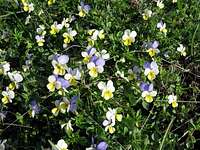 Beautiful flowers on Badanj slopes
The house has no electricity, and water is supplied from the tank. There is no garbage collection, so bring what you need and take it back. The capacity of the hut is some 50 beds and there is no winter room.
Contact numbers: +385 23 561-753
+385 23 340-170
Mountain conditions
Informations on weather conditions in the area can be found onCroatian State Hydrometeorological Institute site:
http://meteo.hrindex_en.php
Maps
SMAND No. 40 - DinaraSMAND official website