
-
 8199 Hits
-
 82.48% Score
-
 15 Votes
|
|
Mountain/Rock |
|---|---|
|
|
34.58126°N / 119.26126°W |
|
|
Ventura |
|
|
Sport Climbing |
|
|
Spring, Summer, Fall, Winter |
|
|
3800 ft / 1158 m |
|
|
Overview
 |
 |
|---|


Potrero John is a rock formation in the mountains along Maricopa Highway, outside Ojai, California.
 small formation to the right of Potrero John
Potrero John may be considered as the sport climbers’ answer to its immediate neighbors Black Wall, also known as Sespe Wall and The Fortress. On Black Wall and The Fortress you find nothing but “Trad” routes, and on Potrero John nothing but bolted sport climbs.

Sport climbing was not always order of the day on Potrero John. In fact, the history of climbing on Potrero John can be traced back to the 1970s when two of the biggest names in rock climbing, Yvon Chouinard and Henry Barber, climbed a hairline fracture in the middle of the face using thin stoppers of the period for protection. Now, that’s what I call climbing.
 Cold Shuts on top of the formation.
Subsequent to the few and far between first ascents on Potrero John, a few 1/4 inch bolts were added on different parts of the rock. In the mid 1990s the old skinny bolts were removed, probably by the late Reese Martin, and replaced by beefier and safer 3/8 bolts. On my last visit to this rock, I noticed that the two old top rope problems on the far right and far left are now bolted bringing the number of sport routes up to seven.

Some of the climbs on Potrero John have their own two cold shut anchors. There is also a third class down climb on the right side of the formation. There are a number of hairline cracks on the face. It’s a good idea to take some thin stoppers, steel nuts and micro cams to supplement the bolts.
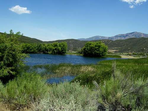
Potrero John may sound like a boring formation to climb on, but it does enjoy a few positive aspects that need to be put on the table. On many days when its very popular neighbor, Black Wall, only a quarter of a mile down the road, gets overly crowded and noisy, you can escape to Potrero John and clip a few bolts. The rock itself is generally cleaner and more solid than the neighboring rocks. It has a very friendly and flat base. The formation is very close to a running creek with trees and small boulders. It’s a great place to bring a climbing family to picnic and climb.


Unlike Black Wall, Potrero John does not stand out from the highway. No need to worry about bringing the traffic to a hault. Tall trees make Potrero John almost invisible to spectators. On hot days, common to this area, you can choose from a number of swimming holes along the creek. Enjoy.
Routes of Potrero John
 |  |  |
 |  |  |
Climbs of Potrero John | |
| A | El Potrero, 5.9, now bolted, but still a runout |
| B | Zyzzxx, 5.8, five bolts |
| C | Pro Job, 5.9+, variation to route D, three bolts |
| D | Micccis, 5.9, four bolts |
| E | Not sure about the name or rating of this route. |
| F | Menage a Trois, 10b, four bolts, a classic climb, |
| G | Rubber Man, AKA Color Blind, 10c/d, five bolts |
| H | Newly bolted route, unknown name or rating |
| I | Beginnings, 5.5, standard rack, this climb is on a separate rock just to the right of Potrero John, not shown in the route topos |
Camping
Unlike in the mountains of Santa Barbara, there are a number of campgrounds along Highway 33 on your way to Black Wall. Wheeler Gorge Campground is one. If you want to camp closer to town, there are many State Beach campgrounds along the beaches of Ventura County.
The following links should help you find a suitable spot for camping.
Ventura/Ojai weather
Ventura Beach Camping
Wheeler Gorge Campground/Ventura, Ojai camping
Emma Wood State Beach
How to get there

Directions to Black Wall of Sespe Gorge cannot be simpler. From Highway 101 and the city of Ventura, California, take Highway 33 north for 13.2 miles to its junction with Maricopa Road in the town Ojai. Turn left here onto Maricopa and drive another twenty miles. You will see Black Wall to your left across the creek. Drive another half a mile up the road to a big dirt pull-out on the left side. Park here. You wont miss the triangular shaped formations across the creek. Those are The Fortress formations. Potrero John is roughly half way between The Fortress and Black Wall.