
|
|
Mountain/Rock |
|---|---|
|
|
38.87023°N / 105.96432°W |
|
|
Chaffee |
|
|
Mountaineering |
|
|
Spring, Summer, Fall |
|
|
10667 ft / 3251 m |
|
|
Overview
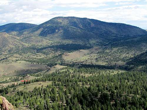
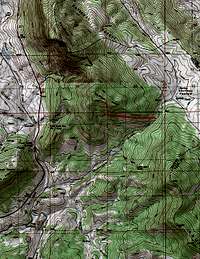
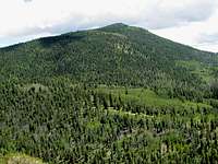
Southwestern Face of Kaufman Ridge North
Kaufman is a 7 mile long ridgeline that forms a portion of the southwestern border of the South Park Plateau in central Colorado. The ridgeline starts at the 9346 ft Trout Creek Pass on Route 24/285 near the town of Buena Vista and heads southeast until it slowly merges into the South Park Plateau. The high points along the crest of the ridgeline have elevations in the 10400-10765 ft range. A 9450 ft saddle breaks the ridgeline into two pieces. The 10765 ft Kaufman Ridge High Point rises directly to the south of the saddle. Kaufman Ridge North is the second highest point of the ridgeline and rises to the north of the saddle.
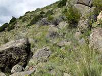
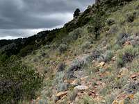
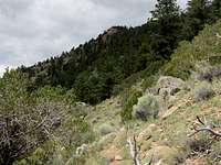
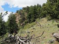
The northeastern slopes of Kaufman Ridge North are gentle and go down to reach the South Park Plateau. The southwestern slopes are much steeper and drop down to the Trout Creek Valley where Route 24/285 runs. You can probably follow any path to reach the summit of Kaufman Ridge North. I am not aware of any trails in the area. Reaching the summit will, however, require route finding skills and will involve much bushwhacking. From its slopes, the summit of Kaufman Ridge is often hidden behind trees or other obstacles.
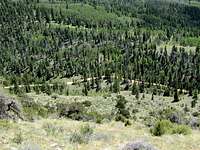
Climbing Kaufman Ridge North will introduce you to a different environment than what you see on the high peaks of the nearby Sawatch Range. Juniper trees along with bushes, grasses and interesting rock formations create a very scenic environment. From the summit of Kaufman Ridge North you will have great views of the South Park Plateau to the east and the high peaks of the Sawatch Range to the west.

West face of Kaufman Ridge North
Getting There
Directions to the trailhead for the route that I took:From the town of Buena Vista, drive 2 miles south on Route 24 to reach the intersection with Route 24/285. Turn east and drive Route 24/285 through Johnson Village and continue 6.3 miles until you see the sign for Forest Road 307 on the right (south side). Turn onto Road 307 and drive 2.1 miles (going past the junction of Forest Road 187) until you reach Forest Road 308. Turn right onto 308 (a.k.a. Mushroom Gulch Road). I drove this road another 2.2 miles to a nonspecific spot at just above 9400 ft of elevation at the base of the southeastern ridgeline of Kaufman Ridge North (Forest Roads 308 and 307 are well graded dirt roads that are passable by most/any cars).
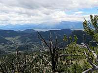
Views From The Summit
 SW/RT285/Mt. Antero | 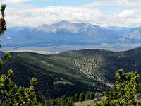 W/Mt. Princeton |  W-NW/Mt. Yale |
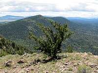 South/Kaufman Ridge High Point | 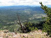 S/SW |  E-SE/South Park Plateau |
Route
Here is the description of the path that I happened to take. It involved bushwhacking and required route finding skills.
Trailhead Elevation: 9420 ft
Kaufman Ridge North: 10667 ft
One Way Hiking Distance: 1.1 mile
From Mushroom Gulch Road, I did not go to the top of the southeastern ridgeline because it looked like I might run into difficult rocky spots. I traversed the southeastern slopes below the ridgetop until I reached a spot near the summit. I then went to the ridgetop and followed it to the summit.
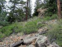
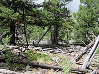
Route Pictures:
 |  |  |
 |  |  |
 |  |  |
 |  |  |