
-
 3816 Hits
-
 79.04% Score
-
 10 Votes
|
|
Route |
|---|---|
|
|
39.21330°N / 105.1203°W |
|
|
Hiking, Scrambling |
|
|
Spring, Summer, Fall |
|
|
Half a day |
|
|
Overview
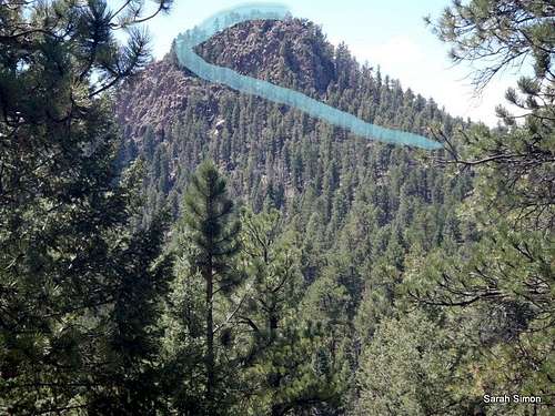 Follow this obvious east-side ramp to the southeast weakness in the summit top
This route to the summit of Turtle Mountain is a neat little day outing across rolling terrain. The route combines quick stepping on established trails, tracking old/decommissioned trails, and navigating on trackless terrain, plus some easy scrambling.
Note that FS Trails 649 and 650 are popular with two-wheelers (dirt-bikes and some mountain bikers) but the trails are too narrow in spots to accommodate many ATVs. This trail system gets hot and dusty in the summer. Spring or fall would be nice seasons for a visit. Unfortunately, Rampart Range Road, the main artery serving this area, is closed in the winter, rendering this specific route unrealistic as a snowshoe.
Roundtrip Distance:
Net Elevation Gain: 300 feet {Trailhead: 8,580; Summit: 8882}; Rolling terrain means cumulative gain is higher than net gain
YDS Class: 2+
Getting There
• From CO Hwy 67, travel roughly 12.5 miles south on Rampart Range Road (FS 300). This road is well-graded and suitable for most passenger vehicles.• Park at the small trailhead for FS Trail #649.
 Eastern views Eastern views |  Western views Western views |
Route Description
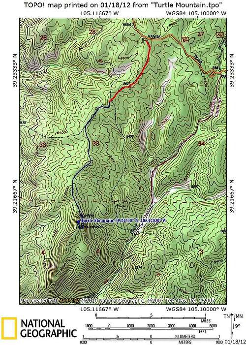 Route Map
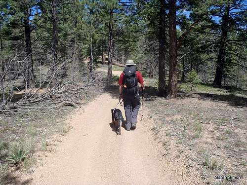
• Follow Trail #649 roughly 1 mile to the junction with Trail #650.
• Trail #650 will gain a ridge before the newly routed trail turns down hill. Keep your eyes sharp and look for the old, decommissioned trail (to the right / west) after approximately 1.25 total foot travel miles.
• The old trail will follow the ridge and enable you to reach the northern spur of Turtle Mountain.
• At the highest point of the old trail, depart the trail and head southward toward turtle mountain.
• At the base of the peak, hug the east side of the mountain along the cliffs.
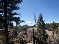
• Wrap around to the south side of the mountain and look for a weakness in the cliff-face. (This ramp is visible from a distance thanks to the more mature trees sprouting from it.)
• Follow the ramp on east side of peak then twist your way around to a weakness in the southeast section of the peak to corkscrew to the summit.
• Ascend the final summit push from the south, via easy scrambling through granite rocks.
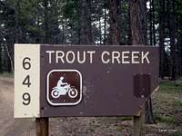 Trailhead Sign Trailhead Sign | 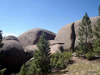 Large granite boulders en route Large granite boulders en route |
 Turtle Mountain in the distance Turtle Mountain in the distance |  On old #650 On old #650 |
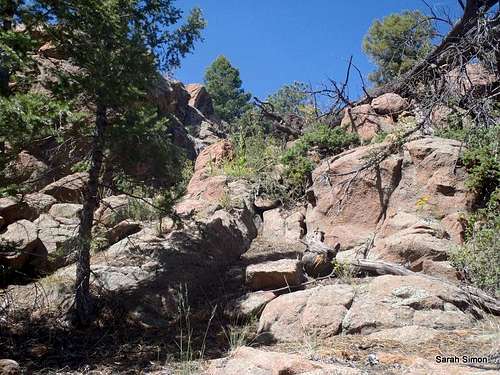 Easy scramble up from the south Easy scramble up from the south |  Easy scramble back down from the summit Easy scramble back down from the summit |
Essential Gear
 Brush to contend with
 Follow #649
• Hiking gear and outwear appropriate to the season
• Plenty of water
• Map and compass (GSP optional)
• Planning Map: Trails Illustrated #135 Deckers | Rampart Range
 Returning on #649