
|
|
Mountain/Rock |
|---|---|
|
|
45.96140°N / 123.9689°W |
|
|
Hiking |
|
|
Spring, Summer, Fall, Winter |
|
|
1225 ft / 373 m |
|
|
Overview
Tillamook Head located between Seaside and Cannon Beach is a high 1200 foot ridge that rises directly above the Pacific Ocean. It is home to the well-known Tillamook Head Trail which is a trail that spans from a trailhead on the south side of Seaside Beach (Right next to a gated community) to Indian Beach, located on the north side of Ecola State Park. Clark’s Mountain is the high point on the ridge. The actual summit is somewhat debatable. On the topo map it shows the high point being an obvious gentle rise to the very top of the mountain. This is far from true as there are many contenders for what is the highest point on Tillamook Head.
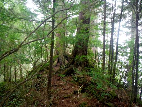 One of the potential summits | 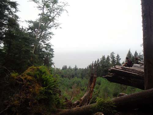 The only viewpoint from the north |
The contenders range from a primitive (potentially illegal) camping area with is the end of a roadway to the east of the trail (on the north side) to a set of tree stumps with a well- marked path to the west of the trail. There are also other contending spots as well which I went up. I feel is that if you really want to hit the exact highpoint of the ridge bring your GPS and take an hour to survey all the points. It should be noted that the one of these that remotely even has a hint of view to the two trees on the southern side of the summit area. To me this was a great disappointment coming off Neakahnie Mountain which has excellent views from the top of the south peak.
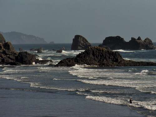
 Looking out at the ocean | 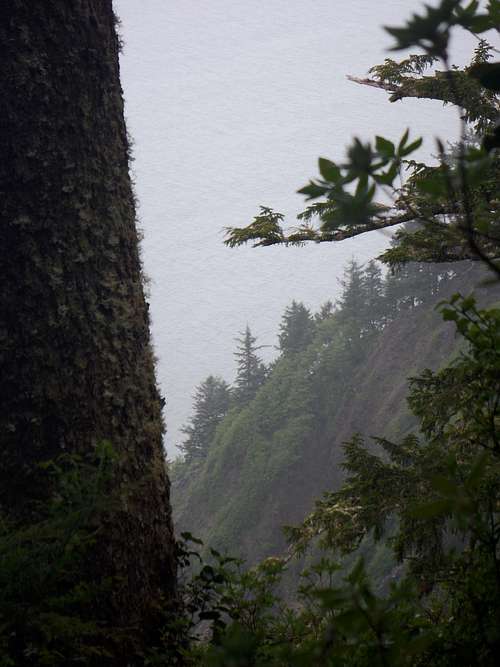 Land rising from the ocean |
When I choose to go for the summit of Clark’s Mountain I chose to summit it from the north by Seaside trailhead. There was clearly not the most scenic way to Tillamook Head and honestly I would advise not to try to summit from this way because you miss out on all but one viewpoint reaching to the summit. Personally I felt quiet cheated going this way. You also miss out Ecola State Park with is every bit worth the $5 admission. Luckily I went beyond the mountain to check out some of the views before heavy rain made me walk off the mountain. Ideally one would want to have someone drop them off on the southside and at Indian Beach and then meet them on the other by Seaside.Most of the excellent views are south of the summit areas.
Getting There
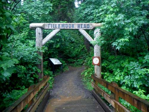
The trailhead sign from the north
VIA THE TILLAMOOK TRAILHEAD FROM SEASIDE: Take 101 to the south part of town. Make a right onto Avenue drive and head to the beach. Make a left onto Edgewood Drive and continue as the road turns into Ocean Vista drive and then again into Sunset Blvd. Once you get to the end of the road you will see the obvious trailhead on your left.
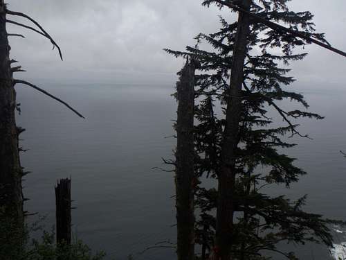
 This must qualify has one of the best views from the trailhead. | 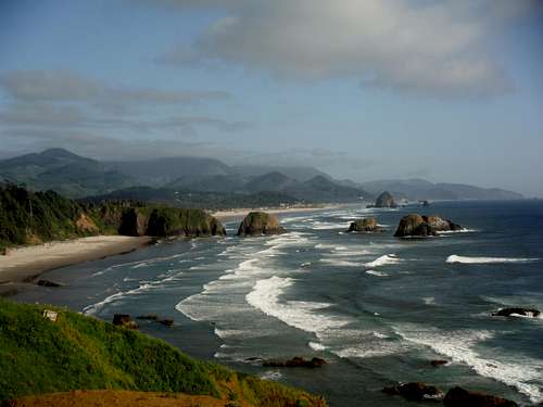 Classic Oregon Coast from Ecola State Park. |
 Hey surf after you hike!! ;) | 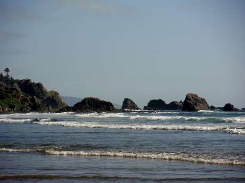 After the summit chill out at Indian beach!!! |
Route
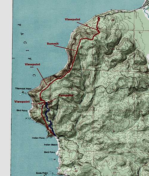
Map of the route
This is the description from south to north. From the south the trail begins out leaving from Indian Beach. From trail then continues to slowly rise up until it hits a trail off to Bird Point on the west (which features excellent views of the Tillamook lighthouse). The trail then continues north as it pass some World War 2 remnants and a primitive first come first serve campground on your right. Continue past the campground where you will run into several switchbacks until you top out onto the ridge. You will soon run into Clarks Viewpoint which has more excellent views. This is the final major viewpoint on the trail although there are more small viewpoints along the ridge.
The trail then continues to follow the path of the ridge rising up and down on several bumps along the ridge. Though there are only a couple of views, the sound of the ocean keeps this hike appealing. At this point the trail does get quiet muddy from this section north for the rest of the trail. On the way north you will path to the west to a stumped tree. From what I could gather this seemed to be the high point although it did not agree with the map completely. I also spent an hour going over every bump to make sure I got the summit but the biggest warning that I have is that the topo map in this area is not that accurate up in this section. There is also clear where gravel road that was a contender and a number of other small rolling summit area but no real areas that were true stand outs. Continue along the highest part of this mountain and soon you will begin loosing elevation. The trail first heads east while slowly loosing elevation then turn into switchbacks as it lowers down to the parking. There will be one small viewpoint along the descent with a good view of the ocean. Again this final section can be very muddy so use caution on this trail. It would not be a great idea to trail run on it because of the mud. Once you hit the large gate you know you are done with the trail.
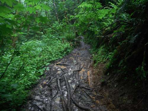
Nasty trail after an hour of rain. a lot of this trail is muddy during the wet season!
Red Tape
Ecola State Park Charges a $5 parking fee. On the other side trail the Seaside Trailhead is free. Note to one doing this peak; unless you are solely into peakbagging this mountain pay the $5 and head up from the southside.
When to Climb
This mountain can be done year round. It rarely snow on this mountain even in winter. The trail does get very mud very quickly so the most enjoyable experience hike this mountain during the dry season summer.
Camping
There is a well known primitive camping area about roughly a mile from the south side of the trail. It is easy to get to and gets full full very quickly.