
-
 55867 Hits
-
 88.48% Score
-
 27 Votes
|
|
Mountain/Rock |
|---|---|
|
|
45.61430°N / 123.5143°W |
|
|
3226 ft / 983 m |
|
|
Overview
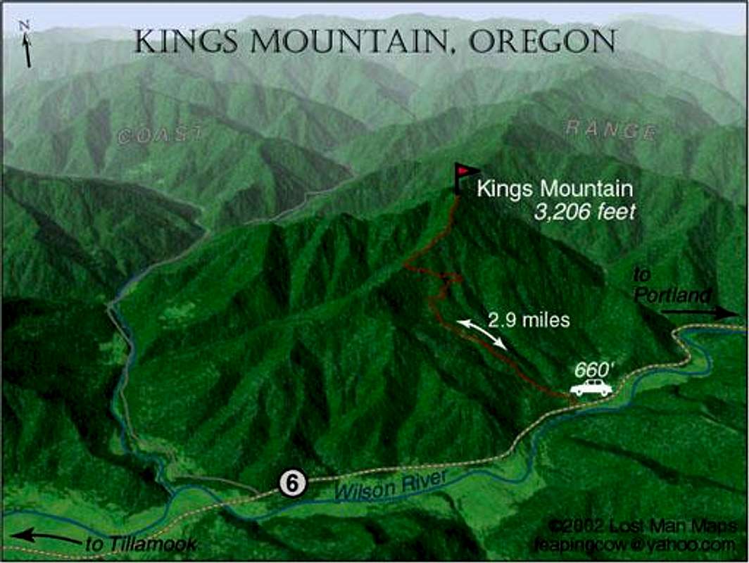
Image courtesy of Lost Man Maps
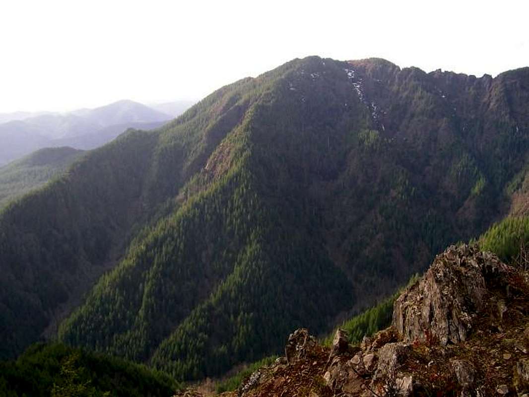
Kings Mountain lies in the Coast Range of Oregon between Portland and the coast. It's a popular summit and has a trail just under 3 miles long to it's summit. The views at the top extend from Mt. Hood to the coast. The trail starts at 450 feet and climbs to the summit of 3226 through a forest up to a small meadow area with a summit register. This mountain and neighboring Elk Mountain form a horseshoe shape and the really great trail to the top comes from connecting the two peaks via a trail on their ridges. Kings Mountain has some dramatic pinnacles along it's ridge as well that are best viewed from Elk Mountain. The cliffs along the ridgecrest between these two mountains fall dramatically down several thousand feet to the valley floor below. The trail is steep in many spots even away from the ridgecrest. Be careful as there has recently been one death, a fellow SP member, on Kings Mountain.
 |
 |
 |
 |
Getting There
See the Elk Mountain page to get to the Elk Mountain Trail to do the start of the loop hike to the summit of Elk Mountain. The rest of the loop hike is described in the Elk/Kings Mountain Combination Trail on this page.
To access the Kings Mountain trailhead from Portland, take Highway 26 west for a few miles to a junction with Highway 6. Take Highway 6 west for 49 miles to a brown hiker-symbol sign at a pullout just east of milepost 25. There is a sign that identifies it as the Kings Mountain Trailhead as well. Room for about 10-15 cars there.
If coming from the coast, take Highway 6 east from Tillamook 25 miles to the same spot.
Red Tape
This is a day-use area so no fees or permits required to park or hike.
When To Climb
Can be climbed year-round but best times are Spring through Autumn.
Camping
Camping is allowed at the nearby Elk Creek Campground
Mountain Conditions
Tillamook State Forest
(503) 357-2191
Always Be Careful
I know this is a minor mountain in a minor range but always be careful when out hiking, on this peak or anywhere. Please see this story if you need a better reminder.