Toggle navigation
Mountains
Routes
Images
Trip Reports
Forum
What's New
People
Areas & Ranges
Articles
Trailheads
Canyons
Huts & Campgrounds
Albums
Logistical Centers
Fact Sheets
Lists
Custom Objects
Gear
Plans & Partners
WELCOME TO SUMMITPOST
SIGN IN
REGISTER
Mount Daniel
Additional Parents
Southeast Ridge
Image
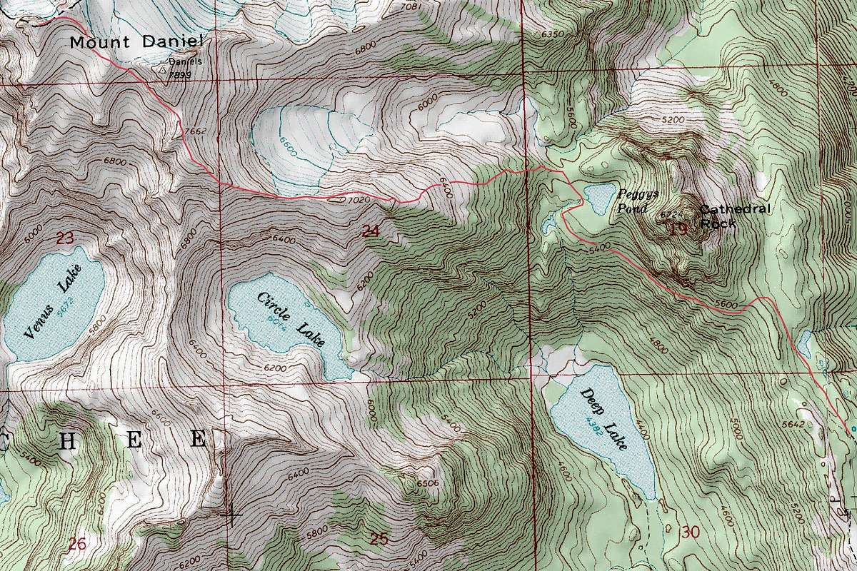
Mount Daniel Topographic Route Map
View High-Resolution Image
Mount Daniel Topographic Route Map
This is the standard route up Mount Daniel via Peggy's Pond. Map
generated by TrailTopo
, route line drawn out by me using PhotoShop CS5.
« PREV
NEXT »
Josh Lewis
on
Apr 27, 2015 8:07 pm
Comments & voting
Other parents
Image Type(s):
Topo/Diagram
Image ID:
937314
5166 Hits
71.06
% Score
1
Votes
Log in to vote
Comments
No comments posted yet.
to post!
Don't have an account?
Mount Daniel
(Mountain/Rock)
« PREV
Viewing
#264 of 276
GALLERY
NEXT »
Josh Lewis's Image Gallery
« PREV
Viewing
#4276 of 4303
GALLERY
NEXT »
Southeast Ridge
(Route)
Loading....
×
You need to login in order to vote!
User Name
Password
Remember me
Forgot your password?
Log me out when I close my browser.
Keep me logged in all the time.
sign in as a user
Don't have an account?
Register now for FREE
Rating available
Suggested routes for you
People who climb the same things as you
Comments Available
Create Albums
Register Here


