Dopo l'area Centrale della Dora Baltea, la Città di Aosta ed il settore Meridionale, che và dal Comune di Villeneuve insino al Centro Turistico di Courmayeur percorrendo l'intera cosiddetta
. Partendo infatti da Villeneuve, all'imbocco delle Valli Savarenche e Rhêmes nonché del
, incontriamo sul lato idrografico sinistro o Settentrionale della Dora Baltea in successione i Comuni di Arvier, Avise, La Salle, Morgex e Courmayeur. Per la precisione dobbiamo evidenziare che quello di Arvier trovasi quasi interamente sulla sponda opposta, come la Frazione di Derby che però appartiene a La Salle, mentre quella di Runaz o Ruinaz é di competenza del Comune di Avise ed é collocata sulla sponda idrografica di destra o Meridionale. Un discorso a parte per quanto concerne Courmayeur che si trova, alla congiunzione delle due Dora Baltea (Ferret a Nord e Veny a Sud), un poco di qua (Verrand, Villair, Capoluogo ed Entrevès) ed un pò di là (Dolonne) come per il successivo Comune di Pré Saint Didier. Una divisione quindi leggermente artificiale però necessaria onde poter effettuare il viaggio in due giornate diversificate, anche perché dalla parte di quest'ultimo settore si aprono la Valgrisenche, Conca di Arpy, Valle di La Thuile e collaterale del Piccolo San Bernardo che già impegnano, vista la vastità dell'area da visitare, ad una scelta. Questa potrebbe consistere in Grisenche e poi Conca di Arpy oppure ancora Arpy e, tramite il Colle San Carlo, La Thuile e Piccolo San Bernardo; questo ultimo vallone almeno in parte, se non fino al confine con la Francia. Per la quale cosa se, orograficamente parlando, risulta corretta la medesima, dal punto di vista pratico é da evidenziare come in una prima giornata é meglio percorrere tutta la
in andata e ritorno da Courmayeur sui suoi due lati, per poi riservare la successiva giornata alla visitazione delle valli laterali Meridionali con la scelta testé citata. Così facendo passeremo, ma velocemente e senza fare soste, lungo l'
in quell'area più ricca di castelli che già abbiam visitato.
But it is also a journey to the "Christianity". Of course, as these places have grown the cult of Christianity, as evidenced shrines, oratories, convents, monasteries, churches and votive chapels, a little scattered throughout the territory. A trip to the interior of another journey, that surely comes after the Age of the Mountains but that precedes that of the Castles, Palaces and Noble, going nell'etensione of human time at the time of the local Salassians People and Romans dating respectively 1158 BC to
"Cordelia", very ancient Capital of Leader
"Cordelus" for the first, and always with the 25/23 BC with the foundation of
"Augusta Praetoria Salassorum", current City of Aosta. Immediately below, ie around the III°/IV° Century came the phenomenon of the Evangelization on the entire and complete Aosta Valley. A phenomenon gradually spread, first to the Valley of Baltea, then to all the valleys reaching even the smallest of villages, up to the last pasture.
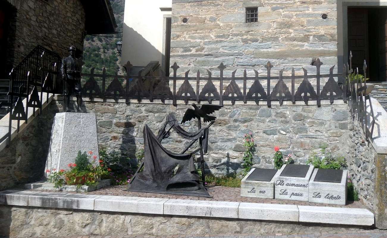
A hyphen key, a "trait d'union" to tie the ancient peoples to the modern.An area that abounds indeed better buildings
"sacred" than in medieval castles or buildings and ruins even older with some exceptions for the, above La Salle,
Château Chatelard and the remains of the
Castle Montmayeur or of Grand Haury, the latter, however, already on South side and at the entrance to Valgrisenche. In fact all the major castles between the City of Aosta and Courmayeur (
Sarre, Sarriod de la Tour, Aymavilles, St. Pierre, Châtel Argent) are located immediately to the West of that area and to Villeneuve. However, with respect churches, steeples or votive chapels have to record a widespread distribution throughout the
"Valdigne", where we like to mention the wonderful
Church of La Salle in 1847 but already built over a previous thirteenth Century and
ancient frescoes of 1620, while just above there is the oldest chapel Ecours flanked by an ancient, torn on the South side but still well standing and intact,
square Tower fortified or House of the Lords De Cours, both from
around 1200. Even the Churches of Morgex (
Parish of 1512 with splendid
Campanile with Sundial of 1823; Archet Castle of XIII° Century in stone tufa and
frescoes of the XVII° Century), the Pré Saint Didier (
Parish late 1700 built on older building and magnificent
Steeple of 1100; medieval bridge of 1585, reconstructed by Prince Charles Emmanuel I° of Savoy over an ancient Roman bridge) and Courmayeur in front of the building Museums
"Duca degli Abruzzi" Office by the Mountain Guides of Courmayeur (
three-aisle Church of 1722 with 1392 Belfry and Missal of 1540 built on the remains of a much older); while beyond the Dora Baltea, in the small hamlet of Derby and under the famous Waterfall Lenterney, we find a
Church probably even older than that of the Chief-town La Salle with slender
Bell Tower with small rooster on the Cross (of 1200?).
![]()
Chatelard Castle just above La Salle Common,
by Emilio Bertona
Ma pure un viaggio verso la "Cristianità"
. Certamente, poichè questi luoghi hanno visto crescere il culto del Cristianesimo, come testimoniano Santuari, Oratori, Conventi, Monasteri, Chiese e Cappelle, un poco disseminate ovunque sul territorio. Un viaggio all'interno d'un altro viaggio, che sicuramente arriva dopo l'Era delle Montagne ma che precede quella dei Castelli e dei Nobili, succedendo nell'etensione del tempo umano all'epoca del locale popolo dei Salassi e dei Romani che datano rispettivamente con il 1158 avanti Cristo per
Cordelia", antichissima Capitale dei primi, e con il 25/23 sempre avanti Cristo con la fondazione di
Augusta Praetoria Salassorum, attuale Città d'Aosta. Subito appresso, cioé intorno al III°/IV° Secolo avvenne il fenomeno d'Evangelizzazione della Val d'Aosta. Progressivamente diffuso dapprima verso la Valle Centrale della Dora, poi a tutte la valli raggiungendo anche il più piccolo dei villaggi, fino all'ultimo alpeggio.
Un testimone, un trait d'union fondamentale per legar popoli antichi e moderni.Un'area che anzi abbonda maggiormente in edifici
"sacri" che non in castelli medioevali o costruzioni e rovine ancor più antiche con qualche eccezione per il Château Chatelard sopra La Salle a
1171 metri ed i resti del tenebroso Castello di Montmayeur o del Petit e Grand Haury
(1081m, 1177 m) arroccato su d'un selvaggio promontorio roccioso; quest'ultimo però già sul lato Meridionale ed all'ingresso della Valgrisenche. In effetti tutti i maggiori castelli tra la Città di Aosta e Courmayeur (
Sarre, Sarriod de la Tour, Aymavilles, St. Pierre, Châtel Argent) si trovano nell'area subito ad Occidente della medesima e insino al Comune Villeneuve. Per quanto concerne invece Chiese, Campanili o Cappelle votive abbiamo da registrare una distribuzione capillare su tutto il territorio della
"Valdigne", dove ci piace segnalare la splendida
Chiesa di La Salle del 1847, ma già costruita sopra una precedente del XIII° Secolo e con antichi
affreschi del 1620, mentre appena al di sopra troviamo la ben più antica, squarciata sul lato Meridionale ma ancora ben in piedi ed intatta,
Cappella di Ecours con affianco un'antica
Torre squadrata o Casaforte dei Signori De Cours, entrambe del
1200 circa. Anche le Chiese di Morgex (
Parrocchiale del 1512 con splendido e notevole
Campanile con Meridiana del 1823 in pietra tufica ed
affreschi del XVII° Secolo; Castello dell'Archet del XIII° Secolo), di Pré St. Didier (
Parrocchiale di fine 1700 costruita su più antico edificio e magnifico
Campanile del 1100; ponte medievale del 1585, ricostruito dal Principe di Savoia Carlo Emanuele I° sopra un antico ponte romano) e di Courmayeur giusto affronte all'edificio-Museo
"Duca degli Abruzzi" Sede delle Guide di Courmayeur (
Chiesa a tre navate del 1722 con Campanile del 1392 e Messale del 1540 costruita sui resti d'un edificio molto più antico); mentre al di là della Dora, nella Frazioncina di Derby e sotto la famosa Cascata di Lenteney, troviamo una
Chiesetta probabilmente ancor più antica di quella di La Salle con slanciato
Campanile con galletto sulla Croce (del 1200?).
"Meeting for the street a little bit of everything ...",
by Osw 2015
Steeples & Castles up to the Mont Blanc with online travel round trip
Into Courmayeur-Resort nearby "Duca deli Abruzzi Museum" and towards Dolonne Hamlet,
by Jake & Osw
Left Aosta reach the narrow passage between St. Pierre Villeneuve, where he began the 6° or, if we have dedicated a stop to the city, the 7° day of our trip.
Along indifferently the
"Adret" (Sarre, St. Pierre) with the State Road or the
"Envers" (Charvensod-Pont Suaz/Gressan/Jovençan/Aymavilles) through the Regional arrive at Villeneuve (
670m, 10 Km. from Aosta). All this stretch we visited in the first two days of our week (
see page B), so, leaving high on the rocky headland the
Tower of Châtel Argent of XI° Century, continue Westward. We can go through the village past the
Church of Santa Maria Assunta and Campanile in 1400, rebuilt in 1782, and the
bronze plaque in front of the native home of
Abbé Petigat, leaving just left the deviations for Savara and Rhêmes Valleys, through the new bridge to reach the main road. Or, to avoid the crossing of the same, go just before
Chavonne at the same through the old bridge on the Baltea, semi destroyed by the flood of 1907 and partly rebuilt with the stones of the road to Petit Saint Bernard as the country destroyed by a terrible hurricane. Soon, passing nearby the squared
Tour Colin reach
Arvier (
776m, 14.5 Km. from Aosta) located under the Becca del Merlo
(2961m) at the end of the long watershed that originates even with the Punta Galisia, this last bordering with Piedmont and France. But, if you listen to my advice, do not operate any of these two choices, but you reach Arvier with a third and most impressive road itinerary. Villeneuve to take the Regional Road to Introd but not reach the same why you visited already since the second day. Instead reached the junction 806 metres for
Villes Dessous at the
Chapel of St. James of 1867 cross the country reaching
Ville Dessus with small
Church of St. Hilary always 1800. Here
(863m) can also be reached by continuing briefly on Regional Road and with short descent that leads to the tiny square in front of the same, where as part of a much shorter nice walk on an
ancient paved and signaled path and adressed to the above little
Chapel of Santa Anna (0h'15) on the road that goes down to Arvier. From this, with mini
"Picnic area" and small car park as well as magnificent views over the Central Valley of Baltea and the Group of Mount Emilius
(3559m), continue straight on the right, leaving the detour to
Les Combes (1341m), the place of spiritual summer retreats of the Popes
"John Paul II° Benedict XVI°" in recent years; passing high above the
"Comba Neye de la Mort" and through a wild valley, down towards Northwest Arvier with beautiful view over the remains of the
Château de la Mothe or of Arvier XIII° Century and the nearby
Parish Church with Romanesque Bell tower, immediately below to a small
"Naturalistic Area" with a pond. Leaving Arvier toward State Road meet one after the other a
Monumental Cross, wrought iron of a Mission of 1933 and an artistic roundabout dedicated to the local cyclist
"Maurice Garin", winner in 1903 of the first
"Tour de France" and even two Paris-Roubaix. Just beyond you meet the Hamlet of
Leve or Liverogne (water mange or growling), where he arrived in a gorge the Doire de Valgrisenche (
Chapel of Rochefort, built on the ruins of an ancient castle). Continuing West you reach the deviation with daunting bridge to the underlying Avise (
762/82m; Parish Church with Romanesque Bell tower; Oratory of Clapier in Comba Vertosan three castles and the most important of which is that of
Avise by Lords of Avise, 1492, built by Boniface squire by Henry IV°. On the opposite side of the road we find the fraction of
Runaz or Ruinaz (that remains of the ruins) (
787/803m; white
Church with Bell tower, followed by the location known as
"Pierre Taillé" that before the
"Pont de l'Equilivaz" in front of the
"Waterfall of Vertosan" of more than 300 metres and with a view, for the first time, to the
Mont Blanc (4810m). Leaving South subsequent detours to the Village of
Derby and the Village of
Chabodey another, starting with a big roundabout, brings us to the Capital of La Salle with the
"Bourg" in the center of the village and the tiny and splendid Hamlet of
Ecours or De Cors just above
(1090m), but of these, as for the following Municipalities of Morgex, Pré St. Didier, Courmayeur, we said with plenty in
"Overview". On the way back we will start with a visit to the Hamlet of
Dolonne (
1208/12m; tombstone to the Mountain Guides Edoardo Glarey and Albino Pennard;
Chapel and Bell Tower "hidden" to the interior of the country,
"Park of the Reindeer" at the foot of Mont Chétif
(2343m) first sentinel of Mont Blanc that hides here, while they are in great front view
"Dente del Gigante and Grandes Jorasses". All that remains is to return, through the same route or State Road n° 26, towards the Common of
Villeneuve, where we will continue with the streets
"Adret" or the
"Envers" and, finally, until
Aosta.
Round trip recommended towards Mont Blanc: from Arvier exit out to Avise and La Salle Commons with Ecours Chapel & Coumayeur,
by Osw 2015
Lasciata Aosta raggiungiamo la strettoia tra St. Pierre e Villeneuve, dove inizia la sesta o, se abbiamo dedicato una tappa alla città, settima giornata di viaggio. Percorrendo indifferentemete sia l'
"Adret" (Sarre, St. Pierre) con la Strada Statale che l'
"Envers" (Charvensod-Pont Suaz/Gressan/Jovençan/Aymavilles) tramite la Regionale arriviamo a Villeneuve (
670 m; 10 Km. da Aosta). Tutto questo tratto lo abbiamo visitato nei primi due giorni della nostra settimana (
vedi pagina B), per cui, lasciando in alto sul promontorio roccioso la
Torre di Châtel Argent dell'XI° Secolo, continuiamo verso Ovest. Possiamo attraversare il paese passando davanti alla
Chiesa di Santa Assunta e Campanile del 1400, ricostruita nel 1782, ed alla
lapide in bronzo dell'Abbé Petigat davanti alla casa natia e, lasciando subito sulla sinistra la deviazioni per le Valli Savara e Rhêmes, tramite il nuovo ponte raggiungere la Statale. Oppure, evitando la traversata del medesimo, passare appena prima presso
Chavonne sulla medesima per mezzo del vecchio ponte sulla Baltea, semi distrutto dall'alluvione del 1907 ed in parte ricostruito con le pietre della strada del Piccolo San Bernardo come il paese distrutto da un terribile uragano. Ben presto, passando presso la quadrata
Tour Colin raggiungiamo
Arvier (
776 m; 14,5 Km. da Aosta) sita sotto la Becca del Merlo
(2961 m) al termine del lungo spartiacque che si origina addirittura con la Punta Galisia ai confini con Piemonte e Francia. Ma, se ascoltate un consiglio, non operate nessuna di queste due scelte, bensì raggiungete Arvier con un terzo e più suggestivo itinerario stradale. Da Villeneuve prendete la strada per
Introd ma non lo raggiungete poiché lo avete visitato di già nella seconda giornata. Raggiunto invece il bivio
806 metri per
Villes Dessous presso la
Cappella di San Giacomo del 1867 attraversate il paese raggiungendo
Ville Dessus con Chiesetta di Sant'Ilario sempre del 1800. Qui
(863 m) si può giungere anche continuando per breve tempo sulla Strada Regionale e con breve discesa che porta alla piazzetta davanti alla medesima, dove parte una tanto corta quanto bella passeggiata su d'un
antico sentierucolo lastricato nonché segnalato verso la soprastante
Cappelletta di Santa Anna (0h'15) sulla Strada che scende ad Arvier. Da questa, con mini parcheggio e minuscola
"Area Picnic" nonché magnifico panorama sulla Valle Centrale della Dora Baltea ed il Gruppo del Monte Emilius
(3559 m), si prosegue lasciando subito sulla destra la deviazione per
Les Combes (1341 m), luogo dei ritiri estivi spirituali dei Papi
"Giovanni Paolo II° e Benedetto XVI°" negli ultimi anni. Passando alti sopra la
"Comba Neye de la Mort" ed attraversato un selvaggio valloncello, si scende verso Nordovest ad Arvier con bella vista sui resti del
Château de la Mothe o d'Arvier del XIII° Secolo e la vicina
Chiesa Parrocchiale con Campanile romanico, subito appresso ad una piccola
"Area Naturalistica" con laghetto. Uscendo da Arvier verso la Strada Statale si incontrano una dietro l'altra una
Croce monumentale in ferro battuto di una Missione del 1933 ed un'artistica rotonda dedicata al locale ciclista
"Maurice Garin", vincitore nel 1903 del primo
"Tour de France", nonché di due Parigi-Roubaix. Appena oltre si incontra la Frazione di
Leve o Liverogne (acqua che rogna ovvero che brontola), dove arriva in una forra la Doire de Valgrisenche (
Cappella di Rochefort, costruita sui resti di un antico castello). Proseguendo verso Ovest si giunge alla deviazione con ardito ponte per la sottostante
Avise (
762/82 m; Chiesa Parrocchiale con Campanile romanico; Oratorio di Clapier nella Comba di Vertosan e tre castelli il più importante dei quali é quello di
Avise del 1492 dei Signori di Avise, costruito da Bonifacio scudiero di Enrico IV°. Sul lato opposto della strada troviamo la frazione di
Runaz o Ruinaz (cioé resti di rovine) (
787/803 m; bianca Chiesetta con Campanile, seguita dalla località conosciuta come
"Pierre Taillé" precedente il
"Ponte de l'Equilivaz" con di fronte la
"Cascata di Vertosan" d'oltre 300 metri e con in vista, per la prima volta, il
Monte Bianco (4810 m). Lasciando a Sud le successive deviazioni per la Frazione di
Derby ed il Villaggio di
Chabodey un'altra, iniziando da una grande rotonda stradale, ci porta al Capoluogo di
La Salle con il
"Bourg" nel centro del paese ed alla Frazione di
Ecours o De Cors appena sopra
(1090 m), ma di queste, come per i successivi Comuni di Morgex, Pré St. Didier, Courmayeur, abbiam già detto con abbondanza in
"Overview". Al ritorno inizieremo con una visita alla Frazione di
Dolonne (
1208/12 m; lapide alle Guide Edoardo Glarey ed Albino Pennard;
Cappella e Campanile "nascoste" all'interno del paese;
"Parco delle Renne" ai piedi del Mont Chétif
(2343 m), prima sentinella del Monte Bianco che qui nasconde, mentre sono in gran vista frontale
"Dente del Gigante e Grandes Jorasses". Non rimane che rientrare fino a
Villeneuve, dove proseguiremo con le strade dell'
"Adret" o dell'
"Envers" insino ad
Aosta.
Return recommended towards Villeneuve: from Courmayeur to Dolonne Hamlet, Pré St. Didier, Morgex Commons and Derby Village,
by Osw 2015