
-
 2675 Hits
-
 78.27% Score
-
 9 Votes
|
|
Route |
|---|---|
|
|
46.54865°N / 7.01700°E |
|
|
Via Ferrata |
|
|
Spring, Summer, Fall |
|
|
Half a day |
|
|
K 4 / 5 |
|
|
Overview
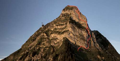 Voie Hohl in the eastern part of Petit Moléson's north face Voie Hohl in the eastern part of Petit Moléson's north face |
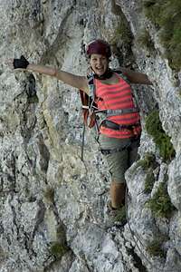
Voie Hohl is the more difficult of two via ferratas which run through the north face of Petit Moléson in the Fribourg Prealps of Switzerland. It requires a lot of strength to negotiate the vertical and overhanging sections and exposure is extreme in this typical north face route. However, the ferrata as equipped à la francaise meaning a protection cable accompanies the route for all its 1300m and there are steel footrests and handholds all the way from the starting point beneath the face to the exit on the north-west widge of Petit Moléson. 5 tons of steel are estimated to have gone into the protection of the route!
Therefore you need only little experience to climb the route, even though stamina, power and levelheadedness are required in good measure. There are several scenic traverses strewn in between the vertical sections in which you can take a rest from the more strenuous parts. In the topmost part of the face there are three alternatives, one of which is a very difficult overhanging climb to the lowest exit on the north-west ridge. Make sure you have enough battery life left before you head out on this alternative.
Getting There
  |
See the main page for the itinerary. Both ferratas start at the middle station of the Moléson cable-car on the Plan-Francey plateau. There is a restaurant on top of the mountain and another at its base at Plan-Francey so that you don't have to be afraid of starving.
Route Description
- Start altitude: 1500m
- Summit altitude: 2002m
- Prevailing exposure: N
- Type: Ferrata K 4/5
nbsp; - Protection: Lots
The route starts at the cable-car station in Plan-Francey (where I assume you have to pay the 4€ fee - never did it myself) with a hike down to the bottom of the face. Passing a cattle fence the ferrata access trail turns off to the right (sign) and now heads up steep grass slopes beneath pine and fir trees. Take care in wet conditions as the slope is extremely slippery. In my eyes this is one of the two most dangerous sections of the whole route.
 |  |  |  |
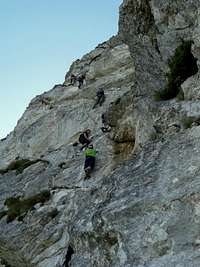
After 100m elevation gain you reach the first protected section, a warm-up across the side of a boulder, after which the trail passes the next boulder in a typical dirt-and-cable section. Right above this boulder the two ferratas split: Voie Hohl, marked red, turns to the right while Voie du Pilier, marked red, heads straight up a first vertical section.
 | 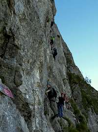 |  |
Voie Hohl traverses to the right and then heads up its own first vertical section with an overhang at the top. In my inexperienced eyes this was the most difficult part of the whole route, also because at that point you don't know what you have to expect higher on. After topping out of the vertical section you get to a ledge, which you traverse down and right, passing a small arrète. The ledge is broken, one of the few sections were you can induce rockfall so take care.
 |  |  |  |
After the ledge the first long vertical section starts. You head up the left side of a pillar, mainly following the direct vertical line which turns into a slight overhang at its top. Here turn right across the top of the pillar to a small ledge-like resting place. From here the next vertical section starts with a rather tricky part up the side of a chimney, then crossing the chimney back and forth. At the top a short traverse (again tricky - the only spot where one !! foothold is missing) to the left takes you to a long vertical section which cuts through the face diagonally. Again, a slight overhang leads to a resting position on a ledge. Here a sign informs you that you climbed half of the route already.
 |  |  |  |
Now follow the north-west ridge of the mountain for a good 50m upwards. Again this section ends in an overhang and you'll need lots of strenght to pull over it. A long traverse to the left follows, which almost unnoticably turns steeper, leading to the first of the two intersections of the route. The right hand alternative heads up a very difficult overhanging section but ends the whole route after some 25m, when it reaches the north-west ridge. The left hand alternative crosses left for about 10m until you reach the next intersection. Here you have the choice between a 25m traverse to the ridge or a 75m left - right combination, finally heading for the ridge as well but higher up. This last allternative is home of the crux of the route, an overhang right before you head out onto the ridge.
 |  | 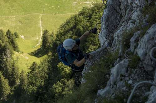 Pulling up for the very last time Pulling up for the very last time |
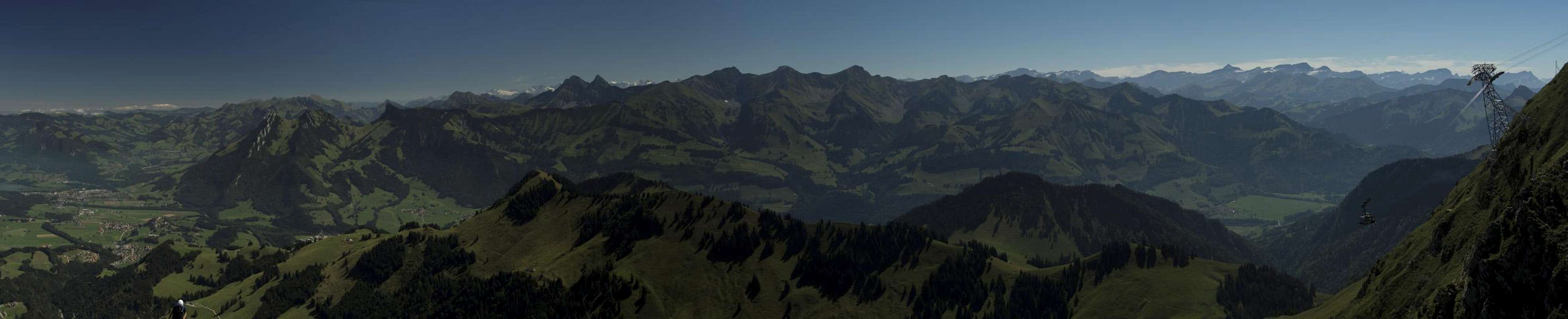
The remainder of the route follows Petit Moléson's north-west ridge directly, also steeply. Again, this section is more difficult than the whole face climb as the protecting cable lies on the ground between your feet. A climber pulling on the rope can easily trip the one in front of him. some 50m of steep hike take you to the summit cross of Petit Moléson. From there you'll have to descend into a saddle, then steeply up to the main summit. This last section is still protected and very scenic. Enjoy the views from the top.
[img:809767:aligncenter:medium:Pulling up for the very last time]
Essential Gear
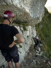
- Helmet (though rockfall danger is comparatively low)
- Harness
- Ferrata set Y-rope with biners and a rope braking device
- Water (I was parched by the time I had reached a quarter of the route)