
-
 6076 Hits
-
 73.06% Score
-
 3 Votes
|
|
Route |
|---|---|
|
|
50.03780°N / 114.9683°W |
|
|
Hiking, Scrambling |
|
|
Summer |
|
|
Overview
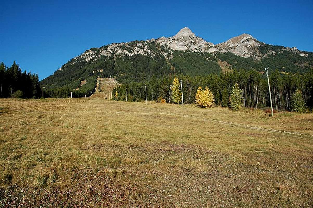
Situated just west of Elkford, Wapiti Mountain, with its two distinct peaks, is the town’s most discernable mountain. Getting to the summit of Wapiti Mountain is relatively straightforward. It requires some scrambling and a minimum amount of routefinding between the top of the avalanche chute and the saddle. Neither should present much difficulty, provided you have some experience with hiking and scrambling. From Elkford, the two peaks appear to be of similar elevation; however, the north peak is the true summit and is distinctly higher. This is will be quite obvious once you reach the saddle of the mountain.
Between the start of the hike and the summit is about 1050m (3500 feet) elevation gain. Other than the trail which circles around to the back (west) side of the mountain, the route wastes little time in gaining elevation. Most of the way is straight up or making a direct line for the summit. Expect to take 5-7 hours for the return trip.
From the summit, one can see the High Rock Range to the east as well as Crowsnest Mountain and the Seven Sisters to the southeast. However, the most impressive views lie to the west. In the distance to the NNW, once can even catch a glimpse of Mount Assiniboine.
At many times of the year, bear and cougar sightings in and around Elkford seem to be the norm. Be knowledgeable of hiking in the proximity of these animals' territory and take all normal precautions for travelling in this type of country.
Topo Map: 82J/02
Route Description
See the “Getting There” section of the main page for information on getting to the start of the hike.
Once you have walked to the base of the ski hill and are at the bottom of the main run (which the T-bar lift is situated on – probably minus the T’s in the summer), you begin by hiking up the run to the top of the T-bar lift. By the time you reach the top, you will have done 1000 feet of elevation gain already. Carry on past the top lift shack to the very top tower (and top bullwheel) of the T-bar lift.
From the very top tower of the lift, take the ski run that goes left (south) in order to get to the trailhead of the hike. As you are nearing where the run makes its first hairpin turn downhill, look on your right side for the trailhead leading into the trees. It would be easy to walk by this if not watching for it. If you have hiked to where the run switchbacks downhill, you have gone too far and will need to double back a bit looking for the trailhead on the uphill side of the run.
Once you walk into the trees from the trailhead, you will know that you are on the right path. The trail is fairly easy to follow as it loops around the south side of the mountain on its way to the west side of the mountain. There is some flagging along the trail and expect to be crawling over some fallen trees along the way.
Once you are around the back (west) side of the mountain, you will come across two open avalanche chutes in quick succession. There is flagging on the far side of the first chute showing you where to re-enter the trees. Almost immediately after, you will come out into the open again into the second avalanche chute. This is the one that will lead you up to just below the saddle between the two peaks. Walk to the far end of the second chute and follow the faint trail that starts up the left side of it. There should be flagging up to this point where you turn your path uphill, but don’t depend on it. A faint trail switchbacks its way up the chute. Other than this trail, this may not appear to be the right way, but it is. A few times it will seem like the way ahead is going to get choked off with trees, but it doesn’t. Keep making your way up the chute to the open scree. There will be no wasted time in making elevation gain here. The grass makes for a slippery trail, especially on the descent – even when dry.
 The trailhead
When you make your way out of the chute into the open slope above, you will not have any trail or cairns to mark the way from here. Improvise your way up and slightly to the right behind the few patches of trees which are above. Try to follow the easier contours of the slope and a lot of the scree can be avoided. Be sure to look back occasionally and note the correct way back into the chute for your descent. Once you are above the patches of trees, continue on up and slightly to the right until you surmount the ridge. From here, you will see the two peaks with the summit a short ways away on your left.
Following the ridgeline up to the summit is quite straightforward. Occasionally, you may need to skirt just below the ridge, but this will not be necessary too often.
The views from the top are impressive. Once you have taken it all in, retrace your steps to make your way back down.

Essential Gear
Standard day hike gear
Proper hiking footwear
Warm clothes
Rain gear
Bear spray
Also recommended:
Hiking poles
Ice Axe - For early/late season outings.