
|
|
Route |
|---|---|
|
|
44.82080°N / 121.7625°W |
|
|
Hike / scramble |
|
|
Half a day |
|
|
Cl 2 |
|
|
Approach
A little intro is needed here. For those who are after the highpoint of Wasco county, the best way to approach it is via the Ollalie Butte Trail and so this is why I am adding this route and incorporating it into the Ollalie Butte page.
The highpoint of Wasco county is what is called a "liner" in the county highpointers terminology. Instead of being on the top of a mountain or peak, the actual highest spot of land in Wasco County is on the side of Ollalie Butte at the 6280 foot mark. Finding this exact spot is not easy nor exact but a dedicated highpointer will criss cross every foot of land to make certain that they have touched upon it. The aspect of liners is the one negative to county highpointing and fortunately isn't that common. One other liner in Oregon occurs for Marion county on the north side of Mt. Jefferson.
Bob Bolton, his wife Rhonda and I tracked down the elusive "liner" after we had climbed to the top of Ollalie Butte, which is a route I'd recommend. The approach to Ollalie is via the Ollalie Butte Trail, as described by Brian Jenkins. Regardless whether you go after the highpoint from the top of Ollalie Butte or by going cross country from the trail, you most likely would appreciate the way we did it the most as described below.
Route Description
From the top of Ollalie Buttef
It is a real treat to hike first to the top of Olallie Butte and enjoy the tremendous views you can get from there. After you have satisfied your hunger for views (and food), go to the north side of the Butte, past the old lookout building and look downhill. If there is still snow, caution would be advised and an ice axe and perhaps even crampons would be needed. However, most of us are going to do this in July or later when the snow has melted so it is a simple matter of just working your way down the reddish rock covered slope to a saddle.
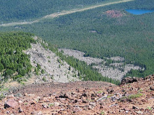
Looking down to the Wasco HP area from the top of Ollalie Butte (lightcolored rock area)
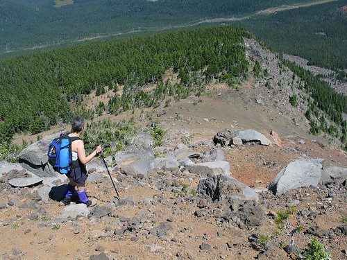
Heading for the saddle
After the descent to the saddle, follow the slope downward to the east. The scree is loose so I found trekking poles to be helpful in maintaining my balance as this was not the stuff you could boot ski easily. This saddle is probably at around 6700 feet and you'll lose over 400 feet to get to the area of
where the liner is. When you take a look at this topozone map, you can see how the surveyors created this liner situation.
After you make the effort to cover all the possibilites you can to hit the hypothetical (my wording) county highpoint, remember, that you have a 400-500 foot climb to regain the saddle. From the saddle, the trail is downhill to the west. I'd have my map and a GPS waypoint already established for making certain that you hit the trail in the right spot.
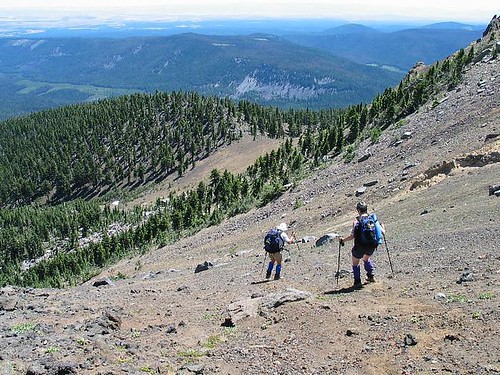
Bob and Rhonda head down the somewhat slippery scree slope
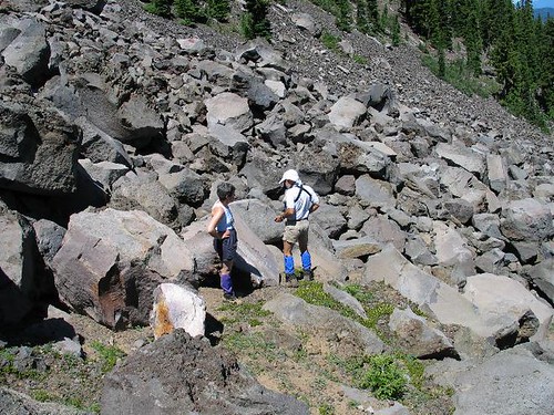
Bob and Rhonda looking for the spot where the highpoint is
From the trail:
If you decide not to go to the top of the Butte, you can strike out cross country from the trail as noted on this Topozone Map. When you hit the saddle, just follow the directions as noted above.
Essential Gear
Normal hiking gear plus water as there is none to be found in mid summer.
I highly recommend trekking poles for this one as I felt they were invaluable when we did the hike. If you do this when there is snow present, an ice axe and crampons would be advisable. However, if snow is present, it might make finding the Wasco county highpoint even more difficult.
Miscellaneous Info
If you have information about this route that doesn't pertain to any of the other sections, please add it here.