
|
|
Area/Range |
|---|---|
|
|
49.10984°N / 113.9502°W |
|
|
Hiking, Mountaineering, Trad Climbing, Bouldering, Ice Climbing, Aid Climbing, Big Wall, Mixed, Scrambling, Skiing |
|
|
Spring, Summer, Fall, Winter |
|
|
Preface
October 16, 2008 update;I have fixed a link in the "International Travelers" section and updated the "Homeland" Security requirements.
Please note that Hulio has added some really fantastic images to the gallery that should not be missed!
In the "What does the Future Hold" section there have been some new developments [mostly rhetorical] that I am researching, though suffice it to say for now that the North Fork of the Flathead [on the British Columbia side of the border] coal deposits and methane gas development has reached fever pitch once again.
So... I still have work to do! [I think this sentence will end up staying here.]
I would still like to extend the invitation to all members who have photos of this area to please attach them , and I will try to incorporate them with the text. I have included a section for photo credits, and will be very happy to give all contributors a hearty thank you there.
Please Report Missing or Broken Links Here
 Looking E. from the P.of W. Hotel at Vimy Peak 2379/7805 and the Vimy ridge 2422/7949. Photo by munroitis
 Introduction
I am not sure what made me decide to adopt this page back in October, 2006 maybe it was just the thought of this very important region being neglected on this site. Or maybe it was the thought of collaborating with saintgrizzly, author of the definitive Glacier National Park page, and the fun it would be to join these parks on Summitpost, just as they were joined in the Peace Park designation. The other possibility is that I did not know what I was getting into, but said to me-self what the heck, I can do this! Probably it was a combination of all three, but either way, this has turned into a rather unorthidox compendium of information that I hope you find useful. The variety of topics covered here may hold the answer to questions that I myself have asked as I was was walking up a trial.I have tried to pay at least a cursory interest to the cultural and environmental aspects of this region in a way that a person new to the area can get an over-arching "feel" for the park. In this light I invision individual mountains being added by SP members with intimate knowlege thereof, or by members willing to research and borrow information.Here is a complete list of Waterton Peaks. Please, if you have mountains to add, or pictures of this beautiful park, do not hesitate to attach them. I welcome your constructive comments/suggestions, and I will be happy to integrate them into this dynamic project.
 Ghostly aparition of Lineham Peak 2728m 8950`
After viewing this page, I hope that you will visit the Glacier National Park page, {a true work of art}, and also the work of Dow Williams whose 29 pages [at present] on the peaks of Kananaskis Country are absolutley tremendous. The combination of all these works will give you an excellent understanding of why this region is called "The Crown of the Continent".
 Looking East to Middle Waterton Lake,from Buchanan Peak.Photo by Dow Williams
Overview
Located just north of the Canada-USA border, in the province of Alberta, Waterton Lakes National Park is an area rich in natural history. The geology, climate, flora and fauna, all combine to make this National Park a very unique region of the Rocky Mountains known as the Crown of the Continent. Waterton Lakes is an integral part of an interconnected area of more than 10 million acres of the wildest land in the USA and Canada. The mixing of different eco-systems infulenced by pacific and continental weather systems, create a rich, and diverse environment. Complete and fully functioning as nature intended, predominatly with out the heavy influence of man.

Here the prarie meets the mountains, the West slope encroaches on the East slope, the Maple Leaf flies along side The Stars and Stripes, and the Olive Branch circling the World watches over.

Over 400,000 people per year visit Waterton Lakes National Park to view its wildlife and majestic vistas, camp and hike, take scenic boat tours, or head deep into the backcountry to climb its many challenging peaks, or explore its wild places.
The Canadian National Park Service is activley involved in management planning to ensure the ecological integrity, and cultural history of this area. Through baseline studies, and extensive reasearch projects currently underway, problems created by human use can be identified early, and necessary regulatory measures taken to mitigate the effects. A part of the Parks management plan states that "visitors experience the park without impairing its ecological and commemorative integrity". Then further the National Parks Act dictates that Canadas parks are "to be maintained and made use of so as to leave them unimpaired for future generations."
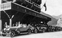
 A wonderful shot looking South towards Montana from the 1st class dining area of the Prince of Whales Hotel. Photo by kungfucious
This predicts a bright future for this beautiful park, which Canadian, American, and World citizens have given, through the auspices of The United Nations Educational Scientific and Cultural Oraganization, {UNESCO} to Waterton-Glacier International Peace Park the special designation of a World Heritage Site. The 2006 revised criteria for inclusion state; "(ix) The property occupies a pivotal position in the Western Cordillera of North America resulting in the evolution of plant communities and ecological complexes that occur nowhere else in the world."[emphasis added].
With holistic management plans, world recognition, and a continued conservation ethic, this region will remain a most valued jewel in the Crown of the Continent.
History
In May 2. 1895 140 sq.km./54sq.mi. of Waterton was protected by the Canadian Federal government as Dominion Forest Park, it was the 4th Park designated. At 525 sq.km./203sq.mi., it is currently the smallest of the Western Canadian Park system.The Waterton chain of Lakes were named by Lieutenant Blakinston of the Palliser Expedition, to honor the famed British naturalist Squire Charles Waterton {1782-1865}.
 What a place to look for oil!
 The first Western Canadian oil strike was in the Cameron Valley in 1902, and this sparked development that led to a well established settlement at the current townsite by 1915. There was also a townsite plotted out up the Cameron valley between the strike and the Little Prarie, but without subsequent substantial finds, the site fizzled before it even got much of a start.
In 1910 James Hill, President of the Great Northern Railway,


By 1927, the Prince of Whales Hotel openend, and bus service brought tourists from Great Northern train depots in E. or W. Glacier on a 1 week vacation that included stays in Hotels, lodges, and tent camps, and culminated with a cruise on the M.V.International, across upper Waterton Lake to Goat Haunt, and then a bus ride back to the railway station at either E. or W. Glacier. The price for this vacation? $1000.00 an extravigant sum in those times!
1932 brought the designation of Waterton Lakes National Park and Glacier National Park as an International Peace Park. The first of its kind.
1995 saw the designation of the Peace Park as a World Heritage Site.
Geology
A complete listing of the peaks of Waterton Lakes National Park can be found here, Peaks of Waterton.The Mountains of Waterton Lakes-Glacier National Parks, the Bob Marshal Wilderness to the South, and the Kananaskis Country to the North, are made up of layered rock that was formed 1,500 million years ago as an ancient sea bed. The rocks are Argillite [limestone], a crystilized calcite deposit from the life cycle of the cyanobacteria, also know as blue gree algae. The main composition of limestone is from aragonite, a very tiny molecule that is formed in the inner tissues of cyanobacteria, as the algae dies, these argonite crystals precipitate to the sea floor creating lime mud, which with time, and pressure spontaneously recrystalizes as calcite. This same process is occuring today, the cyanobacteria found in present day oceans are geneticly identical to those that formed the layered rock of Waterton 1.5 billion years ago. The famous red rocks of Waterton contain oxidized iron, and the green layers contain unoxidized iron. The black band is an igneous rock.
The mountains were formed by a single plate of an ancient inland sea bed, originating 100 km./62mi. to the S.W., being pushed N.E. horizontaly over 70 million year old Cretaceous era rock, this, in geological terms, is known as the , Lewis Thrust. This plate was 160km./99.4mi. long, and 6km./3.72mi. thick, the reach of which is present day
Mount Kidd near Canmore Alberta to the North, and Steamboat Mountain Mt., due W. of Bowmans Corners to the South. The Lewis Thrust is a small part of a giant overthrust belt, called the Purcell Supergroup. The overthrust phenomenon extends in different forms along the entire Continental reach of the Rocky mountains.
This explains the occurence of some oil and natural gas deposits in the Rockies. The cretaceous rock was formed during the age of the toothed birds, dinosaurs, and ammonites, as this biomass decomposed it formed oil and gas. When the present day Rocky Mountains were thrust over the cretaceous rock, voids were created where oil and gas deposits form and pool. In areas of great buckling to the N. and S. of the Lewis Thrust many productive deposits have been found. However it is believed that because the Lewis Thrust was one single plate, there are not many areas where oil and gas could pool, and potential productive reserves in the entire region of the Lewis Thrust are [thankfully] not promising.
 Drilling Rig on the Rocky Mountain Front. Note the "small footprint".
The mountains of Waterton Lakes, [and the entire Crown of the Continent] were then carved and shaped by ancient glaciers that have since completely receeded from the park. The evidence of their past existence is marked by the massive cirques, hanging valleys, aretes, kames, and eskers, and to the South, klippes. One good example of a klippe is Chief Mountain, a section of the thrust that was isolated by erosion.
 Schematic of Glaciation and Erosion of the Lewis Thrust
Climate
 Wet and Windy, but not very warm! A view across Upper Waterton Lake to the foot of Vimy Ridge
Another phenomenon associated with this storm track is the Chinook wind. As the moist air is forced over the mountains it is expanded, cooled, and dried out. Once over the mountains the now dry air rushes down slope to the prarie, and is warmed by compression. Each 100m./328` drop in elevation warms the air by 1 deg.C.. These Chinooks can reach speeds over 150 kmph./90mph., blow primarily from the S.W., and occur year round, but are more pronounced in the winter months.
Summer highs in the park can reach 35C./94 F., and winter lows can be -40C./-40F., In winter the Chinook winds cause frequent warm spells of 10C./50F.. Sometimes these warming trends occur in very short time periods, causing near record temperature swings in 24 hour periods.
Wind is almost a constant in the park with a daily average of 30kmph./19mph. in the summer, and winds over 97kmph./60mph. are common in the winter with occasional 150kmph./90mph. gusts.
Flora and Fauna
Over 970 species of vascular plants exist in 4 distinct eco-regions within the park. These eco-regions support 45 vegetation communities of which 16 are considered rare or threatened. Due to the narrowness of the mountains, the high winds, and milder climate, there is an invasion of plant species that are more common on the Western slopes of the Rockies. Examples of this are beargrass, and pink meadowsweet.The four distinct eco regions in Waterton Lakes National Park define and classify the symbiotic relationship between plants, animals and elevation. They are the FOOTHILLS, the PARKLAND MONTANE, the SUB ALPINE, and the ALPINE. Although some overlap exists between plant species in these regions, the distinction lies in the groupings of plants found within elevation ranges.
 The prarie about to meet the mountains! Photo by Hulio 2404
 THE FOOTHILLS are the driest region of the park and see less snow. This can be attributed to high wind scouring of snow and drier air masses. The elevation defining this region is typicaly 1280m./4200ft. to 1500m./5000ft.. The foothills are a prarie like setting with rolling hills, aspen groves, and rough fescue grasses. This area is very important wintering ground for the ungulate populations, as the fescue grass retains a high nutrient content even when dried. There is also less snow to break through to get to the grass.
 A large elk herd grazes on the foothills of the Waterton. Photo by Hulio 2404
THE PARKLAND MONTAINE overlaps the foothills in elevation 1280m./4200ft.-1680m./5500ft.. It also shares some plants, trees, and animals, but here you will find mixed groves of aspen, and Douglass fir,or limber Pine, with juniper. The main grasses are bunch grass, with bear berry [kinnikinnick], arnica, thimble berry, and twin flower, common. Mule deer, black bears, red squirrels, big horn sheep, Western tanagers, and vireos are common species to this eco-region. Higher moisture levels are found in this zone, from a deeper, drifting snow pack, and moister air in the upper elevation levels.
 A Ghostly view of Buchannan Peak,
THE SUB ALPINE has two [sub-sub] regions, the upper, and lower sub alpine regions are much moister and cooler, with deep snow packs that can last well into the late spring on leeward slopes. The lower sub alpine ranges in elevation from 1650m./5420ft., to 1950m./6400ft.. This sub sub region is moist and cool, with stands of spruce, and sub alpine fir. Honey suckle, and huckleberry bushes are common, ground cover is wintergreen, lichens, ferns, mosses, fake azalea and kinnikinick. Stellers jays, varried thrush, grizzly bears, wolverines, pine martins and snowshoe hares [the only species of rabbit in the park] are present.
Most of these animals will range into the upper sub alpine zone defined by elevation levels of 1950m./6400ft., to 2250m./7381ft.. White bark pine, and sub alpine larch are typical of this upper zone. These are very long lived tree species, and the larger trees are several hundred years old. The oldest tree in the park [and Canada] is a sub alpine larch at over 700 years of age. The effects of wind, snow weight, and moisture stress cause the twisted growth of these hearty trees. It is not uncommon to see several trees growing out of one trunk, this can be caused by wind or avalanches breaking off the main growth of the tree, and the roots will send up several shoots to replace it.
With the white pine comes the Clarks` nutcracker, which plays a symbiotic role in the life cycle of this Pine. The cones of the white pine do not open on their own, this tree relys on the nutcracker to break open the cone and carry the seeds to areas with deep soil where it caches them for food storage. The grizzly bear often raids these stashes and relys on these high protein nuts to accumulate fat for the long winter months. What the bears and the birds do not eat will germinate, and start new stands of White bark pine. [White Pine, Clarks Jay,Grizzly photos?]
 Views from Avion ridge. Photo by Hulio 2404
THE ALPINE,at 2250m./7381ft., and above, is the wettest and harshest of these eco-regions, with a very short [less than 60 days] growing season. The sparse plant growth, and species found are similar to artic tundra. With snow willow, alpine cinquefoil, moss champion, mountain avens, sky pilot, and various lichens typical. Most plants reproduce through rhizomes and bulbs, rather than seeds. Plants grow very low to the ground to avoid the wind, and to take advantage of radiant heat from the soils. Hoary marmot, pika, and white tailed ptarmigan are common to this region.
 Ptarmigan. One of the hearty residents of the Alpine zone. Photo by Dow Williams
 Waterton is home to 250 species of birds, 60 species of mammals, 24 species of fish, 10 reptiles/amphibians and countless insects, arthropods and invertebrates. The Parks eco systems support a healthy population of all the major and minor predators including wolves, cougars, wolverines, grizzly and black bears, pine martin, fishers, lynx, bob cat, fox and coyotes. There are large herds of elk, mule and white tailed deer, moose, bighorn sheep, and mountain goats. There are also 35 species of small mammals, such as squirrels, pika, bats, beaver, river otters, and porcupines. Herpitiles in the park include frogs, toads, and salamanders. In 1998 a baseline study of invertebrates was begun by the University of Calgary, and the Blood Tribe to identify indicator species and populations.
There are 5 species of annimals, and one plant that are considered of
Fire Flood and Avalanche
These three factors are the modern day sculptors of the mountain sides and valleys of Waterton. All are necessary to maintain the ecological balance that is the hallmark of nature. Floods that scarify the mountain sides and small valleys high in the mountains, deposit necessary nutrients in the wetlands and alluvial fans on the valley floors. Fires clear a mosaic of trees, and make room for huckleberry bushes, that are one of the highest calorie foods in the grizzly bears, and many other forest species diet. Avalanche clears trees, and makes room for plants that grizzlies, elk, big horn sheep, and mule deer graze on. Avalanche warning sign at the Little Prarie Picnic Area, Akamina Parkway.
Water
The string of the 3 Waterton lakes are the result of deep gouging by cordilleran [mountain] glaciers that flowed like rivers of ice, out of the mountains to meet the Continental ice sheet glaciers [which functioned much like seas]. Upper Waterton Lake is the largest of the chain at over 10 miles long, it is also the deepest lake in the Canadian Rockies. There are over 100km./62mi. of rivers and streams that drain this region, and all join to create the Waterton River, which flows into the S. Sasketchewan River, whose waters eventualy reach the Hudson Bay.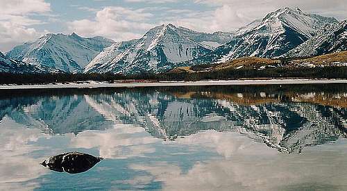 Beautiful Reflection on the Waterton River. Photo by Hulio 2404
A quote from the naturalist John Muir explains this best,"When one tugs at a single thing in nature, he finds it attached to the rest of the world".
The water brings it full circle, binds it together, and holds its solution.
 Upper Waterton Lake after a storm. Photo by moni
 What Does the Future Hold?
On 12/6/01, a formal proposal was initiated to expand Waterton Lakes National Park to include 100,000 additional acres directly to the West of the existing Park boundarys. Map and additional information here. This proposal has the limited backing of the British Colombia Provincial Government, Tembec Forestry, [lease holder to affected area], and Conservation groups. The main idea is to offer Tembec a publicly funded upgrade to their Elko B.C. mill that would allow the processing of logs from different areas, in return for their relenquishing leases, clearing the way for Parks Canada to complete the expansion. Looking S.W. to the Castle Wilderness from Avion ridge, N.W. corner of the park. Photo by Hulio 2404
 There is however a claim of first use rights made by the Ktunaxa Nation to the entire S.E. portion of B.C. that must be considered also. The most recent proposals would create a National Park Preserve, this would give full Park Preservation status to the area, while also preserving the aboriginal claim.
Another consideration is the North Fork of the Flathead River headwaters lie in this expansion area. The Government of the State of Montana is demanding non degradation of this river resource, which is a possibility due to mineral claims and forestry leases set to be excercised by Canadian extractive industry companies. So none less than International politics enter into this, which in light of the soft wood import tarrif bruhaha could have Park expansion caught up in the mess.
Parks Canada has no information available in their data base regarding this expansion. There is no current information regarding this expansion that has been published, most of the information available is circa 2002, with some conservation organizations publishing updates in 2004, and one update in 2005. Leading this researcher to think the proposed expansion is on the back burner.
With all of these powerful forces pulling on this region, the future of Park expansion is indeed a question mark. Meanwhile the inexoriable pressures of progress [read heli skiing, snowmobiling, 4 wheelers] threaten to over run this remarkable eco-system before it can be protected.
As we witness this magnificent jewel in the Crown of the Continent that is Waterton, we can only marvel at the gift of this creation. Then... jump right in to explore its many secrets and experience the awesome completeness that nature has put forth.
The more we understand our natural environment, and our ever increasing role in its changes, the better off we, and the Park will be.
May your experience in Waterton Lakes National Parks be rich, and fulfilling.
Important Information and Links
A wealth of information can be found here:Waterton Lakes National Park
Alberta Canada
Box 200 Waterton Park AB CA TOK2MO
Ph. #[403]-859-2224, Fax #[403]-859-5152
e-mail, watertoninfo@pc.gc.ca
Waterton Lakes National Park Web Site
Current Weather Link
Current Trail Conditions
Current Avalanche Conditions
Currency Converter
Historic Resources
Waterton Chamber of Comerce,
for a listing of accomodations, restaurants, and businesses inside and outside of the park
Camping Reservations
Entry Fees:[All prices in Canadian dollars]
Daily
* Adult $6.90
* Senior $5.90
* Youth $3.45
* Family/Group $17.30
* Commercial Group, per person $4.45
* School Groups, per student $2.95
* School Groups, Entry and a Heritage Presentation Special Program, per student $3.95
Annual
* Adult $34.65
* Senior $29.70
* Youth $17.30
* Family/Group $87.15
CAMPING
1 Night
* Townsite - Water, sewer, and electrical $32.65
* Townsite - Unserviced with washroom building having toilets and showers $23.75
* Townsite - Walk-in - Unserviced with washroom building having toilets only $20.80
* Crandell - Unserviced with washroom building having toilets only $18.80
* Belly River - Primitive $13.85
Group Camping - 1 Night
* Belly River, no showers, per person $3.95
CAMPING SERVICES
Fireplace Permit
* Per Day $7.90
BACKCOUNTRY USE AND CAMPING
Per Permit
* Overnight $8.90
* Season $62.40
* Reservation $11.85
FISHING
Per Permit
* Daily $8.90
* Annual $29.70
International Travelers
Please note that all non U.S. Citizens, Canadian tourists, and certain Mexican travelers, will be required to have a current I94 form [Arrival-Departure Record] to enter the United States from Canada. These are available at U.S. Ports of Entry for U.S.$6.00, payable only in U.S. currency or travelers checks. No credit cards are accepted for this form.,FAQ`s for I94 I94 Form Instructions
As a further caution, as of January 23, 2007 U.S. citizens are required to present a Pass Port to re-enter the U.S. when traveling by air. >U.S. Citizen re-entry FAQ`s on passport requirements for air travelers..
*
ALL persons*, including U.S. citizens, traveling by air between the United States and Canada, Mexico, Central and South America, the Caribbean, and Bermuda are required to present a valid passport, Air NEXUS card, or U.S. Coast Guard Merchant Mariner Document.
*
Oral declarations are no longer accepted from U.S., Canadian or Bermudan travelers seeking to enter the U.S. by sea and/or land. Travelers will need to present a valid government issued ID and a birth certificate or naturalization certificate.
*
On June 1, 2009 all U.S. and Canadian citizens who are 16 and older traveling between the U.S. and Canada, Mexico, Central and South America, the Caribbean, and Bermuda by land or sea (including ferries), will be required to present a valid passport or other alternative documents as determined by the Department of Homeland Security. U.S. and Canadian citizens who are 15 years old or younger will still be allowed to travel with just a copy of their birth certificate, as will teens between the age of 16-18 if they are part of an adult supervised school, religious, cultural or athletic group.
*
Lawful Permanent Residents (Green card holder's) do NOT need a passport to enter the United States, however you may need a passport to enter another country. Please contact the embassy of the foreign country you will be traveling to for their requirements Within a year, all U.S. citizens will be required to present a passport to re-enter the U.S..
This was a recommendation of the 9-11 commission and enacted by congress.
Getting There
Highway Map, Waterton National Park Map, Waterton Townsite Map.Copy Right Information on Maps.
Adobe Reader avaliable here
From Canada Highway 3 turn S. on Highway 6 to the Park.
From Montana take Mt89 N. to Canada 2 to Cardston, AB then W. on 5 to the Park, or in summer [6/1 through 9/30] use the Chief Mountain International Hwy {US 17-CA 6].
Nearby air connections in Canada are Calgary and Lethbirge Alberta, and in the U.S. are Kalispell, and Great Falls Montana.
Photo Credits and Thank You Notes
Thank you kungfucious for adding this wonderful photo of the P.of W.!Thank you munroitis for adding these fantastic shots of Vimy and Upper Waterton Lake!
Thank you Hulio for adding the great pictures of the elk herd, the Castle Wilderness, the buffalo stomp, the views from Vimey Ridge, and the reflection on Waterton River!
Thank you moni for adding the wonderful shot of Upper Waterton Lake after a storm!
Thank You Dow Williams for the use of the Buchannan Peak, and Ptarmigan photos!
Thank You saintgrizzly for attaching the nice Townsite photo!