Toggle navigation
Mountains
Routes
Images
Trip Reports
Forum
What's New
People
Areas & Ranges
Articles
Trailheads
Canyons
Huts & Campgrounds
Albums
Logistical Centers
Fact Sheets
Lists
Custom Objects
Gear
Plans & Partners
WELCOME TO SUMMITPOST
SIGN IN
REGISTER
Front Range
Additional Parents
Image
Webster BM
View High-Resolution Image
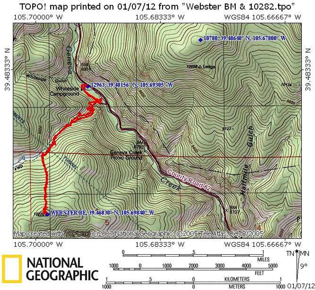
Webster BM
Our route on Webster BM. The trail, starting at Whiteside TH. Follows the trail for a while, then a relatively easy bushwhack to the summit. 4 miles, 1375' of gain.
« PREV
NEXT »
Jeremy Hakes
on
Jan 7, 2012 7:47 pm
Comments & voting
Other parents
Lat/Lon:
39.46830°N / 105.6984°W
Image Type(s):
Topo/Diagram
Image ID:
769948
646 Hits
0
% Score
0
Votes
Log in to vote
Comments
No comments posted yet.
to post!
Don't have an account?
Front Range
(Area/Range)
« PREV
Viewing
#252 of 255
GALLERY
NEXT »
Jeremy Hakes's Image Gallery
« PREV
Viewing
#854 of 927
GALLERY
NEXT »
×
You need to login in order to vote!
User Name
Password
Remember me
Forgot your password?
Log me out when I close my browser.
Keep me logged in all the time.
sign in as a user
Don't have an account?
Register now for FREE
Rating available
Suggested routes for you
People who climb the same things as you
Comments Available
Create Albums
Register Here


