
|
|
Route |
|---|---|
|
|
43.92260°N / 71.5778°W |
|
|
Hike |
|
|
Half a day |
|
|
Class 1-2 |
|
|
Approach
From I-93, get off on Exit 28 East towards Campton and Waterville Valley. Stay on Route 49 past NH 175 and keep going about five miles through mostly wilderness until you reach Mad River Road on your left. Stay on the road up and over the hill for about 0.7 miles (2 minutes) until you see a small sign on the right of the road pointing the way to the trail. Stay on the road until then take a small fork in the road to the right to the the parking area(fee).
Route Description
The Welch Dickey Loop Hike is the only major route up the two mountains. It is very popular for it's vast number of open ledges and large number of panoramic views. It is also very short, usually taking about two and a half hours to complete it 4.5 mile circuit.
This trail description will go counterclockerwise over Mt. Welch first than Mt. Dickey. Typically Mt. Welch is much easier to ascend than to descend.
From WELCH DICKEY TRAILHEAD take a right on Mt. Welch path. The path soon cross a brook and follow the brook 0.5 miles upstream. It then turn into a large switchback and angles up towards a large flat open ledge at about 1.3 miles. This ledge has a beautiful view of Sandwich Dome in the background. From here is where the real climbing begins.
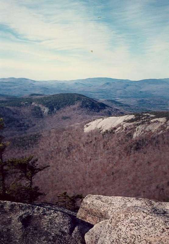
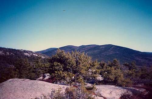
From the open ledge follow the trail up the steeper open ledges of Mt. Welch. The difficulty borderlines class 2 in these sections. Among the ledge you are climb are stands of jack pine, which are rare and which typically grow when forest fires have removed competing trees. Other summits in New Hampshire with rare jack pine include Mt. Cardigan and Mt. Chocorua. Remeber to look back occasionally because this section as some exhilierating views. Continue on until you reach the summit of Mt. Welch (2,605'). On top on Mt. Welch is 360 panorama of Sandwich Mtn. and Mt. Tripyramid in the west, Mt. Dickey and Mt. Tecumseh in the north, Mt. Mooselauke and Carr Mtn. in the west and Plymouth Mtn. and Campton Mtn. as well as the town of Campton in the south.
The trail drops steeply over yellow blazes to a small col then rises at times steeply to the top of Mt. Dickey (2,734') 2.4 miles. On top of Mt. Dickey there is a side path that lead to a fine overlook of Mt. Tecumseh and Franconia Ridge. From the summit continue on the trail down at a moderate grade through many more open ledges, though these ledges are at much less a grade. At 3.2 miles you will encounter a very impressive drop off on your left. Though not dangerous if you stay towards the edge, use proper caution here. The view is impressive though. After this grand finale of ledge the trail then reenters the woods where it takes a moderate grade down for about a mile until it approaches an old logging road. Take a left on the logging and stay on the logging for 0.3 miles until you reach the parking lots.
Essential Gear
In summer, all that is required is hiking boots, water and essential hiking gear. For winter though crampons are strongly recommended due to many steep open slabs of rock as well as large drop-off that are encountered.
Miscellaneous Info
If you have information about this route that doesn't pertain to any of the other sections, please add it here.