
|
|
Route |
|---|---|
|
|
39.50191°N / 110.31654°W |
|
|
Mountaineering, Trad Climbing, Bouldering, Scrambling |
|
|
Spring, Summer, Fall |
|
|
A long day |
|
|
Class 4 |
|
|
Class 4 |
|
|
Overview
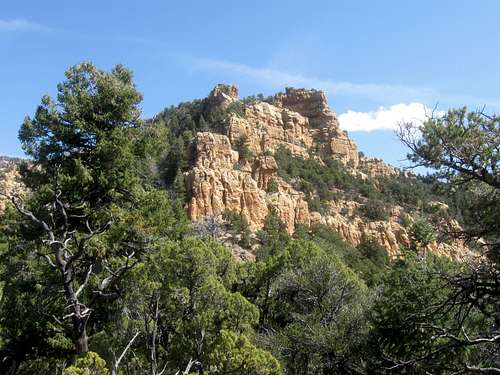
The West Ridge Route is a rugged and steep route to the summit of Patmos Head. There are several cliff bands to climb. If you want to keep the route under class 4 in difficulty, it might be possible to do so with careful routefinding. Otherwise, prepare to climb several cliff bands on the ridge (several 5th class routes are also possible). The route has 4000 feet elevation gain and the going is slow because the route is so rugged. Climbing one of the cliff bands on the West Ridge.
Route Diagram/Map

Getting There
From Highway 6 East of Prince and Wellington, turn east (about 9.1 miles) on Highway 123. Drive east on Highway 123 about 8.7 miles to the junction of Highway 124 in East Carbon City. From East Carbon City, drive south of Highway 124 until it turns east and reaches the Geneva Coal Mine. The road is paved to this point, but is gravel beyond here. Drive east up horse Canyon past the water tanks and to a small pull off/campsite/corral on the left. Park here.You can get slightly closer to the mountain if you continue along the road a short distance up Horse Canyon until an old road takes off to the left.
 Patmos Head from above the old Geneva Coal Mine (right below the trailhead).
Route Description
From the trailhead (there is another slightly shorter route from an alternate trailhead-see map), head down the steep slope to the west and scramble down to Horse Canyon Creek. Follow the creek north until Horse Canyon divides into a North Fork (left) and a South Fork (right). Turn left and into the North Fork. Usually above this point there is no water on the mountain. Horse Canyon not too far from the trailhead.
Follow the North Fork of Horse Canyon north. This is easy at first, but the canyon eventually narrows into a nice slot canyon. There are several (class 3) boulder jams to climb over at the head of the slot canyon.
 Nice narrow section of North Fork Horse Canyon.
 One of the obstacles in the slot canyon.
Once out of the slot canyon, the walking becomes easy once again. Keep following the canyon north. In places there are remains of an old jeep road, but the road has been totally washed out and is no longer usable to 4wd vehicles though there are some faint signs of ATV use. If you are planning on an overnight trip, keep a close eye out for campsites as they are pretty sparse. As soon as you find a suitable site, take it!
Continue up the North Fork of Horse Canyon to a major junction near spot elevation 7047T. Turn right here and into an East Fork of the canyon. You want to climb up to the ridge to the southeast after following this canyon for a little ways. There is no trail and the going is very steep (but this is only an introduction of things to come).
Once on the ridge, you basically follow it west and northwest to the summit of Patmos Head. This ridge is very rugged and the first buttress to climb is reached not too far after obtaining the ridge. This buttress has several 4th and 5th class routes to either climb it or bypass it and to regain the ridge. With careful routefinding, you might find an easier route, but this is unconfirmed. At the summit of the buttress is an old pole.
 Looking up at the first buttress.
Continue along the ridge. There are actually several more buttresses to climb or bypass and the route is not easy. Next to the first buttress, the last buttress is the hardest to climb. Make sure to remember the route you came up or you can easily get into some very exposed terrain. There are a few aspens near the summit.
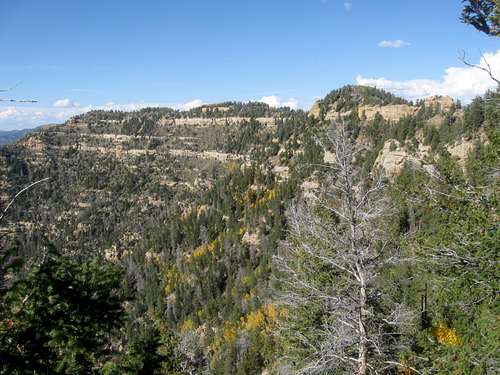 Looking north from near the summit.
The summit is marked by the remains of an old survey station. The views are excellent.
 Looking south from the summit.
The climb down the mountain is almost as challenging as the climb up. You can return the same way or choose an alternate route. We headed north from just east of the first buttress and descended the very steep slope to the canyon bottom to the north. This was a very steep route, has several cliff bands and slippery pine needles on steep slopes.
The round trip distance is about 10 miles with 4000 feet altitude gain, but because this is such a rugged route, the climb will take an entire day and it might be a long one.