
|
|
Route |
|---|---|
|
|
40.59072°N / 110.78659°W |
|
|
Hiking |
|
|
Half a day |
|
|
Class 2 |
|
|
Overview
East Grandaddy Mountain is located between Route 35 and the Mirror Lake Highway in the western Uintas of Utah. Like most of the Uinta summits it doesn't get much press and sees few visitors even though the trailhead is packed with the vehicles of hikers headed to nearby Grandaddy Lake. It seems that most hikers only venture where there are established trails and virtually all of the trails in the Uintas head to lakes, not summits. Nevertheless, many summits, including this one are attainable by the average hiker.Stats
Length: 4.1 miles one way (2.3 on trail and 1.8 off trail)Total elevation gain: 2300 feet
Start elevation: 9680 feet
End elevation: 11659 feet
Getting There
 View of Castle Rocks (10660') from the access road
It is about a 2 hour drive from Salt Lake city to the Grandview Trailhead from which the hike starts.
From Salt Lake City, take I80 east to Exit 146 (route 40).
Head east on Route 40 to exit 4.
Take Exit 4 to a traffic light.
Turn left on State Route 248 to head to Kamas.
After about 11.5 miles you will come to a traffic light in the center of Kamas.
Turn right on State Route 32 and go 2 miles to a 4 way intersection with a blinking red light.
Turn left on State Route 35 and go 32 miles to just past mile marker 32. The sign says "North Fork Duchesne River".
Turn left.
Go about 6.3 miles (the first 5.2 miles are paved) and turn right. The sign says "Grandview Trailhead".
Follow the dirt road 5.6 miles to the trailhead. First you will come to a horse trailer parking area on the left with an outhouse. Shortly after you will reach the hiker parking lot from which the trail starts.
Until the last right turn, the road is really good. Once you make this turn, it gets narrow and steep and has a big dropoff on one side. However, it is still suitable for all but the wussiest of cars, but the going is slow.
Route Description
Follow the trail 2.3 miles to Hades Pass. To your right will be a steep boulder covered slope. Go up this slope to the top of the ridge. Go up
Go upOnce on top of the ridge, head east. Near the start you will go through a section with large boulders and deep chasms. Although it is not technically difficult, it is not easy to walk through and it will take you some time.
 Rough footing
Following this section is a section of moderately hard to walk on boulders as you go over the minor 11500 bump. It gets easier after this and it is about 1 more mile to the summit which is clearly visible. Along the way, you will pass a series of well constructed cairns which presumably mark the wilderness boundary.
 Wilderness boundary cairn, summit at right
When to Climb
The access road is not plowed and is most likely to be clear of snow from late June through the beginning of October.Essential Gear
Standard hiking gear.Red Tape
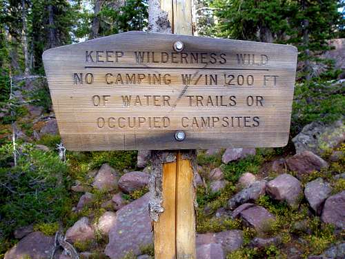
Normal wilderness area rules apply. In addition you are not allowed to build a campfire within 1/4 mile of a lake.
Extra Credit
 Heading to Point 11470
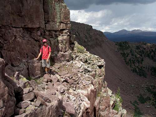
Once you get to the summit of East Grandaddy, it is possible to continue east 1.05 miles to the summit of Point 11470, another ranked peak. However, it is an order of magnitude more difficult. The east side of East Grandaddy is ringed with cliffs and unless you want to backtrack and descend all the way down to the lakes on the south side and then go back up, it is class 3-4 to get through the cliffs. We zigzagged our way down on the north side and after several dead ends, managed to find ourselves on a shelf between two cliff bands and followed the shelf to the saddle between the two peaks. After studying some pictures, I think the going might be easier on the south side. It is trivial to get from the saddle to the top of Point 11470.
Mountain Weather
 East Grandaddy summit on a predicted mostly sunny day
On a predicted mostly sunny day with a 20% chance of isolated thunderstorms we got hailed on for over an hour and there was wide spread rain but usually not on us.
Here is a link to the current 7 day forecast for East Grandaddy Mountain.
Map
 Route map