
|
|
Route |
|---|---|
|
|
39.14615°N / 106.73219°W |
|
|
Mountaineering, Skiing |
|
|
Winter |
|
|
One to two days |
|
|
Overview
The West Slopes Route is the best and shortest route up the peak, assuming this peak is the only one you wanted to climb on the trip. This would be a very long ski or snowshoe (nearly 12-14 miles round trip depending on which summit you want with 2800 feet elevation gain), so most people stay overnight in one of the Benedict Huts.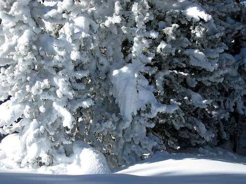 Frosted trees seen on the slopes of Smuggler Mountain.
Getting There
Getting to the trailhead can be confusing because it is just outside the huge resort town of Aspen. From the intersection of Main Street and Mill Street in Aspen, drive north on Mill Street and across the bridge over the river. Turn left onto Red Mountain Road and follow it for about a mile. Turn right on Hunter Creek Road. Just after 0.2 miles, turn left and to a parking lot marked for the 10th Mountain Division Parking Area.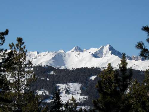 Pyramid Peak as viewed from the slopes of Smuggler Mountain.
Route Description
From the trailhead you are going to have to walk up the road until it crosses Hunter Creek on a bridge. Follow the trail up Hunter Creek and bear right at the junction (about 0.75 mile). This area is confusing and the route changes every year or even month to month, so have your topographic map handy and with you at all times.Assuming you found the right turnoff by following your map carefully, follow the road grade west then south then east and up the mountain. If you are on the correct route, eventually you will be on a ridge crest with a telecommunications reflector. From here on the route is easy to find.
Follow the trail east and through the woods. At first there are some steep sections, but it gets less steep as you climb along. The trail continues to follow the old road grade, but after 5.3 miles from the trailhead, it leaves the old road grade and heads east (keep a close eye on the map here!).
The route climbs up the steep slope to the Southeast before reaching the Benedict Huts (Fritz’s and Fabi’s Cabin. This is right near the elevation 10,977 summit of Smuggler Mountain. Views are somewhat limited, because of trees but are really great from the outhouse.
Peak 10,977 isn’t the tallest point on Smuggler Mountain and there are actually several summits scattered about. Using a map you can visit other summits which aren’t that far away. Peak 11,140 and the Warren BM (11,954) have nice views from their summits.
Since the route to Peak 10,977 is 11.8 miles round trip with 2800 feet elevation gain, most will want to make an overnight trip of it (winter is the only season to climb the peak), but if conditions are good you could do the route in one very long day. If you want to climb some of the other summits, including the highest one, this will add 1-3 more miles round trip depending on the summit.
 Mount Sopris as seen from Smuggler Mountain on January 17 2009.