
|
|
Route |
|---|---|
|
|
39.58280°N / 105.6681°W |
|
|
Hike |
|
|
Half a day |
|
|
Class 2 |
|
|
Overview
The West Slopes Route is the most popular route to Mount Bierstadt and in fact is one of the most popular 14er routes in the State of Colorado. It has seen thousands of ascents.The route is marginally class 2, and is 7.0 miles round trip with 2850 feet elevation gain. It is also a popular climb year round with winter ascents being common. The route was probably the easiest route up a Colorado 14er in winter, but this has been eclipsed by the East Ridge of Quandary since the road to Guanella Pass is no longer open year round.
The area is well known for summer thunderstorms and high winds in winter, so take this in account before making the climb. Just because it is one of the easier routes on the 14ers doesn't mean it shouldn't be respected.
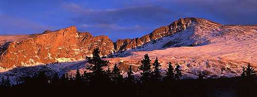
 The upper section of the West Slopes route as seen in January.
Getting There
Via the North and I-70Take Exit 228 "Georgetown" off 1-70 west of Denver. Drive through Georgtown while following the marked road to Guanella Pass Scenic Byway. Follow the road 12 miles south to one of two paved parking areas. The parking is very easy to find and plentiful on all but the busiest summer weekends.
Via the South and US 285
Drive US 285 west from Denver or East from Fairplay. About 12 miles west of Baily is the village of Grant. In Grant turn north and drive about 13 miles to Guanella Pass and the two parking lots which are the trailhead.
In winter the road is usually plowed to within 1.5 miles of the Summer trailhead.
 Mt Bierstadt as seen from the trailhead.
Route Description
The route starts at the Guanella Pass Trailhead (11,670). The trail starts near the parking area on the east side of the road.From the pass descends southeast to the willow flats below Bierstadt. In recent years this trail has been improved, so the old guidebook descriptions warning about the willows are no longer applicable.
You will cross Scott Gomer Creek after about half a mile.
Once past the willows (near timberline) continue along the trail as it switch-backs up the western slope of Bierstadt to the shoulder of the South Summit at 13,780. No route finding is needed on this straightforward and easy trail. This is a great trail for conditioning when coming from sea level to attempt more demanding 14er routes.
From the South Summit follow the ridge as it ascends to the summit proper. Descend the the route to the pass or continue on the Sawtooth Ridge, class 3, to Mount Evans about 1.5 miles to the East.
 Looking down the West Slopes Route.