
-
 34881 Hits
-
 92.85% Score
-
 40 Votes
|
|
Area/Range |
|---|---|
|
|
49.20420°N / 114.7528°W |
|
|
Hiking, Mountaineering |
|
|
Spring, Summer, Fall, Winter |
|
|
8740 ft / 2664 m |
|
|
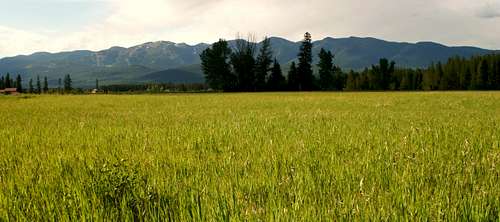
Overview of the Whitefish Range:
Layout designed for best viewing on a "1024 x 768" screen.
A BASTION OF BIODIVERSITY …
PLENTY OF ROOM TO GET AWAY FROM IT ALL …
A HAVEN FOR ENDANGERED ANIMALS AND PLANTS …
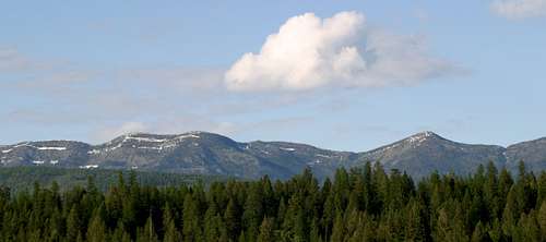
These phrases could be used to describe The Whitefish Range. Unlike its neighbors to the East, Glacier National Park and Waterton National Park, this range is not visited nearly as much in spite of tremendous views and an extensive trail system.
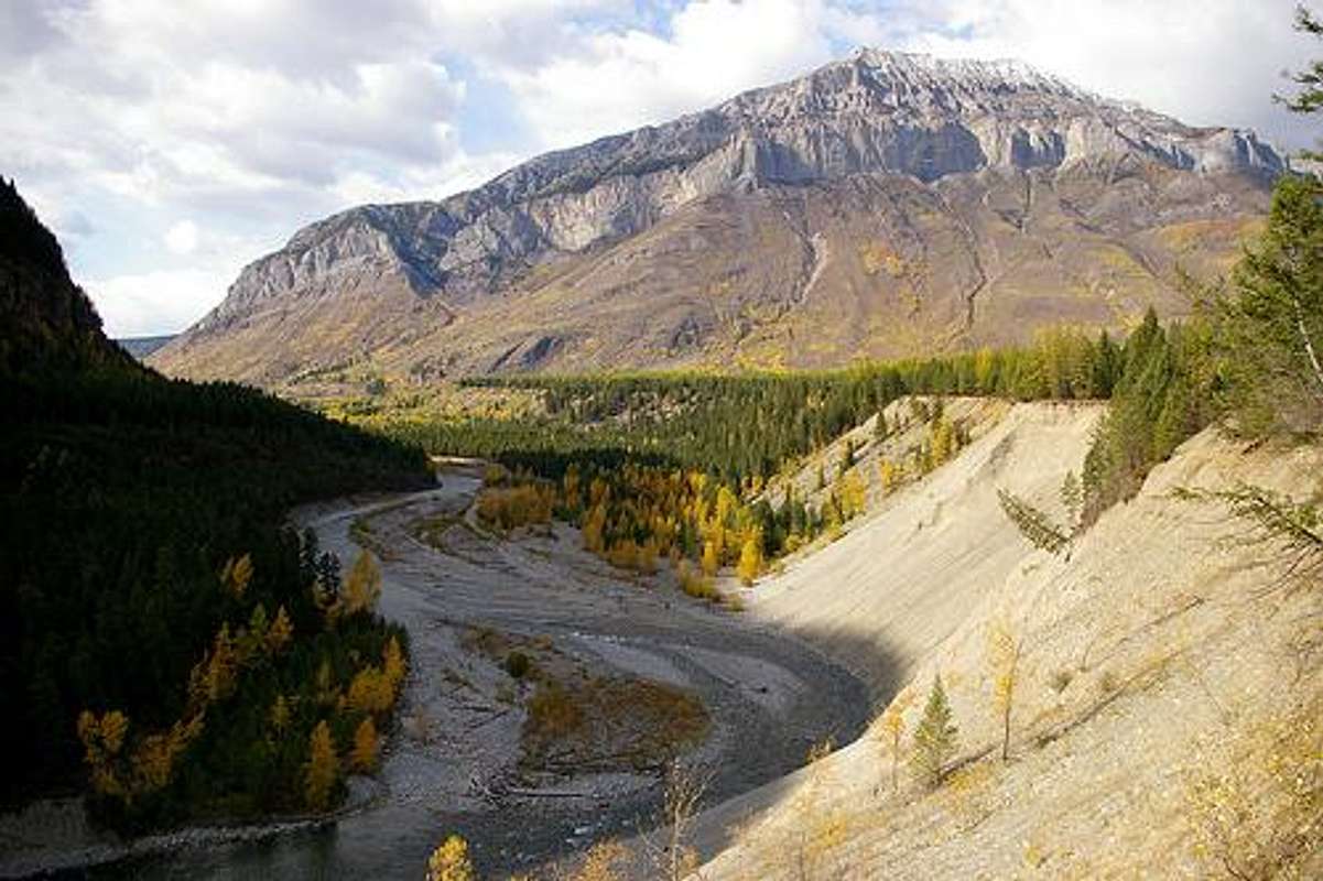
Mount Broadwood, D. Couse photo.
This area and its associated mountains and drainage system spans over 50 miles (80 km) north and south and over 25 miles (40 km) in width. This area provides a home for a rich diversity of plants and animals. It is sparsely populated by humans which gives large carnivores such as grizzly bears and wolves plenty of room to stretch their paws.
Interestingly enough the Whitefish Range crosses the 49th Parallel and therefore has dual citizenship in both Canada and the United States. There are three names to the ranges contained in this geographic area, but more on that later. In Montana it is called the Whitefish Range. In British Columbia it is referred to as the McDonald and Galton Ranges. On the northeastern side of the range, The Flathead Valley is Canada’s only large unsettled low elevation valley. On the northwestern side of range in Canada, is made up of the Wigwam and Lodgepole drainages.
The named peaks in the Montana portion range from Nine Mile Mountain at 4,250 feet (1295 m) to Nasukoin Mountain at 8,086 feet (2465 m) in elevation. North of the border the tallest named peak in the MacDonald Range is Mount Doupe, which stands at 8,740 feet (2664 m) in elevation. Two other Canadian peaks are also listed in PeakFinder as being taller than their southern neighbors. Those peaks are Overfold Mountain at 8,150 feet (2484 m) and Mount Swope at 8,250 feet (2515 m).
Geography of the Whitefish Range:
The southeastern end of the Whitefish Range
A mountain range is a chain of mountains bordered by highlands or separated from other mountains by passes or valleys.
According to this definition, the Whitefish Range makes up one cohesive mountain range with three names. These ranges are not separate geographically isolated entities and if it weren’t for the border designation it would be difficult to distinguish between one named range or another.
Perhaps it is best to think of this area as a corridor. Native Americans and white trappers certainly saw it this way as do the bear, wolves and ungulates that call this area home. Modern day fisheries management requires being sensitive to the effects of regulation on each side of the border as what happens in the Ten Lakes Scenic area effects the Wigwam River fishery and what happens in Canada’s Flathead Valley effects Montana’s Flathead River fisheries.
The corridor, known as The Whitefish Range in Montana is also known as the MacDonald and Galton Ranges in Canada, is located in Northwestern Montana and Southeastern British Columbia and is part of the Rocky Mountains.
Understand the many names in the range is really an exercise in geography. Although it is one range there are different names depending upon which side of the 49th Parallel the mountain range lies. For simplicity sake on this SummitPost page the name “Whitefish Range” includes all of the ranges and sub-ranges as described below unless specifically designated otherwise.
In Montana, the Whitefish Range, as it is called, extends north along a line that extends from near the confluence of the main stem of the Flathead River near Columbia Falls west to Whitefish. To the west the range is bordered by U.S. Highway 93 and the Stillwater River as it travels from Whitefish to the Canadian border near Eureka. The eastern boundary is Glacier National Park and the North Fork of the Flathead River.
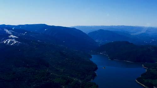
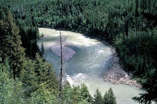
Angling in BC
Mountain Ranges know no borders and in Canada these same mountains have been labeled as sub-ranges of the Crowsnest Range. These mountains are referred to as the Flathead Range, a sub-range of the Crowsnest, and are made up of two sub-sub-ranges. The MacDonald Range, whose drainage feeds the Flathead River in Canada, which becomes the North Fork of the Flathead River after it crosses the U.S. - Canadian Border, and the Galton Range, whose uppermost drainages empty the Ten Lakes area near Eureka, Montana and empties into the Elk River which is part of the Kootenai River system. The Galton Range lies northeast of Roosville, British Columbia to the west and has a western and northern border marked by the incredible Elk River. All water drained in the entire range eventually dumps into the Pacific Ocean as part of the Columbia River.
Naming the MacDonald Range:
The MacDonald Range lies west of the Flathead River and east of Wigwam River, just north of US border. The range was named on John Palliser’s 1863 map and may have been named after Sir John A. Macdonald, who later became Canada’s first prime minister.
Naming the Galton Range:
The Galton Range forms the eastern edge of the Kootenay River Valley from the Elk River south to the U.S. border. The Wigwam River lies to the east of the Galton Range.
In his report, Thomas Blakiston of the Palliser Expedition wrote, "On the morning of the 25th of August at starting we were obliged to climb the face of a steep hillside for the purpose of keeping on the left bank of the Kootanie Fork or Elk River, which here sweeps in close under an outer range of the mountains, having a north and south direction, and which I have called, 'Galton's Range.'"
As a youth Galton developed a passion for travel. He was studying medicine but when his father died he was left with sufficient fortune that he was free to indulge in his craving for travel. He wrote nine books and over 200 papers. They deal with many diverse subjects, including the use of fingerprints for personal identification, and calculus -in both of which Galton was a pioneer - twins, blood transfusions, the art of travel in undeveloped countries, criminality and meteorology. He was also deeply concerned with improving standards of measurement. He was knighted in 1909 and died near London on January 17, 1911.
Source for MacDonald and Galton Range Information: PeakFinder
Author’s note: Please do not confuse British Columbia’s Flathead Range with Montana’s Flathead Range which lies south of Glacier National Park and is made up mostly of peaks in The Great Bear Wilderness. Also do not confuse British Columbia’s Flathead Valley with Montana’s Flathead Valley. British Columbia’s Flathead River becomes Montana’s North Fork of the Flathead River when it crosses the international border.
It is easy to support a corridor idea for this range due to its similarity in geography, geology, biology as well as history.
Now that you are thoroughly confused about geography and place names let’s move on before it gets even more dizzying.
Geology of the Whitefish Range:
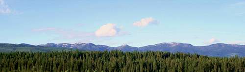
The Whitefish Range
The Whitefish Range is formed from cake-like layers of siltstone, mudstone and limestone that are thousands of feet in depth.
Geologists believe that the bedrock of the range actually originated some 40 to 50 miles (64 to 80 km) west of its present location. The extreme pressure created by the perpetual shifting of the earth’s crust forced the rock of the Whitefish Range to shift upward toward the sky as well as to slide eastward to its present location. Eventually, the crust’s compression eased and the mountain blocks settled, creating the valleys of the North Fork of the Flathead, the Stillwater River, the Wigwam River as well as the Elk River, all of which are part of the Rocky Mountain Trench system.
Small valley glaciers ground and slipped east and west and smoothed the jagged features of the range, leaving its valley floors strewn with unsorted rocks, boulders, gravel, sand and other debris.
The area averages 16.5 inches (31.75 cm) of rain annually and in the winters there is an average of 65 inches (1.65 m) of snow in the valleys and over 12 feet (3.6 m) of snow on the peaks.
Whitefish Range Flora:
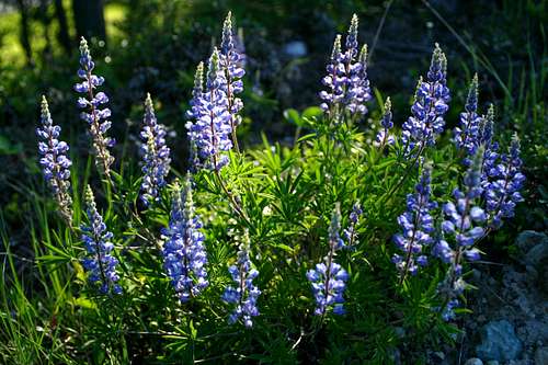
Native Lupine
The Whitefish Range is home to Western red cedar, western hemlock, and grand fir that prefer wetter climates as well as Engelmann spruce, Douglas fir and white pine that tend to live in moderate elevations. Sub alpine fir and shrub-like bushes are found at tree line. Western larch, Ponderosa and lodge pole pine can frequently be found on south facing slopes and white bark pine is found in places where there is abundant moisture and in the fall and spring.
Forest fires have long shaped the Whitefish Range and the range has had extensive fires in 1910, 1929, 1988 and 2001. Wildfire shapes the various types of shrubs and other smaller plants that grow in the Whitefish Range. Morrell mushrooms flourish after wildfires as do huckleberries. They attract both humans as well as bears which has created concerns for safety.
A rare plant, Water Howellia, Howellia aquatilis, can also be found in this range.
Whitefish Range Fauna:
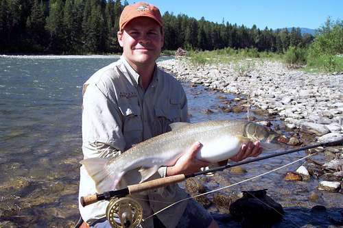
An Elk River Bull Trout
The Whitefish Range provides habitat for approximately 250 species of wildlife and 22 species of fish.
The following large wildlife species are found in the Whitefish Range: grizzly, black bear, gray wolf, mountain lion, lynx, bob cat, wolverine, fisher, marten, whitetail deer, mule deer, elk, rocky mountain bighorn sheep, mountain goat, moose, beaver, otter, mink, bald eagle, golden eagle, owls, bull trout, cutthroat trout, toads, frogs, salamanders, and many lesser species make their living in these hills and waterways.
Fish species of special concern are the Bull Trout and the Westslope Cutthroat Trout. In recent years Lake Trout have been moving up the Flathead River system and displacing these incredible native fish.
Mammal species of special concern include the grizzly as well as the Canadian lynx.
Early Human History:
Early human habitation of this area was most likely comprised of the Kootenai or Kootenay (in Canada).
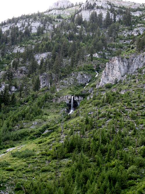
BC Waterfall
To their own people they are called The Ktunaxa. They learned the mountain trails, crossed the passes, hunted the animals and gathered its rich harvest of fruits.
They also named a few of the mountains and streams such as Akinkoka Mountain (place of red willows), Nasukoin Mountain (chief), Tuchuck Mountain (thumb) and perhaps the most fun one to say Yakinikak Creek (moose trail).
Other tribes used this area to a lesser extent and would pass through the corridor on their way to hunt on the Great Plains. Some of the other tribes that would use portions of this area were the Flathead, Salish and Stony Indians.
White man’s first incursions into this area were from The Hudson Bay Company as it traded with the Ktunaxa in the early 1800s. David Thompson was perhaps the first white man to extensively explore this area while he was trapping. A fort was established near present day Eureka, Montana as well as a post in the Red Meadow Creek drainage on the North Fork drainage side.
By the late 1890’s settlers began to establish homesteads along the rivers edge and the U.S. government established post offices at Bowman Lake, Trail Creek, Kintla Lake, and Polebridge.
The western side of the range saw more development due to the main line of the Great Northern Railway. These towns were Whitefish, Olney, Fortine, Eureka, The Tobacco Plains near Roosville and Grassmere.
Current Threats to The Whitefish Range:
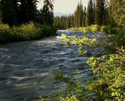
The Stillwater River
In the recent years there have been serious concerns raised about possible threats to the Whitefish Range and its river basins.
All of those serious threats due to mining, methane gas exploration and oil development were put to rest on February 9, 2010 when British Columbia announced a ban on all of these activities in the Canadian portion of the Flathead Basin. See the Daily Interlake Article.
The energy giant, BP (British Petroleum), had proposed developing the Cline Mine. The Cline Mine is a Coal Bed Methane project was to last for an estimated 20 years and potentially could have destroyed an entire mountain and poisoned the watershed of the Flathead Basin, both in Canada as well as Montana. Negotiations were in place for a number of years that would have presented a more sensible alternative that accounted for both the need to protect the environment as well as promoting intelligent use of our natural resources.
There are also concerns related to existing oil and gas leases on the eastern side of the range. Perhaps it will be as they found out in the early 1900’s that there is just too little oil and gas to make it profitable.
It is crucial that this incredible area animals and plants as well as way of life be preserved for future generations to enjoy.
Preserving The Whitefish Range: The Future,Present and Past
The Buffalo Cow Trail – Bristish Columbia and Montana-Proposed:
A unique opportunity exists for restoring an ancient Ktunaxa trail north of the border. The Buffalo Cow Trail criss-crosses over the international border as it “originates in the Tobacco Plains area near the Canada US border north of Eureka, Montana, traverses the Whitefish/Galton Range including the Wigwam River, crosses the North Fork Flathead River into today’s Glacier National Park, and crosses into Canada along Kishinena Creek. While most of the trail corridor looks much like it has for hundreds or thousands of years, the stretch through British Columbia has been obliterated in many areas by large clear cuts and logging roads. Interest has been expressed by tribal elders in restoring the ancient trail if the Flathead portion in the southeastern corner of British Columbia is one day managed as a protected area.
Winton Weydemeyer Wilderness-Montana-Proposed:
The Whitefish Range
A new wilderness area of approximately 171,000 acres has been proposed to honor a conservation advocate from the Tobacco Valley. The Winton Weydemeyer Wilderness honors Winton Weydemeyer who was born in 1903 and he spent his life ranching, growing Christmas trees, serving his community as lodge Grange Master, helped found the local Soil Conservation District as well as the Lincoln County Fair, and assumed other community positions. He also served as a Montana Senator from 1951-1953. During his free time he spent leisure time in the woods where he developed his skills as an amateur photographer. Over the years he published more than 300 of his own photographs.
This is how Weydemeyer described this are of his beloved Whitefish Range:
“... the Whitefish Range, which with its outlying ridges, lies adjacent to the Canadian boundary and the west boundary of Glacier National Park, with a central roadless area of approximately 485,000 acres -- half as great as the park itself.
“Topographically the country in this area is much the same as that in the lower elevation of the park, and the fauna and flora are similar...
“Many sections have never been visited by anyone other than a few old-timer hunters and trappers, and members of the United States Geological Survey party. Trails are usually few and distant, probably because of the surprising lack of forest fires in the past years. Though it thus admirably conforms to the requirements by the Western wilderness lover, it is by no means inaccessible to the ordinary camper or tourist who is willing to pay the just price of entry -- a few hours’ travel from automobile roads by foot or horseback...”
Source: Winton Weydemeyer Wilderness
In 1925, Winton Weydemeyer first proposed the Whitefish Range Wilderness. Then in 1964 the Wilderness Act was signed into law. In 1988 Congress passed the Montana Wilderness Act, recommending areas across Montana, and in the North Fork, as designated wilderness. That same year, President Reagan vetoed the bill at the request of Senate candidate Conrad Burns and his campaign manager, Denny Rehberg. Now, almost two decades since the nation’s only presidential wilderness bill veto still no movement to establish this wilderness area.
Source: The North Fork Association
Flathead National Park- British Columbia-Proposed:
A January 3, 2008 article from the The Tyee in Vancouver, B.C. reads “In recognition of the Crown of the Continent's natural beauty and abundant wildlife, Waterton Lakes National Park was established in Alberta's southern Rockies in 1895. Fifteen years later, the Americans created Glacier National Park next door in northern Montana. In 1932, the two parks were honoured as the world's first international peace park.
In 1995, UNESCO designated Waterton-Glacier International Peace Park a World Heritage Site. But it noted that the adjoining section of British Columbia's Flathead Valley was "a missing element," and recommended that the site boundaries eventually be expanded to include it.
British Columbia's Flathead River
It goes on to state that, “In 1980, the Canadian Parks and Wilderness Society took up the cause and began pushing for establishment of a large provincial park in the Flathead's southeast corner.”
"Fifteen years later, we got Akamina-Kishinena Provincial Park," recalls Bob Peart, one of the original campaigners, "but it was woefully inadequate." At 109 square kilometres, he says, it was too small, lacked important valley-bottom habitat, and, like many B.C. parks, remained open to hunting.”
As a bit of a concession, the Akamina-Kishinena Provincial Park was created. Supporters of the larger Flathead National Park feel that key land features are not protected and continue to push for the Flathead National Park. Opposition forces continue to fight for timber, recreational snowmobilers, mining as well as gas lease rights and this situation has created the perfect storm for lawsuits and unhappy folks on both sides of the issue. Hopefully they can all arrive at an agreement that meets this unique areas best usage as well as preserves it for future generations whether a national park is established or not.
Perhaps the final decision will come from government leaders and Ktunaxa tribal leaders. But at this point the establishment of a new park appears to be a moot point.
"The province isn't interested in a feasibility study for a national park and that's kind of the beginning and the end of it," says Doug Harvey, Parks Canada's chief for new park proposals. On the other hand, there is support for a feasibility study from the Regional District of East Kootenay, the City of Fernie, and the Ktunaxa Nation, whose traditional territory includes the Flathead Valley.”
Source: The Tyee
Ten Lakes Scenic Area:

Ten Lakes Scenic Area
The Ten Lakes Scenic Area is located in the northwestern portion the Whitefish Range just below the International Border. The Ten Lakes was designated a scenic area in 1964. In 1984 further legislation through the Montana Wilderness Study Act officially designated the Ten Lakes Scenic Area a wilderness which placed restrictions on motorized vehicles or equipment of any kind. The only exception to this rule is over-snow vehicles.
The Ten Lakes Scenic Area covers more than 6,400 acres and has an additional 19,000 acres surrounding it. The Ten Lakes basin along the Canadian border is the namesake of this spectacular area which is home to Therriault Lake and the Bluebird Basin. Alpine lakes can be found throughout the basins and cirques that form the Ten Lakes Scenic Area.
The Montana Lookout System:
<fontcolor="white">
| Name | Elevation Feet | Established In: | Current Status: |
|---|---|---|---|
| Akinkoka | 7,014 | 1930's | Abandoned Camp, 1930s |
| Benchmark Mountain | 7,099 | 1934 | Destroyed, 1957 |
| Big Creek | 6,430 | 1933 | Destroyed, 1957 |
| Canyon | 6,050 | 1940s | Abandoned Tower, 1940s |
| Coal Ridge | 7,105 | 1928 | Existing structure?? |
| Cyclone Peak | 6,031 | 1935 | Manned Lookout |
| Demers Ridge | 6,235 | 1935 | Destroyed, 1957 |
| Forks | 6,497 | 1933 | Destroyed, 1977 |
| Hay Creek Divide | ???? | 1930s | Abandoned Camp, 1930s |
| Hornet | 6,744 | 1922 | Existing Rental Lookout |
| Link Mountain | 7,230 | 1939 | Abandoned Camp, 1952 |
| Locke Ridge | 7,206 | 1938 | Gone |
| Moose Point | 7,531 | 1931 | Abandoned, 1957 |
| Moran Peak | 7,404 | 1930 | Abandoned |
| Mount Hefty | 7,585 | 1930 | Abandoned Cabin |
| Mount Locke | 7,205 | 1929 | Abandoned Tower |
| Nasukoin Mountain | 8,086 | 1929 | Abandoned Tower, 1956 |
| Red Meadow | 5,650 | 1923 | Abandoned Tower, 1930s |
| Smoky Ridge | 6,650 | 1933 | Destroyed, 1977 |
| Standard Peak | 7,196 | 1929 | Gone before 1956 |
| Stryker Peak | 7,338 | 1935 | Structure |
| Stryker Ridge | 6,906 | 1960 | Abandoned Structure, 1969 |
| Thoma | 7,104 | 1930 | Structure |
| Tuchuck Mountain | 7,751 | 1931 | Destroted, 1957 |
| Wedge | ???? | 1930 | Abandoned, 1930s |
| Werner Peak | 6,960 | 1911 | Existing Manned Structure |
| Whitefish Mountain | 4,370 | 1938 | Destroyed, 1974 |
Forest Service Lookout System
Before the advent of reliable plane observation and satellite imagery the U. S. Forest Service had to rely on their eyes in the mountains to quickly spot and report forest fires. In Montana’s potion of the Whitefish Range there were 30 lookouts. These lookouts were manned during the fire season and a system was devised to accurately identify the exact location of the fire. After properly identifying the location the fire watchers would call their dispatch that would then send out the necessary fire fighting crew.
The chart on the left describes the name of the U. S. Forest Service Lookout or Fire Camp as well as the elevation, date established and current status. Similar lookout systems exist in Canada as well.
Source: Rex’s Forest Fire Lookout Page
Peaks of the Whitefish Range:
Peaks in the Whitefish Range have some interesting names. Krinklehorn Peak is perhaps the most interesting name and can be reached via an 11.5 hiking mile trail. Mount Hefty, which must be a heavy mountain, has twin summits one in Canada and one in the United States.
In the Whitefish Range most of the higher peaks are found near or north of the U. S. - Canadian Border.
The tallest peak in the range is Mount Doupe which stands at 8,740 feet (2,664 m) in elevation. Mount Doupe can be accessed from the west along the Lodgepole Cabin Forest Service Road along Wigwam and Bighorn Creek or from east along the Lodgepole Forest Service Road. There are no trails or even any roads that make a close approach to the peak. Perhaps someone reading this page has been there or has a recommended approach route to summit the tallest peak in the range.
“Mount Doupe is named for Jacob Lonsdale Doupe, DLS, PLS, who surveyed in this area in 1899; he obtained his commission as a Provincial Land Surveyor in 1898 and practiced until 1932; his name is associated with 1915 surveys in the Railway Belt in professional land surveyors' index; Doupe was in his 90's when he died at Victoria in 1952.”
Mount Swope was named to remember Canadian Army Gunner John N. Swope from Trail, BC. He was serving with 5 Canadian A.A. Regiment, Royal Canadian Artillery, when he was killed in action on 4 September 1944 at the age of 32. He was buried at Gradara War Cemetery in Italy. His parents William Albert and Georgina Swope lived in Cranbrook, BC.
Source for Mount Doupe and Mount Swope Information: BCGNIS Query.
The tallest peak in the U.S. portion of The Whitefish Range is Nasukoin Mountain which stands at an elevation of 8,086 feet (2,465 m) and can be accessed via a trail near Red Meadow Campground. It can also be accessed via a trailhead that is located above Upper Whitefish Lake on the western side of the divide.
As of initial publication the only peak featured in SummitPost was Teakettle Mountain, which is located in the southern portion of the range near Columbia Falls, MT. For other peaks featured on SummitPost from the Whitefish Range see Mountains and Rocks of the Whitefish Range.
Located below are a list of the 25 tallest peaks in The Whitefish Range.

Mount Broadwood

Mount Marston

Tuchuck Mountain
| Rank | Name | Elevation Feet | Elevation Meters | Location |
|---|---|---|---|---|
| 1 | Mount Doupe | 8,740 | 2,664 | British Columbia |
| 2 | Mount Swope | 8,250 | 2,514 | British Columbia |
| 3 | Overfold Mountain | 8,150 | 2,484 | British Columbia |
| 4 | Nasukoin Mountain | 8,086 | 2,465 | Montana |
| 5 | Sheep Mountain | 8,050 | 2,454 | British Columbia |
| 6 | Mount Broadwood | 7,950 | 2,423 | British Columbia |
| 7 | Piaysoo Ridge | 7,850 | 2,393 | British Columbia |
| 8 | Mount Mahaney | 7,846 | 2,391 | British Columbia |
| 9 | Poorman Mountain | 7,832 | 2,387 | Montana |
| 10 | Green Mountain | 7,822 | 2,384 | Montana |
| 11 | Mount Thompson Seton | 7,820 | 2,384 | Montana |
| 12 | Lake Mountain | 7,814 | 2,382 | Montana |
| 13 | Tuchuck Mountain | 7,751 | 2,363 | Montana |
| 14 | Red Benchmark | 7,601 | 2,317 | Montana |
| 15 | Mount Hefty | 7,578 | 2,312 | Montana |
| 16 | Windfall Mountain | 7,550 | 2,301 | British Columbia |
| 17 | Moose Peak | 7,531 | 2,295 | Montana |
| 18 | Krag Peak | 7,510 | 2,289 | Montana |
| 19 | Ksanka Peak | 7,488 | 2,282 | Montana |
| 20 | Mount Hefty | 7,450 | 2,271 | British Columbia |
| 21 | Stahl Peak | 7,435 | 2,266 | Montana |
| 22 | Whitefish Mountain | 7,417 | 2,261 | Montana |
| 23 | Independence Peak | 7,416 | 2,260 | Montana |
| 24 | Krinklehorn Peak | 7,411 | 2,259 | Montana |
| 25 | Deep Mountain | 7,406 | 2,257 | Montana |
Getting to The Whitefish Range:
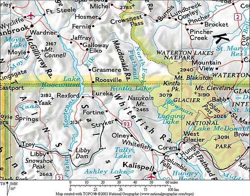
Location of the Range, saintgrizzly image
British Columbia, Canada and Montana in the United States are a long way from most places. That’s why many of us live here.
The very nice locals say, "Have a nice VISIT in Montana". While you are visiting check out other things to do at Things To Do In Montana's Flathead Valley.
In Canada they say “Eh?” a lot and most folks there are real friendly too.
It is possible to get here by:
By Air: Glacier International Airport serves as the air hub for northwestern Montana. Horizon, Delta Connection and Northwest Airlines service this area.
By Bus: Northwest Montana is served by bus service.
By Rail: Amtrak arrives daily from Minneapolis or Seattle stops in East Glacier, Essex, West Glacier and Whitefish.
By Road: The major highways serving northwest Montana include U.S. Highway 2 running east and west and running north to south are U. S. Highway 93 and Montana Highway 83. The Whitefish Range is located 160 miles north of Interstate 90 which runs through the southwestern portion of Montana.
Rental cars can be secured in the Flathead Valley at and near Glacier International Airport. See Car Rentals in Montana.
Access to the British Columbia portion of the Whitefish Range can be achieved along the Elk River. Both Fernie and Cranbrook, BC have numerous hotels and restaurants to cater to the needs of visitors.
Access by air is most easily gained by flying into Calgary and renting a vehicle to drive to southern BC. This Calgary Airport link also has information regarding car rentals.
International Travel Information:
With increasing concerns related to international threats of terrorism and such the border between Canada and the United States is more restricted. The following guidelines were found on-line from the respective countries regarding crossing the International Border between the Commonwealth of Canada and the United States of America.
Entering Canada from the United States:
Required Documents
When entering Canada from the United States, U.S. citizens must show either a U.S. passport or other proof of U.S. citizenship - such as an original or certified birth certificate together with photo identification. U.S. citizens entering Canada from a third country must have a valid passport. A visa is not required for U.S. citizens for a stay up to 180 days.
Special Circumstances
TRAVELING WITH CHILDREN
Due to international concern over child abduction, children traveling with one parent, grandparents or other guardians should carry proof of custody or letters from the non-accompanying parent/s authorizing travel. (This is in addition to proof of the child's citizenship.) Travelers without such documentation may experience delays when seeking admission to another country.
Any person under the age of 18 and traveling alone should carry a letter from his/her parent or guardian authorizing the trip. Travelers without such documentation may experience delays at the PORT OF ENTRY.
NATURALIZED CITIZENS
If you are a naturalized citizen and do not have a passport, you should travel with your naturalization certificate. A driver's license or Social Security card is not valid proof of citizenship. All U.S. citizens entering Canada from a third country must have a valid passport.
PERMANENT RESIDENTS
Alien permanent residents of the U.S. must present their Alien Registration Card, commonly called the "Green Card."
DUAL CITIZENS
If you are a dual U.S.-Canadian citizen you should always present yourself as a Canadian citizen when entering Canada and as a U.S. citizen when entering the United States.
Customs Restrictions for U.S. Visitors to Canada
As a visitor, you can bring certain goods into Canada for your own use as "personal baggage" during your stay. If you declare these goods when you arrive, and take them back with you when you leave, you will not have to pay any duties or taxes. These goods may not be used by a resident of Canada or on behalf of a business based in Canada.
Personal baggage includes things like clothing, camping equipment, sports equipment, personal computers and cameras. It also includes vehicles, vessels, and aircraft. Items for business use in Canada are admissible as personal baggage. You may be required to fill out a Customs Declaration Card.
The Customs inspector may request a security deposit on your goods and may issue Form E29B, the Temporary Admission Permit, as a Customs control of the goods. Present the goods to Customs when you leave Canada and your deposit will be refunded.
ASummary of Canada's Customs regulations can be read for more details.
Source: Canadian Embassy Web Site
Entering the United States from Canada:
Please note that all non U.S. Citizens, Canadian tourists, and certain Mexican travelers, will be required to have a current I94 form [Arrival-Departure Record] to enter the United States from Canada.
These are available at U.S. Ports of Entry for U.S.$6.00, payable only in U.S. currency or travelers checks. No credit cards are accepted for this form.
As a further caution, as of January 23, 2007 U.S. citizens are required to present a Passport to re-enter the U.S. when traveling by air.
U.S. Citizen re-entry FAQ’s on passport requirements for air travelers.
ALL persons*, including U.S. citizens, traveling by air between the United States and Canada, Mexico, Central and South America, the Caribbean, and Bermuda are required to present a valid passport, Air NEXUS card, or U.S. Coast Guard Merchant Mariner Document.
Oral declarations are no longer accepted from U.S., Canadian or Bermudan travelers seeking to enter the U.S. by sea and/or land. Travelers will need to present a valid government issued ID and a birth certificate or naturalization certificate.
For U.S. and Canadian Citizens who are 16 years old and older:
On June 1, 2009 all U.S. and Canadian citizens who are 16 and older traveling between the U.S. and Canada, Mexico, Central and South America, the Caribbean, and Bermuda by land or sea (including ferries), will be required to present a valid passport or other alternative documents as determined by the Department of Homeland Security.
For U.S. and Canadian Citizens who are 15 years old and younger:
U.S. and Canadian citizens who are 15 years old or younger will still be allowed to travel with just a copy of their birth certificate, as will teens between the ages of 16-18 if they are part of an adult supervised school, religious, cultural or athletic group.
Lawful Permanent Resident:
Lawful Permanent Residents (Green card holders) do NOT need a passport to enter the United States, however you may need a passport to enter another country. Please contact the embassy of the foreign country you will be traveling to for their requirements. Within a year, all U.S. citizens will be required to present a passport to re-enter the U.S.
This was a recommendation of the 9-11 commission and enacted by congress.
Resources for U.S. Entry:
FAQ`s for I94
I94 Form Instructions
U.S. Citizen re-entry FAQ`s on passport requirements for air travelers.
Red Tape for the Whitefish Range:

Forest Service Access Sign
For Montana’s Flathead and Kootenai National Forests see: MT Rules and Regulations.
For British Columbia contact the Rocky Mountain Forest District for Rules and Regulations.
When to visit the Whitefish Range:
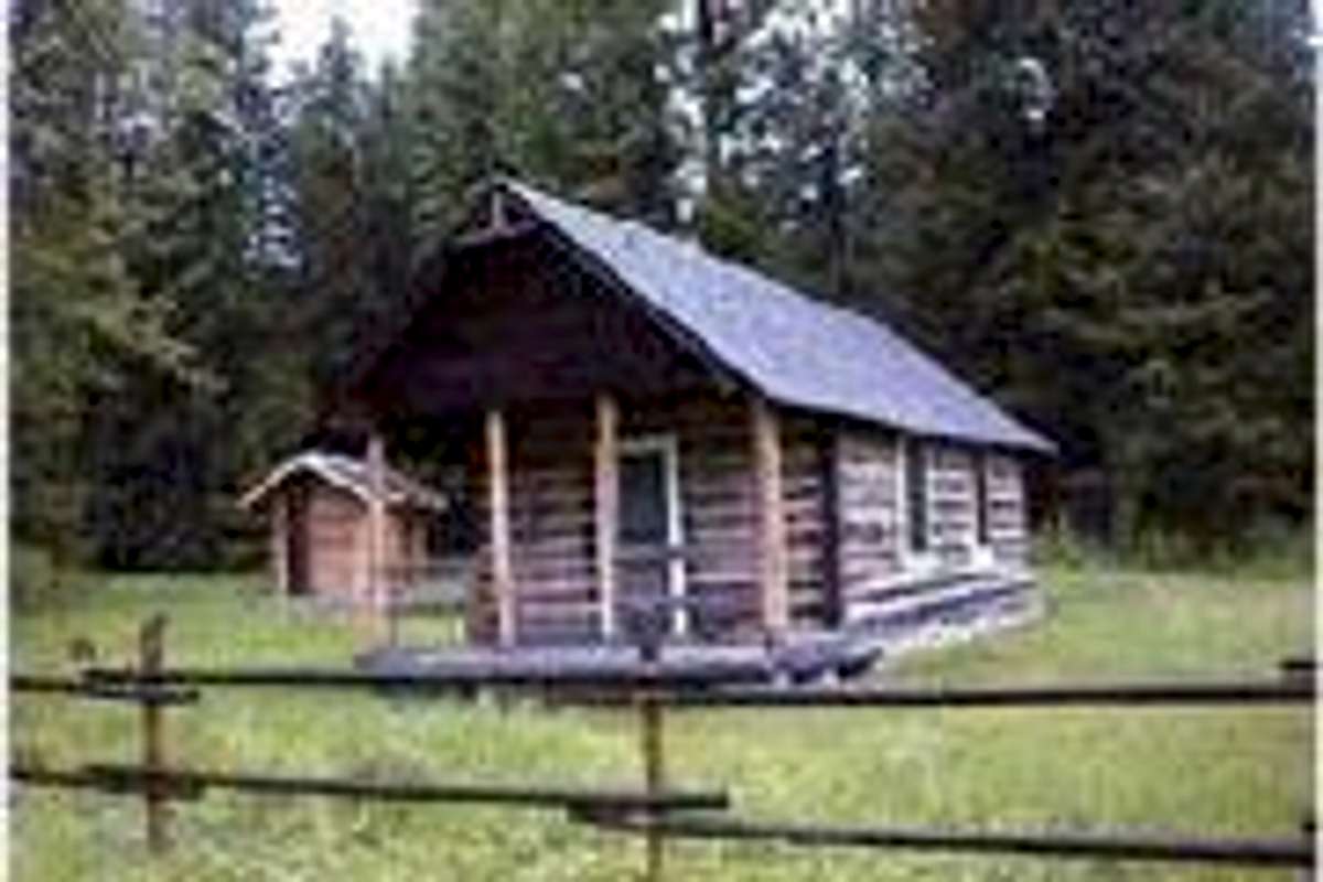
The Ford Cabin, available to rent.
The Whitefish Range is accessible throughout the year. With groomed snowmobile trails as well as forest access roads it would be possible to ski, snowshoe or snowmobile to many of the peaks in the Whitefish Range. Keep in mind that access to medical care would be a long drawn out procedure no matter what time of year but is even more protracted when the peaks are in the grips “old man winter”. Backcountry users should also be familiar with avalanche safety when traveling during the winter. There are links to Avalanche Centers in the last section of this page.
Generally the range begins to become snow free in mid-May and by early July most peaks would be accessible. Access to the range becomes day to day in late September due to cold nights that may result in snow and warm fall days resulting in generally wet conditions. By late October do not count on traveling to higher elevations in the range unless prepared for snow travel.
Recreating in the Whitefish Range:
4th of July, Polebridge, Montana Style:
Perhaps there is a no more original way to celebrate the birthday of the United States than celebrating it in Polebridge, Montana. If you are near Glacier National Park and the Whitefish Range make plans to attend.
The Big Mountain (a.k.a Whitefish Mountain Resort):
Brief interlude for a tirade: Okay the big money people have changed the name of this ski resort to Whitefish Mountain Resort but most locals still call it Big Mountain or even “The Mountain”. This makes more sense when you consider that there actually is a mountain named Whitefish Mountain that is located about 18 miles (30 km) northwest of Big Mountain. What was wrong with Big Mountain Resort?
The Big Mountain
Big Mountain is the home of “Whitefish Mountain Resort” and is without a doubt THE most visited mountain in the entire Whitefish Range. Skiers from both the U.S. and Canada flock to the mountain to ski and do whatever else there is to do when they arrive. “The Mountain” has changed from a quaint little place where an all access lift pass was purchased for about $12.00 to a commercialized over crowded “Colorado style” resort with condos, restaurants and a mini mall. If you really want the home town feel ski at Blacktail Mountain, its less expensive and has a nice family feel.
Perhaps the best feature of “The Mountain” is the Danny On Memorial Trail.
The Danny On Memorial Trail was named for Danny On a Forest Service silviculturist and renowned nature photographer, conservationist, and avid skier on The Big Mountain. He generously gave his time to teach others about nature, photography, skiing, and forestry. Sadly Danny On died at the age of 55 while skiing on The Big Mountain.
The Danny On Trail is from 4-5.6 miles in length and climbs 2,353 feet (717 m) to the 7,000 foot (2133 m) summit of Big Mountain. The trail climbs through subalpine fields of wildflowers and old growth trees. In July and August locals hike the trail and find huckleberries as well as fabulous views. The hike takes from 1.5 to 3 hours to complete and after enjoying the views into Glacier National Park and the Flathead Valley from the Summit House the 20 minute chair lift ride to the bottom is absolutely free.
If there is interest in visiting the “Resort” take a look at their internet site for complete details on all of the winter and summer activities.
Ten Lakes Scenic Area:
The Ten Lakes is accessed via by turning off of U.S. Highway 93 and following Forest Service Roads to the trail heads. From these trail heads trails criss-cross the Ten Lakes Scenic Area allowing easy access to this spectacular region of the Whitefish Range.
The areas highest peak is Poorman Mountain which stands at 7,832 feet (2387 m) in elevation. Other significant summits include: Ksanka, Stahl and Independence Peaks.
Glacier National Park Access:
Access to Glacier National Park can be found all along the North Fork of the Flathead River since the park’s western boundary is the river.
Common access points along the North Fork of the Flathead River include:
Kintla Lake
Bowman Lake
Logging Lake
Dutch Creek
Camas Creek
Waterton National Park Access:
In Canada, the Whitefish Range lies to the west of Waterton National Park. It might be possible access to the east across the Flathead River from trailheads along Sage, Akamina and Kishinea Creeks but there are no trails connecting directly into the park on the recreation maps that were used for reference on this page. Perhaps someone else has better information regarding access to Waterton from the Flathead Valley.
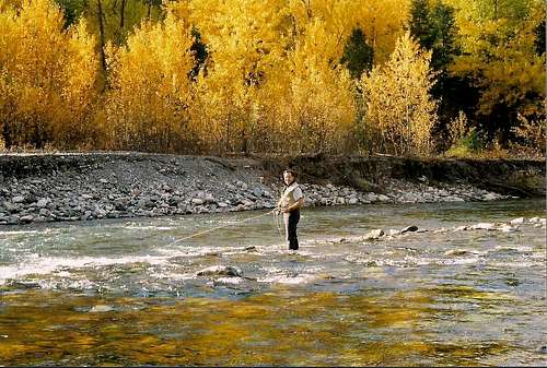
Fishing in the Whitefish Range:

Angling on the Elk
Numerous mountain lakes provide average to above average fishing opportunities to those who seek to wet a line. The North Fork of the Flathead River as well as the Elk River and its tributaries provide excellent seasonal fishing opportunities as well.
For those interested in fishing consider hiring a fishing guide service. In Montana, Lakestream Fly Shop in Whitefish is an excellent choice. In Canada consider contacting The Elk River Guiding Company in Fernie, B.C. There are other fly shop operating in the area as well, I have used these shops and they are quality operations that are staffed by knowledgeable, friendly professionals.
See A Guide to Piscatorial Acts in the Wilderness for a guide to fishing mountain lakes.
Rafting on the Flathead River:
Glacier Outdoor Center and Great Northern Raft Company offer guided float trips on the Flathead River in Montana. Both of these companies are highly recommended. The owners are reliable, knowledgeable and are personal friends of this writer. If you have any questions or would like to book a trip please use their services.
Root Beer Classic Sled Dog Race- Polebridge, Montana:
Sled Dog Racing at Polebridge
The Root Beer Classic sled dog race is held each year on the first weekend in March in Polebridge. Mushers and their sled dogs competed in a 15 mile race with the winner receiving a bottle of root beer. Mushers encourage visitors to pet their dogs and the dogs love the attention.
Heli-skiing in the Whitefish Range- Montana – Proposed:
In 2008 a local business proposed offering Heli-Skiing in the Stillwater State Forest which is part of the Whitefish Range. Large amounts of opposition as well as a need to further study the impact of this proposal lead to the request being denied at this time.
According to a December 11, 2008 story in Kalispell’s Daily Interlake there were 316 requests to deny the proposal that were submitted to the Montana Department of Natural Resources (DNRC). "Their concerns mainly include the noise and effects to winter recreation; the adverse effects to various wildlife species; low-flying aircraft effects to adjacent landowners and the potential for trespass on federal lands," Manning wrote in a letter to Triple-X Helicopter and Valhalla Adventures, two Whitefish businesses that proposed helicopter skiing operations on specific parts of the Coal Creek and Stillwater forests.
Commercially guided ski trips were proposed at Winona, Coal and Stryker ridges on the two state forests.
"Given the amount and breadth of the concerns that have surfaced with the proposed activities and the general nature of the proposals, DNRC will not consider any helicopter skiing operations this season," Manning continued.
The proposal may be reconsidered in the future based on continuing research into its "economic viability and compatibility with other forest management and recreational activities."
The state agency is "contacting other land management agencies in the western portion of the United States that have helicopter skiing operations to learn how the activity is managed and the challenges and benefits they have experienced," Manning wrote. "This effort will continue." Source: The Daily Interlake
Other Uses:
There are forest service access roads and trails throughout the range. In the winter many of theses roads become snowmobile trails which open access for all types of backcountry users.
Camping and Cabin/Lookout Rentals:
<fontcolor="white"></table >
| Name of Rental | Description | Daily Rental Cost | Location |
|---|---|---|---|
| Wurtz Cabin | The Wurtz family beginning in 1913 homesteaded the historic Wurtz Cabin; they worked the land, hunted, and raised livestock until they sold the property in 1964. The Forest Service acquired the land in 1990 and used it as a workcenter into the late 1990’s. In 2003 the planning and restoration work began to add it to the cabin rental program. Please pack out what you brought including your garbage. Polebridge Merchentile is located south of Wurtz and has limited supplies. | $65/night | 46 miles north of Columbia Falls in the North Fork |
| Hornet Lookout | The Hornet Lookout was built in 1922 as part of the fire lookout program. At one time it was one of 146 structures on the Flathead National Forest that made up the integral chain of forest fire detection. Today it is one of less than 15 remaining lookouts and is the only D-1 standard fire lookout still standing. It is listed on the National Register of Historic Places. | $20/night | 54 miles north of Columbia Falls in the North Fork |
| Ben Rover Cabin | The Rover Cabin was purchased by the Forest Service in 1992 from Ronald and D’Ann Wilhelm in accordance with the Wild and Scenic Rivers Act. | $50/night | 35 miles north of Columbia Falls in the North Fork |
| Ninko Cabin | Ninko sits in the Whitefish Range of the Rocky Mountains. The cabin was constructed between 1949 and 1951 by Forest Service Crews as an intermediate ranger station for employees working on the Spruce Park Beetle Campaign. The larger size of this cabin reflects the desire of the ranger to have a larger work space, anticipating the greater amount of time he would have to spend at the location. | $30/night | 56 miles from Columbia Falls |
| Ford Work Center | The area that the Ford cabin now occupies was originally used as a 171-acre, half-way camp for Forest Service officers, government pack trains and fire crews up and down the North Fork of the Flathead River. In 1908 it was reserved as an Administrative Site and the name was changed from Whale Creek Ranger Station to Ford Ranger Station. The cabin visible today was built in 1922 by Ranger Ralph Thayer, in connection with the final clearing of the North Fork Trail which occurred in 1924. | $35/night | 45 miles up the North Fork Road |
| Mount Wam Lookout | This 196-square-foot cabin sits atop Mt. Wam on a rocky point in the middle of the Ten Lakes Proposed Wilderness Area. The site offers views of the Canadian Rockies to the north, Glacier Park to the east, the Whitefish Mountain Range to the south, and the rugged rock cliffs of the Galton Range to the west. | $20/night | 20 miles from Fortine, Montana |
There are at least 9 USFS campgrounds in the range. Those are Big Creek, Red Meadow Lake, Tuchuck, Moose Lake, North Dickey Lake, South Dickey Lake, Grave Creek, Big Therriault Lake and Little Therriault Lake. Information on these campsites can be found by contacting the Glacier View Ranger District at (406) 387-3800 or by going on-line government campground reservation site for Whitefish Range Campgrounds.
Across the border in British Columbia there are numerous camping sites available. Perhaps the most interesting is the campground at Frozen Lake. Frozen Lake is located near the international border in Canada’s Flathead Valley. This is a small semi-open campsite. Akamina-Kishinena Provincial Park also offers tenting pads and pit toilets at Akamina Creek. See BC Camp sites for a complete listing of available camping opportunities.
Other motels and restaurants are available in the large towns that circle the Whitefish Range.
If there is interest in really getting back to nature consider booking a stay at one of the Forest Service Rental Cabins or Lookouts. The above table shows rentals that are available in the Kootenai and Flathead National Forests. To reserve these cabins go to Cabin and Lookout reservations.
Weather:
 |
|---|
Click weather links below for detailed forecast.
Equipment and Maps:
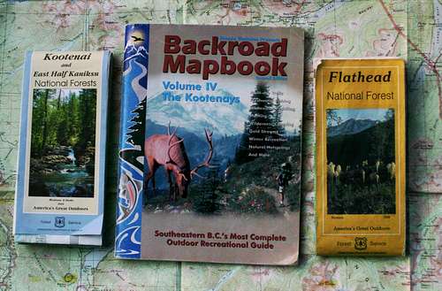
The Maps
In addition to the basic gear used to summit peaks bring bear deterrent spray and topo maps for the area. Water may or may not be available as well.
If additional equipment is needed the Glacier Outdoor Center in West Glacier, Montana has outdoor rentals for both winter and summer equipment.
Contact any U. S. National Forest Service office for maps. The recommended maps for the Montana portion are the Kootenai and East Half Kaniksu National Forests and Flathead National Forest.
In British Columbia maps should be available at most sporting goods stores as well as Ministry of Forests offices.
A useful guide for British Columbia is the Backroad Mapbook, Volume IV, The Kootenays. It is called Southeastern B. C.’s Most Complete Outdoor Recreation Guide. This 2008 book has an assortment of information such as fishing, camping, winter recreation, as well as paddling routes. It is currently in the 3rd Edition and includes basic maps of the Kootenay area. The cost for the 3rd Edition is $ 24.95 Canadian.
Guidebooks and Links:
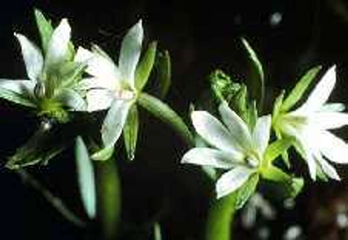
The Rare Plant found in the Whitefish Range, Water Howellia, Howellia aquatilis
For information in Montana visit:
Climbers Guide to Montana
Flathead National Forest
Kootenai National Forest
Glacier Avalanche Center
For information in British Columbia visit:
Rocky Mountain Forest District
Canadian Avalanche Information