
-
 1691 Hits
-
 81.84% Score
-
 14 Votes
|
|
Route |
|---|---|
|
|
46.90691°N / 11.60279°E |
|
|
Mountaineering |
|
|
Summer |
|
|
Most of a day |
|
|
Alpine F |
|
|
Overview
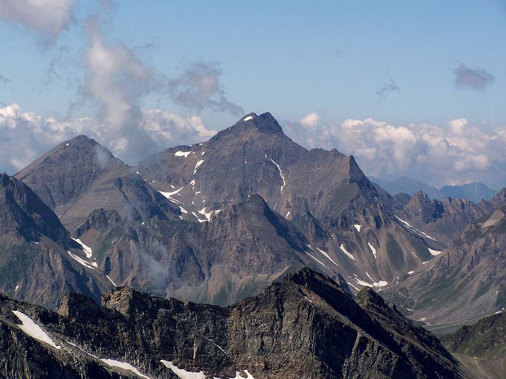
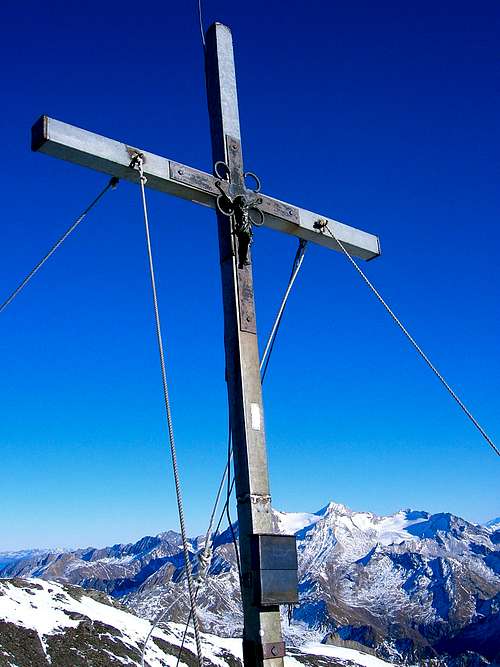
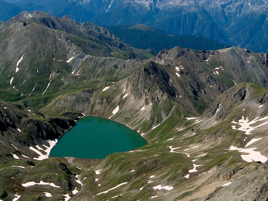
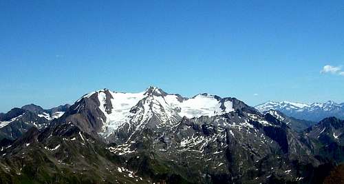
Wilde Kreuzspitze 3134 m - Picco della Croce in Italian - is the main peak and the highest one of the Monti di Fundres in the Bolzano Alto Adige province (South Tyrol) not far from the border with Austria. Picco della Croce is a spectacular lookout point with an impressive view over the Zillertal Alps. It has a double summit and stands isolated in the middle of the mountain range. The highest summit is 3134 m, while the summit cross is located on the the lowest one at 3123 meters above sea level. You can climb Picco della Croce from two sides: from the North (Rifugio Vipiteno- Sterzinger Huette) in Val di Vizze or from the South through the Rifugio Bressanone-Brixnerhuette, which is the Normal ascent route. This latter is not a particularly difficult route, but it requires good training and good physical condition, especially if it is climbed in just one day. On the Southern base of the mountain it's located the magnificent Lago Selvaggio (in German, Wilder See).
Getting There
Road access
From Autobrennero A22 exit Bressanone - Brixen and take the SS49 entering the Val Pusteria (Pustertal). Follow the road for a few kilometers to the village of Rio di Pusteria where to leave the state road turning to the left and going up the small valley of Valles. Reached and passed the village of Valles, the paved road becomes very narrow and crosses the steep Salto del Bove reaching the Pfann Alp - Malga Fana parking lot at an altitude of 1752 m. The road is closed to traffic near the Salto del Bove in the months of July and August from 9 am to 5 pm. Therefore it's necessary to arrive before the 9 am, otherwise a shuttle service is available departing from Valles. From this parking lot it's possible to climb Picco della Croce in just one day with a vertical gain of about 1400 meters. Alternatively, to take the climb more comfortably it is advisable to stay overnight at Rifugio Bressanone.
Walking to the Rifugio Bressanone
From the parking lot of the Pfann Alp - Malga Fana in the upper Val di Valles take the path n. 17 and in a few minutes reach a plain with ancient wooden huts. The itinerary first overcomes a narrow gorge along a forest road and reaches a crossroads, where the path to the Malga Pian di Labes (Labesebnalm) is ignored. We proceed in the direction of the Rifugio Bressanone along a comfortable mule track with moderate ascent, passing a series of bumps and reaching the hut in about 1.30 hours.
Route Description
Wilde Kreuzspitze - Picco della Croce Normal route
Difficulty: Alpine F
Difference in level: 1380 m. from the parking lot in the Valles Valley 1752 m
Hut: Rifugio Bressanone-Brixnerhuette 2270 m
Beautiful and advisable ascent, which doesn't present particular difficulties, in a magnificent environment.
Route description
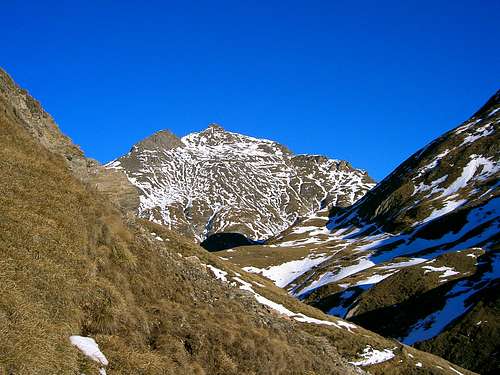
From the Rifugio Bressanone follow the trail 17b, which is part of the Alta Via di Fundres, describing a semicircle in the West direction. At the junction with the path to the Forcella della Rena (Sandjock) turn to left to climb up the Valle di Fumo (Rauchtal). The slope is moderate until the beginning of the ascent towards the Rauhtaljoch pass.
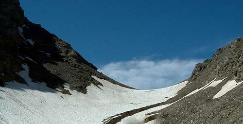
Here the path becomes steep and partly covered by debris and often even snow in early summer. You reach the saddle Rauhtaljoch at an altitude of 2808 m between the Blickenspitze - Cima della Vista and the Picco della Croce. The peak of the Picco della Croce is about 45 minutes uphill along the path n. 18. From the saddle turns to NW and a first hill comes up again. Continuing along the steep trail on debris and rocks with snow residues, we finally reach the cross located on the South summit.
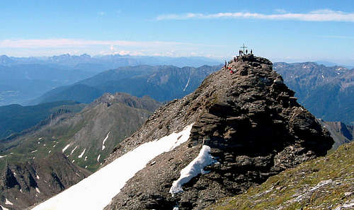
From here we descend towards the Cima Nord, the highest, which can be reached quickly without any particular difficulty. The summit panorama is wide and impressive particularly toward the Alpi Aurine Alps and Zillertal.
Descent: from the top we return to the Rauchtaljoch and continue to the beautiful Lago Selvaggio 2532 m. Go around the lake on the orographic left, along path 18, with a long arch, descend through the pastures to the Labisebenalm - Malga Pian di Labes 2138 m. (refreshment). Along the access road to the Malga, the path to the Rifugio Bressanonee is shortly connected and from here we return to the parking area by closing the loop.
Essential Gear
Normal equipment and high mountain clothing. Early in the season with snow crampons and ice axe are recommended.
Red Tape
No fees no permits required. Pay attention that the road from Valles to tha parking lot at 1752 m is subject to regulation during the summer period: it is closed to traffic near the Salto del Bove in the months of July and August from 9 am to 5 pm.
Hut and other accomodation
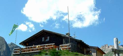
Rifugio Bressanone-Brixner Huette
Other accomodation in Val Pusteria, Bressanone and Valles.
When to climb
The mountain is best climbed in summer or early autumn
Meteo
Guidebooks and maps
Guida dei Monti d'Italia - Alpi Aurine, Brennero-Gran Pilastro - Vetta d'Italia F. Cammelli, W. Beikircher Ed. CAI-Touring Club Italiano, Milano, 2002
Map: Tabacco sheet 37 Gran Pilastro/Hochfeiler – Monti di Fundres/Pfunderer Berge 1:25000