
|
|
Route |
|---|---|
|
|
34.92532°N / 111.7354°W |
|
|
Hiking, Mountaineering |
|
|
Spring, Summer, Fall |
|
|
Most of a day |
|
|
Hike |
|
|
Overview
North Wilson Trail is a well established trail that can serve as an alternative to the usually hiked South Wilson Trail. North Wilson Trail starts on Route 89A at Encinoso Picnic Area and goes up to a plateau known as the first Bench of Wilson Mountain where it joins the south trail. The combined trail then goes up another slope to reach the mesa on top of Wilson Mountain. The mesa is roughly 2 mile long by 1 mile wide and sits at an elevation of 6850 to 6950 ft. Once on top of the mesa, the trail splits. A short branch goes to the southern edge of the mesa to give spectacular views of Sedona and the Red Rock Country and a longer branch goes to the northern edge for equally spectacular views of Oak Creek Canyon, Humphreys Peak and many other mountains and canyons.The true summit of Wilson Mountain rises as a rocky hill on top of the mesa. No trails go to the true summit.
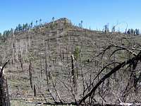
Much of the local forest has burned in the great wildfires of 2006. The forest will likely take many decades to regenerate.
 Wilson Mountain from Sedona, South Face |
Getting There
From the intersection of Route 89A and Route 179 (The “Y”) in Sedona, drive 5.3 miles north to the well signed Encinoso Picnic area on the left (west) side of Route 89A. Parking is available in the picnic area.Route Description
Go to the north end of the picnic area to see the signed start of the North Wilson Trail. The eastern wall of Wilson Mountain and its true summit can be seen to the west. Follow the trail up a valley toward the eastern wall.
 East Wall | |
 East Wall | 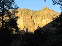 East Wall |
 East Wall | |
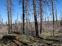
Much of the local forest burned in the wildfires of 2006. The trail takes you through a patch of intact forest at the base of the eastern wall.
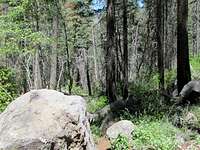 Forest |  Forest |
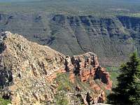
The trail then exits the forest and makes a number of switchbacks going up a steep slope that is covered by a dense growth of bushes. You will have views of Oak Creek Canyon and the eastern wall of Wilson Mountain.
 East Wall | |
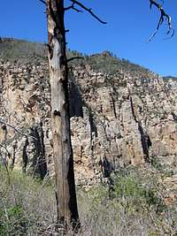 East Wall | 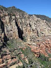 East Wall |
At an elevation of 6200 ft, the trail reaches a plateau called the First Bench of Wilson Mountain. This plateau is covered by short green grass and is dotted with Juniper trees. The trail follows the surface of the plateau south to reach the South Wilson Trail.
 First Bench |  On the First Bench |
The combined trail then goes up another slope to reach the mesa on top of Wilson Mountain. You will have good views of the First bench below you.
 Looking down at First Bench |
On top of the mesa, the trail splits. Left (south) goes to the Sedona View Point and right (north) goes to the Northern View Point. The true summit of Wilson Mountain can be seen as a small rocky hill. No trails go to the true summit.
 Summit |
Most of the Pine Forest on top of the mesa has burned.
 |  |  |
Turn left and hike 0.4 miles to reach the South (Sedona) View Point.
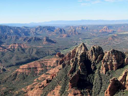 Sedona from South View Point | |
 South View Point | 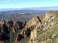 South View Point |
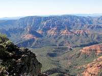
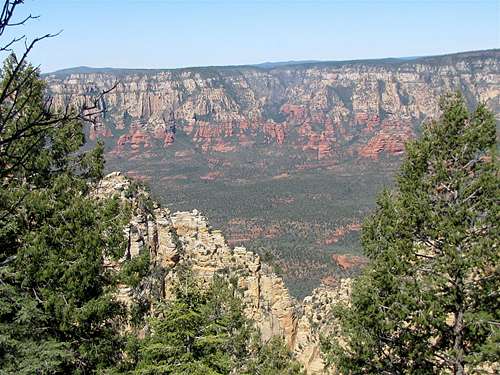
Turn back north and hike 2 miles to the northern edge of the mesa for another view point.
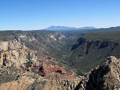 Oak Creek Canyon & Humphreys Peak | |
 Point 6446 ft |  Sterling Canyon |
 Sterling Canyon | |
 Point 6446 ft & Oak Creek |  Secret Mountain |
 Secret Mountain | |
Essential Gear
Hiking EquipmentWeather
See the forecast for the town of Sedona, AZ.Red Tape
You will need a Red Rock Parking Pass. See the link below:http://www.redrockcountry.org/passes-and-permits/where-to-purchase.shtml