
|
|
Mountain/Rock |
|---|---|
|
|
50.66158°N / 114.5745°W |
|
|
Hiking |
|
|
Spring, Summer, Fall, Winter |
|
|
5748 ft / 1752 m |
|
|
Overview
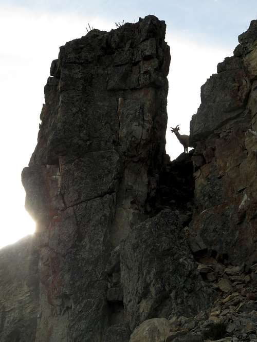
Windy Point Ridge surprises with its cliffs and steep slopes in a countryside of rolling ridges, especially when driving west on Highway 546 and rounding the bend around Foran Grade Ridge. Its folded anticline rises dramatically above steep grassy slopes inevitably dotted with bighorn sheep, cattle and often a black bear or two. Like most hills and ridges in the Canadian Rockies' foothills, it's the highest summit as you go east out of the mountains, so naturally it's a great viewpoint. Given that its grassy slopes fall straight down to the road, it's a popular short hike and also a popular spot to watch raptor migrations.
Getting There
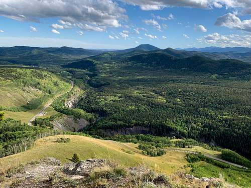
From Calgary, drive west on Highway 22X, then south on Highway 22 to the town of Turner Valley. At the four-way stop in town, turn right (west) up Highway 546 (Sheep River Trail), which hangs a right at the top of the hill in town and becomes a real highway instead of a small-town street. Continue west past the Kananaskis Country boundary and the Sandy McNabb campground. A short distance past the campground, the road turns sharp right (north) and traverses an aspen-covered terrace above the Sheep River with a great view ahead of Windy Point Ridge. Continue past the large, obvious pullout on the left with a view towards the Front Ranges (Windy Point parking lot). The road bends sharp left (west) and traverses an even narrower terrace under the ridge. Park in a small pullout on the left just above the drop-off to the river, right under the road cut in the anticline and immediately before a texas gate.
Route
There are two different routes, which I recommend combining to make a loop that can be done in either direction. Here I describe ascending the west ridge and descending the southeast ridge, because the west ridge is the most frequently used ascent route.
The west ridge has a trail most of the way, whereas the southeast ridge does not have a trail.
West Ridge
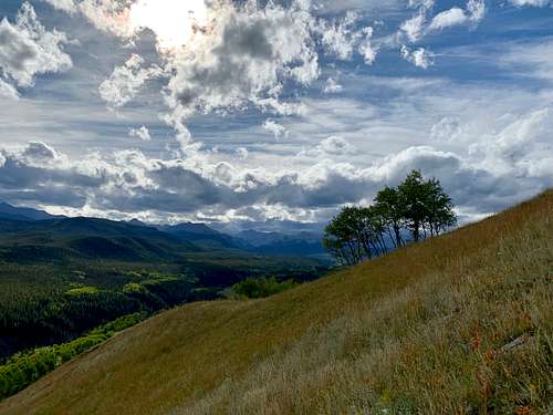
From the pullout, go west along the road a bit to a gate in the fence on the north side of the road, where a bit of a trail ascends a draw under the aspens. The draw surfaces into a very large meadow, with the end of the west ridge rising to your right (east). Simply head up the ridge at the demarcation of trees and grass. You reach a grassy hump that is the start of the ridge proper and where very steep slopes begin to fall away to your right.
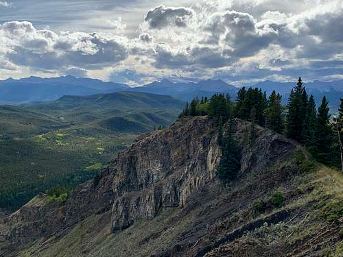
Shortly, the anticline reaches the ridge crest and from here to the lower summit you are walking at the edge of the cliff.
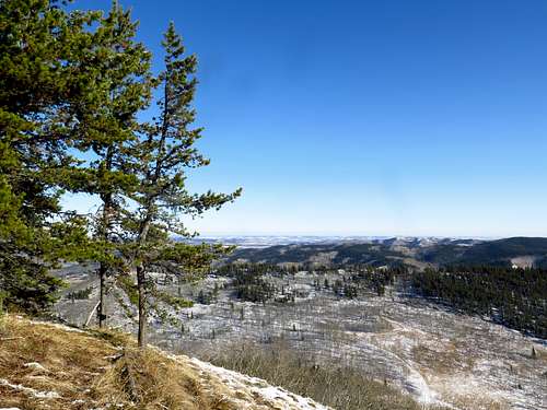
So keep heading up the ridge at the edge of the cliff. A steep gravelly step in the trees precedes an equally steep slabby section that the trail traverses beneath. Beyond this, the ridge levels out a bit while pine branches push almost to the edge. After an overhang with a spectacularly situated tree growing almost underneath the overhang, the ridge descends a bit, then climbs to the lower summit (still on the edge of the cliff), where most people turn around. This is quite a good viewpoint with the road and the river a thousand feet below.
Turn left (north) on a good trail. It descends a bit through a patch of trees then re-enters meadow. While there's no longer a cliff falling away on the right, the meadow descends very steeply and the views out to the prairies are still extensive.
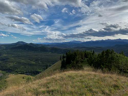
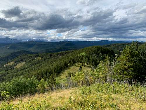
After climbing a bit, the ridge and trail enter lodgepole pine forest. A short distance on, you reach another meadow at the summit of Windy Point Ridge. A completely new view has opened up to the northwest, which includes Moose Mountain, the Forgetmenot group (Banded, Outlaw, Cornwall and Glasgow) and Bluerock Mountain, not to mention a vast expanse of foothills in between. It also includes the continuation of Windy Point Ridge to the north, which is called Gleason Ridge.
Southeast Ridge descent
First, backtrack to the lower top with the cliff.
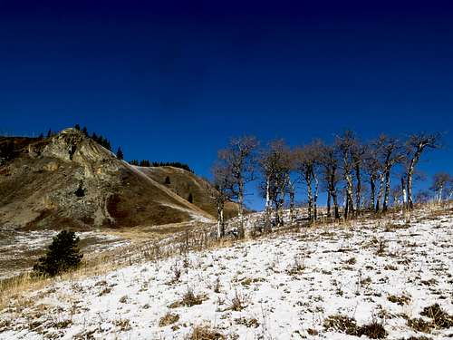
From the lower top, head straight east down the ridge. It's very steep (at least 35 degrees) but it's grassy, not rocky, so it isn't dangerous. Obviously don't stray to the right over the cliff, which is still present at this point. Near the bottom of the very steep section, wend right a bit to take a look at the cool rock pinnacle sticking out of the hillside.
Reach a levelling in the southeast ridge.
Ahead is a slight rise and a spur ridge falling away to the right (southwest) down the long meadow. Simply follow this spur ridge through long grasses and a few aspens to the road. Turn right and walk for less than five minutes back to your car.
Land Management/Red Tape
Windy Point Ridge is located on the boundary between Sheep River and Bluerock Wildland Provincial Park, within the multi-use area Kananaskis Country. No random camping (or hunting) is permitted within Sheep River Provincial Park although this ridge is right above the road so this isn't a problem. There are no other special regulations affecting non-motorized users.
When to Climb
The road is closed past Sandy McNabb campground between December 1 and May 15 each year. However, this ridge is not that far past the winter gate so between those dates you can bike the road or use the very scenic Sheep Trail to get to the base of the ridge. The Sheep Trail runs parallel to the road from the Sandy McNabb campground to Windy Point parking lot just above the Sheep River gorge and has great views.
Between March and June, ticks are a hazard.
Camping
The nearest campground is the Sandy McNabb campground, from which the base of the ridge is about a 5 minute drive.
External Links
Kananaskis Country, Alberta Parks: https://albertaparks.ca/parks/kananaskis/kananaskis-country/
Sheep River Provincial Park information and facilities: https://albertaparks.ca/parks/kananaskis/sheep-river-pp/information-facilities/
Bluerock Wildland Provincial Park information and facilities: https://albertaparks.ca/parks/kananaskis/bluerock-wpp/information-facilities