Early Beginings
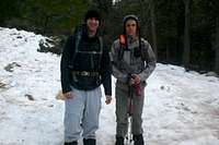
![Matt and I]() Matt and I
Matt and IIt had been awhile since my
last adventure and trips that I had planned prior to this just didn't work out due to being sick or scheduling issues. Finally, everything seemed to work out. Me and my friend Matt decided to make an attempt on San Jacinto and then see how many other peaks we could throw in along the way. Our plan was to take the Marion Mountain Trail up and do San Jacinto. Plan B was to take Humber Park up to San Jacinto.
Another reason for this trip was to try out my new gear. For Christmas, I had gotten
crampons, a
Spot Satellite Messenger, an
ice axe,
new boots and a new daypack. So I had been dying to try them out. I had all my gear, but the only thing was, my friend Matt didn't have any crampons. At Sports Chalet, he found a little four point crampon that fits in the center of your boot. I wasn't so sure if they would work, but we would give them a shot.
The Day Arrives
We had decided to meet at 4:30 at his house and then he was going to drive us up. Unfortunately, I had set my alarm to 4:00 pm instead of am. Luckily, I had been waking up every hour or so just in case.
We left his house around 5:00am and begin the drive from Temecula to Idyllwild. Right from the start, we both knew it was going to be a beautiful day (weather wise). I was thinking that it would be really crowed up there especially since it was MLK Day.
![Tahquitz with the Moon]() Early Moring View
Early Moring ViewWe arrived at the ranger station around 6:30ish. I began filling out the self-issue permit when my friend point out that the Marion Mountain Trail was closed (along with the South Ridge to Tahquitz). So we went to Plan B: Humber Park. I called up my parents and told them of the changed of plans and with that, we headed up to Humber Park. The temperature was hoovering right around freezing, so we knew that the snow was going to be hard. I never realized how long it takes to put gear on, but I sure felt it with the cold. With a nice walker taking our picture at the trailhead, we began to head up the trail at around 7:20.
![Saddle Junction]() Saddle Junction
Saddle JunctionWe had our pons on right from the start, but after about a tenth of a mile, the snow dissipated because the trail was exposed to the sun. So we took them off and then walked about half a mile without them and then decided to put them on again (and they stayed on until we came back to the same section). Progress was slow once more, but we were moving. Matt's crampons were working out real nice and so were mine. We reached Saddle Junction at around 9:45 only seeing one group of people camped on the trail.
![Tahquitz Peak]() Tahquitz
Tahquitz![Gnarled Trees]() Gnarled Trees
Gnarled Trees![East Face]() Snow and Pine Trees
Snow and Pine Trees
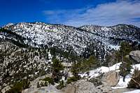
After a quick break, we began the next portion of the trail. I knew from here that the trail was going to be hard to find, which it was. Luckily people had hiked it before, but it was only easy to follow cause of the people who didn't have crampons. We lost the trail about two times, but then managed to find it because of the markings on the trees. However, our luck ran short. Just before the junction between the Wellman Divide Trail and the PCT, we lost the trail entirely. After searching around for half an hour, we gave up and headed up to a high point that I knew was right above us. However, in the process of trying to find the trail, my friend popped out his shoulder that he had dislocated during his football season. We struggled up to the top and then got our position easily. The trail was easy to spot, but it was looking like my friend Matt wasn't going anywhere else. The goal of San Jacinto seemed far off and impossible.After taking in the views for about 20 minutes, I proposed that Matt stay on top of this peak while I try and tackle Marion Mountain. After much deliberating, he decided that this would work. He could rest up his shoulder while I got my need for peak bagging out of the way. I left him with my cell phone while I took my Spot personal locater. I left around 11:45am.
![Looking Up the South Ridge.]() Looking Up
Looking Up![East Face]() Looking Down
Looking DownI was a little nervous about this idea of going solo up to Marion, but I pushed on. The snow began to get deeper and deeper. Past 8,000ft, it had been like 2-3ft deep. It was now getting to the 4-5ft deep mark at around 9,300ft. It was very tiring walking along the snow because of the constant post holing. Snowshoes would not have helped. It was a layer of ice on top that would support you for one second, and then put you up to your waste in powder. The trekking poles and ice axe were lifesavers. The views kept getting better and better as I neared the summit (or so I thought). Along the South Ridge, you see to would be summits, but these are false summits. So I passed these up and then the true summit came into sight. I couldn't quite remember which summit it was (there is three after all on top). So I started with the middle one, then the east one, and then finished with the west one (which turned out to be the true summit). This was a little sketchy to climb, especially for a noob like me solo, but I managed. I was pissed to find out that I had left my camera with my daypack down below, but oh well. After getting back down, I decided to make the descent. I looked back at San Jacinto, but knew it would be possible this trip. Next time....
![View North]() Marion and Jean
Marion and Jean![Cienaga Peak]() Looking Back
Looking Back
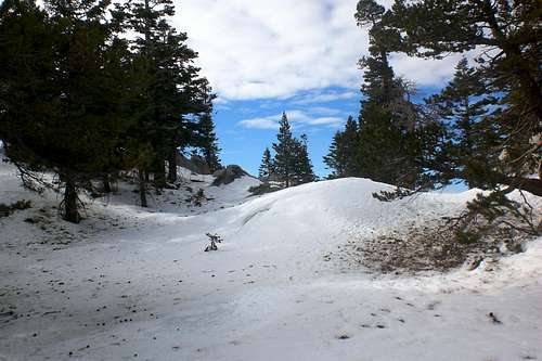
It was on the way down that I learned just how sharp crampons are. I ripped at least five holes in my pants and then put a gash in my left leg. So I began to take it easy. The snow was annoying once more. You could scree slide in some of the snow, which made it go by really fast, but then, you would reach a hard section and almost fall face first because the crampons would catch on ice. I reached back to where Matt was around 1:40. After catching my breath, we decided to call it a day and head back. Finding the trail was easy on the way back. Nothing else really happened. We took our time worked our way down and took a few little shortcuts here and there. We made it down back to Humber Park around 4:30ish. We had only seen one lady taking a little walk on the trail on the way down close to Humber Park. But other then that, we had only seen 2 groups of people the whole day, and that was all around the trail head. The solitude was really nice.
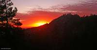
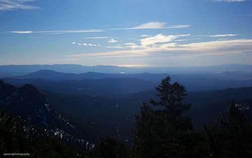
![Idyllwild Sunset]() Sunset
Sunset
After hanging around for another half hour, we decided to call it a day and head home. On the way back, we witnessed another amazing sunset. It seems like they always get better. We took a breather at Taco Bell and then made it back to Matt's house. What a day.
Reflecting
I always have these huge goals for hikes, and lately, they seem a little out of reach. However, they all seem to work out nicely no matter what. I was happy with making it up to Marion, and also to newly named
Cienaga Peak. Aside from Matt's shoulder, everything went smoothly. We had the all the right gear this time to. Matt's little four point 30$ crampons worked out amazingly and made me wonder why I had to get 150$ 12 point crampons. Oh well. We came back in one piece. Also, my parents were thrilled with the Spot Tracking system. Hopefully they will let me out more because of it.
Misc Pictures
![User Profile Image]() Me
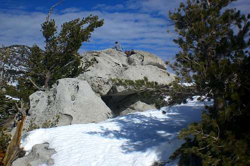
Me![Summit Block]() Summit Block
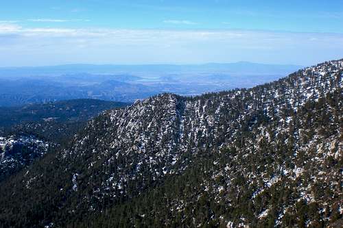
Summit Block![View West]() View West
View West![Hidden Divide]() Hidden Divide
Hidden Divide![Tahquitz Rock]() Tahquitz
Tahquitz![The Ocean]() The Ocean
The Ocean![West Face]() Marion Mountain
Marion Mountain![Suicide Rock]() Suicide Rock
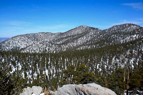
Suicide Rock![San Jacinto and Jean Peak]() San Jacinto
San Jacinto![High San Jacintos]() San Jacinto
San Jacinto![San Bernardino Mountains]() San G
San G![Amazing Sunset]() The Sunset
The Sunset
Thanks for reading, hope you enjoyed the trip report.
Comments
No comments posted yet.