
|
|
Area/Range |
|---|---|
|
|
44.43157°N / 72.62993°W |
|
|
Hiking |
|
|
Spring, Summer, Fall, Winter |
|
|
Overview
The Worceser Range is a small group of mountains in the Stowe area that are seperate from the Greens. They lie due southeast of the town of Stowe. Don't let thier size fool you! Some trails to the summits of these mountains gain over 2000 feet of elevation in 2 miles. They are located in a unique position, first they allow a view of Mt. Mansfield and the Greens that cannot be had from the Greens themselves. Second they are closer to New Hampshire and have good views of the Whites. The expanse facing east is impressive for such low mountains.
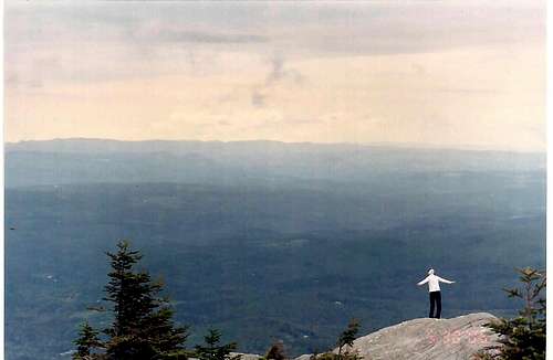 Facing east towards New Hampshire
When the Von Trapp family moved to The United States, they chose Stowe as their home. The Worcester range is what you see when you sit on thier front porch. This range runs from Northeast to Southwest more or less forming the boundary between Lamoille and Washington counties. Mountains: (listed from north to south) Worcester Mtn. Elev:3293 Hogback Mtn. Elev:3505 Stowe Pinnacle Elev:2651 Mt Hunger Elev:3539 White Rock Mtn. Elev:3194
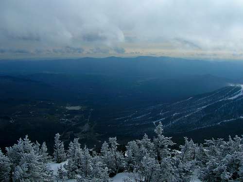 Worcester Range seen from Mansfield
Getting There
Most comon access to these mountains are from the Stowe side. -For Hogback mtn. and Stowe Pinnacle refer to Hogback mtn's page -For Mt. Hunger, refer to that mtn's page -Worcester mtn. does nothave a page yet. It can be reached by continuing north east over Hogback mtn. on the Skyline trail or to drive. Worcester Mountain Trail: From Worcester Villige (0.0 mi). Left on Minister Brook rd. Right at four corners on Hampshire Hill rd.(1.5 mi.). Continue straight, bearing left on Mountain Rd.(4.0 mi.) to trail parking (4.1 mi.) this trail is 2.5 mi. with 1900 ft. elev. gain It climbs the west side of Worcester mt. White Rock Mtn. is right next to Mt. Hunger and can be reached by either the Waterbury or Middlesex trailheads listed on the Mt Hunger page.
Red Tape
The gmc (green mountain club)closes many of the popular hikes in the greens and strongly encourages hikers to avoid higher elevation trails from april 15 to memorial day because of trail erosion due to the wet conditions of spring so check with thier website for more info. Green Mountain Club