
|
|
Route |
|---|---|
|
|
40.66920°N / 111.1292°W |
|
|
Hike and easy scramble |
|
|
Most of a day |
|
|
Class 2 |
|
|
Approach
The trailhead is at a large signed parking lot that is located on the north side of Highway 150 6.5 miles east of Kamas. This trailhead is accessible year-round.
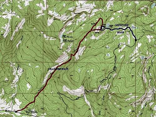 Red = Yellowpine Route.
Route Description
The trail first heads east across a stream before reaching Yellow Pine Creek after half a mile. The trail climbs slowly at first and then steepens at its northern end. All stream crossings are bridged on the lower section of the trail.
After about three miles from the trailhead a spur trail heads northwest to Yellow Pine Lakes. The spur trail is used more than the main trail. Turn right here. The trail can be hard to follow and is steep in places. In another 1.5 miles from the junction, the saddle between Yellow Pine Creek and Box Canyon is reached.
Castle Peak is a 0.7 mile hike south cross-country from the saddle. A steeper, shorter route to Castle Peak is a scramble up the west face. Excellent views of the Wasatch Range, Western Uintas, and Castle Lake are the reward for reaching the summit.
The total round-trip distance is about 10.4 miles with about 3100 feet elevation gain.
Edit: My last trip to Castle Peak was in 1997. I am told that the trails have changed since then.
There is now a trail to Castle Lake from Yellow Pine Lake. Apparently this trail is more used than the one to the saddle between Yellow Pine Creek and Box Canyon and would make a shorter and easier route.
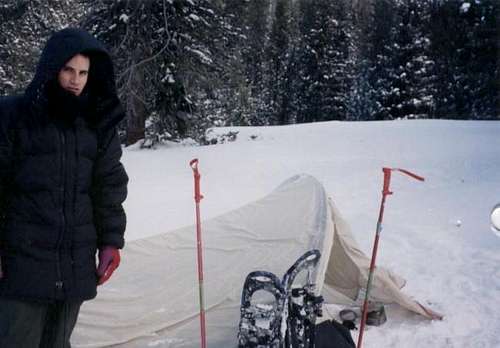 Winter camp just west Castle Peak's summit. The temperature was -8F (-22C) when the photo was taken.
Essential Gear
In summer bring all the usual hiking gear. In winter snow shoes or skiis are required, and an ice axe can come in handy too.